Remote Sensing and Geospatial Resources
Freeware Geospatial Data Viewers, ECW and JPEG2000 Plug-In Software
The following links are made available to download Freeware Imagery and Geospatial Data Viewers, ECW and JPEG2000 Plugins to view and manipulate digital imagery and shapefiles:
Geographic Information Systems (GIS)
Resources and Related Links
Global Climate Change
Archaeology
News Articles on Satellite Imaging Technology
Recommended Remote Sensing and GIS Software
Viewer capable of displaying the most popular raster, elevation and vector datasets. Converts, edits, prints, tracks GPS and allows you to utilize GIS functionality on your datasets in one low-cost and easy-to-use software package.
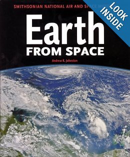
Earth From Space, from the Smithsonian National Air and Space Museum
Earth From Space
This 2004 publication, which was written by Andrew K. Johnston of the Smithsonian National Air and Space Museum, includes 300 spectacular satellite images viewed at different scales by earth observation satellites sensors.
Earth From Space is much more than a collection of extraordinary images. It also includes background details that explain the tools of the trade, as well as maps that place the photos in context.
For this publication, Satellite Imaging Corporation provided a LANDSAT 7 ETM+ satellite image of the Al Hajar mountains in Northern Oman, which was published on page 118. Earth From Space is also available at Amazon.
Overview

Copyright © Benjamin Grant. All rights reserved.
Overview
Inspired by the “Overview Effect” – a sensation that astronauts experience when given the opportunity to look down and view the Earth as a whole – the breathtaking, high definition satellite photographs in OVERVIEW offer a new way to look at the landscape that humans have shaped.
Satellite Sensor Technical Specifications (PDFs)
The following resources may require the free Adobe Reader to view.
Medium Resolution Satellite Sensors (<30)
High Resolution Satellite Sensors (<5m)
High Resolution Satellite Sensors (<1m)
- WorldView-4 Specifications - PDF Download
- WorldView-3 Specifications - PDF Download
- WorldView-2 Specifications - PDF Download
- WorldView-1 Specifications - PDF Download
- GeoEye-1 Specifications - PDF Download
- QuickBird Specifications - PDF Download
- IKONOS Specifications - PDF Download
- Pleiades Constellation Specifications - PDF Download
More Technical Documents
SPOT-5
– PDF (4.5 MB)
– PDF (1.25 MB)
– PDF (542 KB)
– PDF (805 KB)
IKONOS
– J. Grodecki and G. Dial – PDF (163 KB)
– J. Grodecki and G. Dial – PDF (374 KB)
Associations and Societies
Geological, Geophysical, and Oil & Gas Exploration/Production
– AAPG
– SEG
– AAPL
– OGP
– IUGG
(formerly the European Petroleum Survey Group – EPSG)
Remote Sensing, Photogrammetry, GIS, Geodesy, Surveying, and Mapping
– ACSM
– ASPRS
– AGI
– IGA
– ISPRS
– FIG
– IAG
Wildlife Conservation Resources
– World Wildlife Fund
– National Wildlife Federation
Note:
Satellite Imaging Corporation provides the resource information for educational and reference purposes only. We are not responsible for the content or accuracy of external sites.


