Digital Elevation Model
Satellite Imaging Corporation (SIC) provides orthorectified mono and stereo satellite maps that can be processed for visual of terrain conditions in a digital elevation model (DEM) from various stereo satellite sensors including the WorldView-4, WorldView-3, WordlView-2, and the latest Pleiades Neo satellite sensor at 30cm tri-stereo satellite maps for various applications. This DEM data can aid and support project planners, emergency operation managers, and logistics managers to plan field operations in a computer environment ensuring that the best terrain conditions and access is provided to achieve project objectives.
SIC processes satellite maps to produce digital elevation models to utilize and support engineering designs, construction activities, mining, pre-planning and lay-out of corridor surveys, land development, well sites, environmental monitoring, and geological surveys.
Pleiades-1 Tri-Stereo (1m) DEM
Satellite Map of Bingham Canyon Copper Mine, Utah, USA
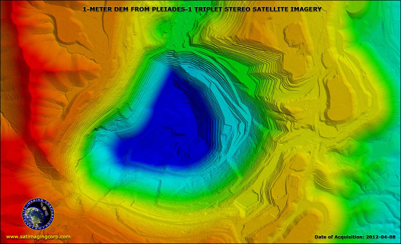
Copyright © AIRBUS Defence & Space/processed by Satellite Imaging Corporation. All rights reserved.
The Pleiades Neo satellites can be programmed to collect tri-stereo maps for the production of high quality 1m-2m DEM for 3D urban and terrain modeling (DTM). The tri-stereo acquisition reveal elevation that would otherwise remain hidden in steep terrain or urban canyons in dense built-up areas.
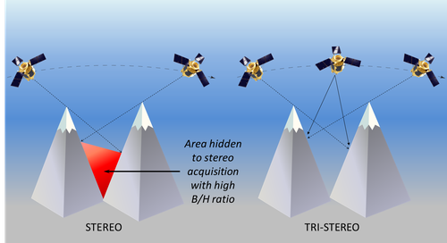
Copyright © AIRBUS Defence & Space. All rights reserved.
There is a variety of DEM data available at various resolutions for developed areas and the suitability of this available DSM/DEM, or DTM data is produced on the project objectives and specifications. In remote regions around the world, where little or no DEM source data is available, the DEM can be produced from stereo satellite maps utilizing automatic DSM extraction or photogrammetric techniques (depending on the applications).
1m DTM for Suez Canal Expansion – Middle East Map of Suez Canal, Egypt
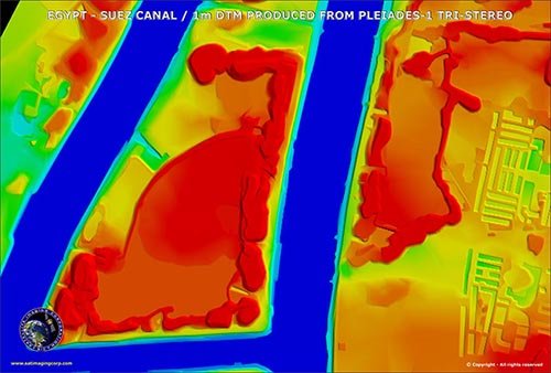
Copyright © AIRBUS Defence & Space/processed by Satellite Imaging Corporation. All rights reserved.
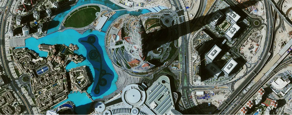
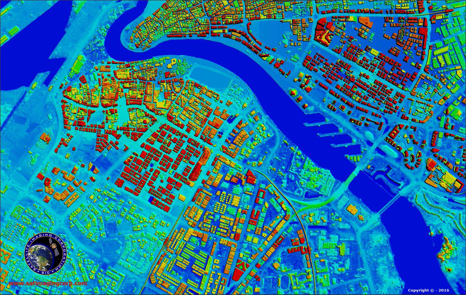
Stereo satellite maps are acquired over the area to produce an urban DEM model for feature extraction of building footprints and building heights such as the the above image of Dubai International Airport (DXB) showing ground navigation system and urban GIS data systems.
Quality DEMs are measured by how accurate the elevation is at each pixel and how accurately the morphology is presented. Several factors are important for a quality DEM:
- Terrain roughness
- Sampling density (elevation data collection method)
- Grid resolution or pixel size
- Interpolation algorithm
- Vertical resolution
- Terrain analysis algorithm
Common uses of models include:
- Extracting terrain parameters
- Volume calculations
- Modeling water flow or mass movement (for example, landslides)
- Creation of relief maps
- Rendering of 3D visualizations
- Creation of physical models (including raised-relief maps)
- Orthorectification
- Reduction (terrain correction) of gravity measurements
- Terrain analysis in geomorphology and physical geography
2m Digital Surface Model (DSM) produced from Pleiades-1 Stereo Satellite Imagery – Dubai, UAE
Copyright © AIRBUS Defence & Space/processed by Satellite Imaging Corporation. All rights reserved.
Consultancy
Ongoing satellite remote sensing and GIS consultancy services are provided to our clients, including the set-up of reliable source coordinate databases in support of computerized mapping, exploration, and development of projects around the world and to clients implementing AI/ CV or GIS management systems.
For more information or for a consultation, please contact us.