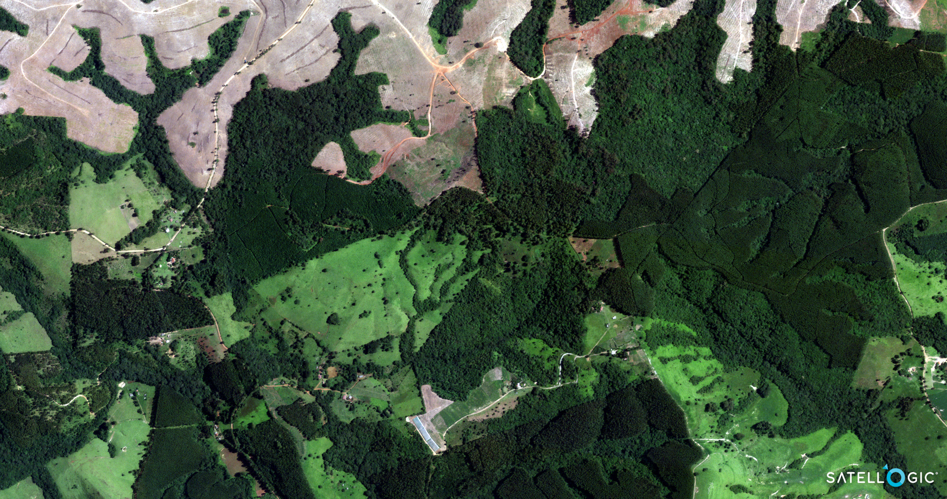
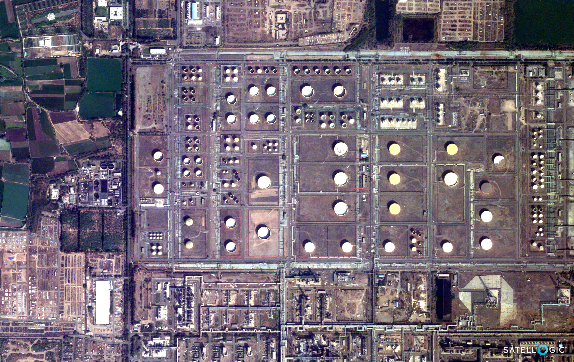
Satellogic MicroSatellite Constellation
(0.7m)
Satellogic satellite constellation is an Argentine owned company that is specialized in earth observation satellite technology and has developed and built NewSat satellites in sun-synchronous Low Earth Orbit (LEO) since the first launch of the CubeBug-1 on April 26, 2013. SpaceX Transporter-7 mission launched 4 more satellites April 14, 2023, orbiting a total of 34 NewSat satellites to date and plan on orbiting 40 satellites in 2023. The latest 4 satellites were named after successful women in the STEM. Satellogic plans to build and develop over 200+ microsatellites by 2025.
Technology
Space Edge One (SE-1) computer built by Spiral Blue in Australia has been integrated with the Satellogic satellite. The SE-1 was launched in early January 2023 onboard a SpaceX Falcon 9 rocket.
The SE-1 technology will assist the Satellogic satellite in capturing high-resolution satellite image data that will process large files while orbiting in space and then transferring to smaller files to be processed back to Earth. This technology will reduce the time and cost of retrieving the data in real time. This will support the management and monitoring in climate change, natural disasters, forest canopy mapping, forest fires, flooding, coastal mapping, and environmental applications.
The SE-1 technology will provide a rapid and cost-effective way to deliver satellite data efficiently to support emergency personnel, management, and researchers to respond to climate change and natural disasters.
Satellogic MicroSatellite Constellation

Copyright © Satellogic. All rights reserved.
Satellogic builds and operates its fleet of earth observation microsatellites to collect high-resolution satellite image data for rapid and frequent daily decision-making to many industries including environmental, forestry, agriculture, energy, defense, and intelligence applications. The microsatellites provide a sub-meter resolution multispectral imagery, 29 bands, 25-meters hyperspectral imagery, and a 1-meter resolution full-motion video capability on every satellite with daily updates.
Sample Images
GeoEye-1 Satellite Image Gallery
* Click on thumbnail to view in full resolution.
Learn more about our products and satellite imaging services with a complimentary consultation. Contact us today.
High-Resolution Imagery Specifications
Resolution (GSD)
70cm
Spectral Bands
4
Wavelengths
Blue: 450 – 510 nm
Green: 510 – 580 nm
Red: 590 – 690 nm
Near-IR: 750 – 900 nm
Image Accuracy
10m CE90
Image Delivery bits/pixel
8 or 16 bits
File Format
GeoTiff
File Compression
LZW lossless data compression
Image Metadata
Included
Projection
UTM/WGS84
Swath Width
5 km
Hyperspectral Imagery
Satellogic’s hyperspectral cameras collect 25-meter imagery data at an altitude of around 475km. Its 29 visible to near-infrared (460 – 830nm) spectral bands are delivered ortho-rectified and GIS-ready.
Resolution (GSD)
25m
Number of Bands
up to 29
Wavelengths
Between 460 and 830 nm
14 to 35 nm FWHM depending on the wavelength
Image Delivery bits / pixel
8 or 16 bits
File Format
GeoTiff
File Compression
LZW lossless data compression
Image Metadata
Included
Projection
UTM/WGS84
Swath Width
125km


