Pleiades Neo Satellite Constellation
30cm/HD15cm
Latest Update:
Pleiades Neo Next Satellite Addition to Constellation
The Pleiades Neo Next satellite is part of the Pleiades Neo constellation, developed and operated by Airbus Defence and Space. These satellites are designed for Earth observation, providing high-resolution (30cm-HD15cm) imagery for various applications including environmental monitoring, urban planning, agriculture, and defense.
The Pleiades Neo Next satellite boasts 30cm imagery with advanced capabilities, including enhanced native resolution, agility, and revisiting times compared to its predecessors. With a constellation of multiple satellites, Pleiades Neo aims to offer global coverage with rapid revisit rates, allowing for frequent updates of imagery and enabling users to monitor changes on the Earth’s surface with high precision.
Pleiades Neo Satellite Constellation

Copyright © AIRBUS Defence and Space.
Pleiades Neo 5 and 6 Satellite Launch
On December 20, 2022, at 10:47 p.m. (local time in French Guiana),Arianespace announced the loss of the Vega C launcher carrying Pléiades Neo 5 and 6 satellites to complete the Pleiades Neo constellation. Under standard procedure, the order of destruction of the launcher was given by Centre National d’Etudes Spatiales (CNES), including the Pleiades Neo 5 and 6 satellites were destroyed. Pleiades Neo 5 and 6 satellites were to join the first two satellites, Pleiades Neo 3 and 4, that launched in April and August 2021.
Pleiades Neo 3 and 4 Satellites
Pleiades Neo 3 satellite 30cm sensor, was successfully launched on April 28, 2021 followed by Pleiades Neo 4 on August 16, 2021, by the European Arianespace Vega launcher from the Guiana Space Center, view launch and will be phased at 180° as part of the new Pleiades Neo satellite constellation. The standard 30cm/1.2m Pleiades Neo Satellite imagery can be delivered as a Pansharpened bundled (RGBN) 15cm imaging product.
The Pleiades Neo satellite constellation will provide customers with 30cm panchromatic and 1.2m 6-band multispectral satellite imagery and HD15cm Imagery produced with AIRBUS prepriatory AI algorithms, and collects mono, stereo, and tri-stereo imagery for various GIS and geospatial mapping applications. The Pleiades Neo will supply reactive and rapid delivery of imagery and provide coverage at a regional scale for 2D and 3D monitoring and management of various areas needing fast information such as environmental monitoring, forestry, energy, land development, and agriculture.
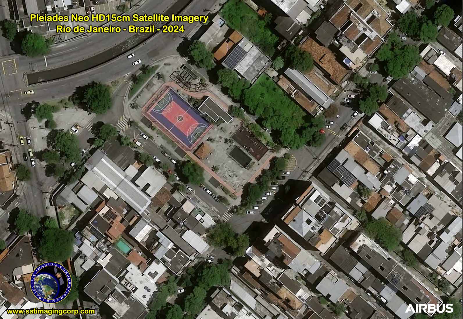
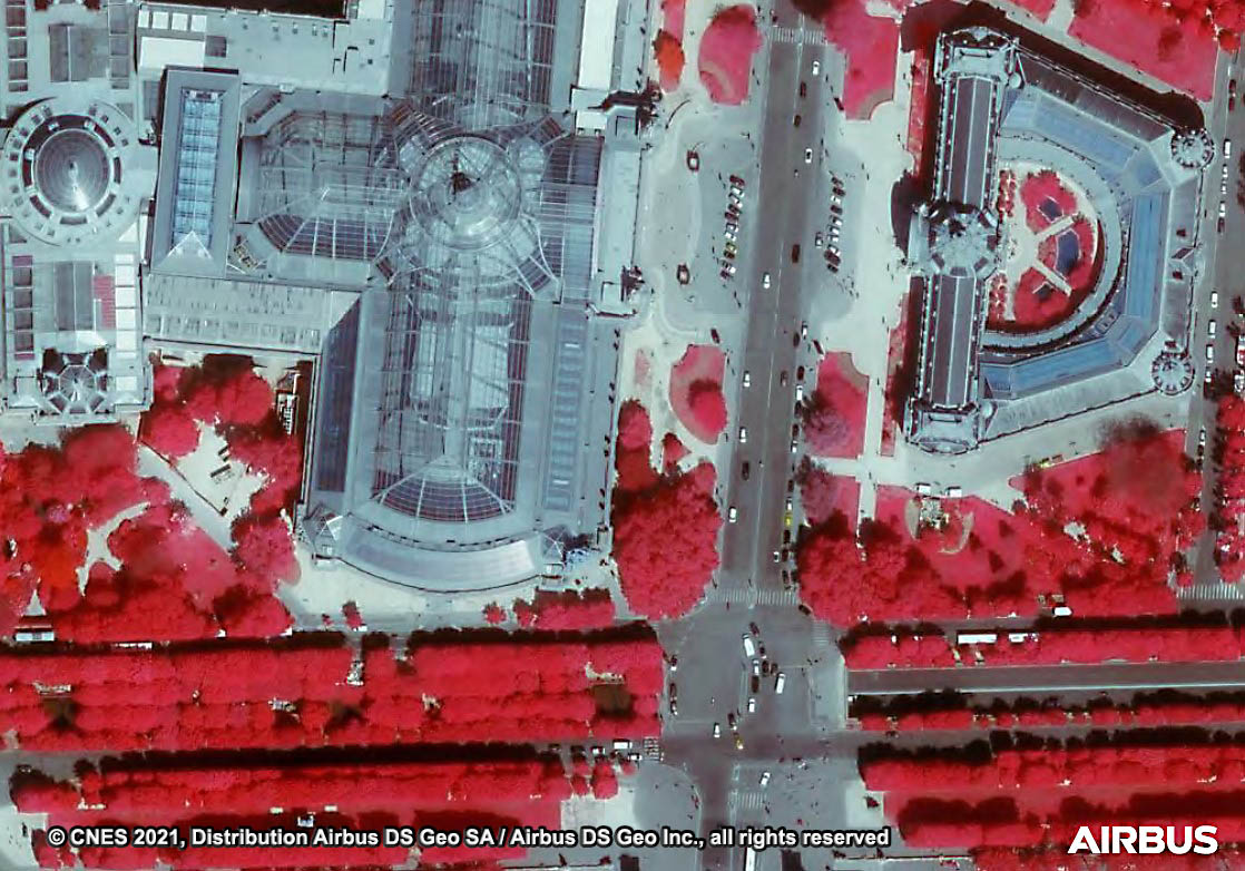
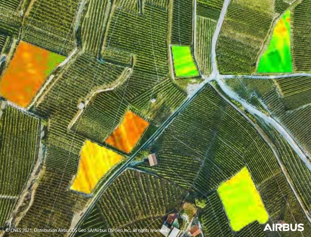
Sample Images
Pleiades Neo Satellite Image Gallery
* Click on thumbnail to view in full resolution.
Pleiades Neo Satellite Sensor Specifications
Orbit
Sun-synchronous, 10:30a.m.
Descending node, 620km altitude
Life
Estimated Service Life: 10 years
Number of Satellites
2 identical satellites in constellation
Sensor Bands
Panchromatic: 450-800 nm
Multispectral:
Deep Blue: 400-450 nm
Blue: 450-520 nm
Green: 530-590 nm
Red: 620-690 nm
Red Edge: 700-750 nm
Near-infrared: 770-880 nm
Sensor Resolution (GSD)
30cm
Dynamic Range
12-bits per pixel
Swath Width
At nadir: 14km
Revisit Frequency
Daily, anywhere (30° off-Nadir)
Twice daily, anywhere
(46° off-Nadir)
Acquisition Capacity
Up to 2 million km² per day


