IKONOS Satellite Sensor
(0.80m) - Decommissioned
The IKONOS satellite sensor was successfully launched as the first commercially available high-resolution satellite sensor on September 24, 1999, at Vandenberg Air Force Base, California, USA. The IKONOS satellite sensor was decommissioned by DigitalGlobe on March 31, 2015.
IKONOS Satellite Sensor (0.80m)

Image Copyright © MAXAR. All rights reserved.
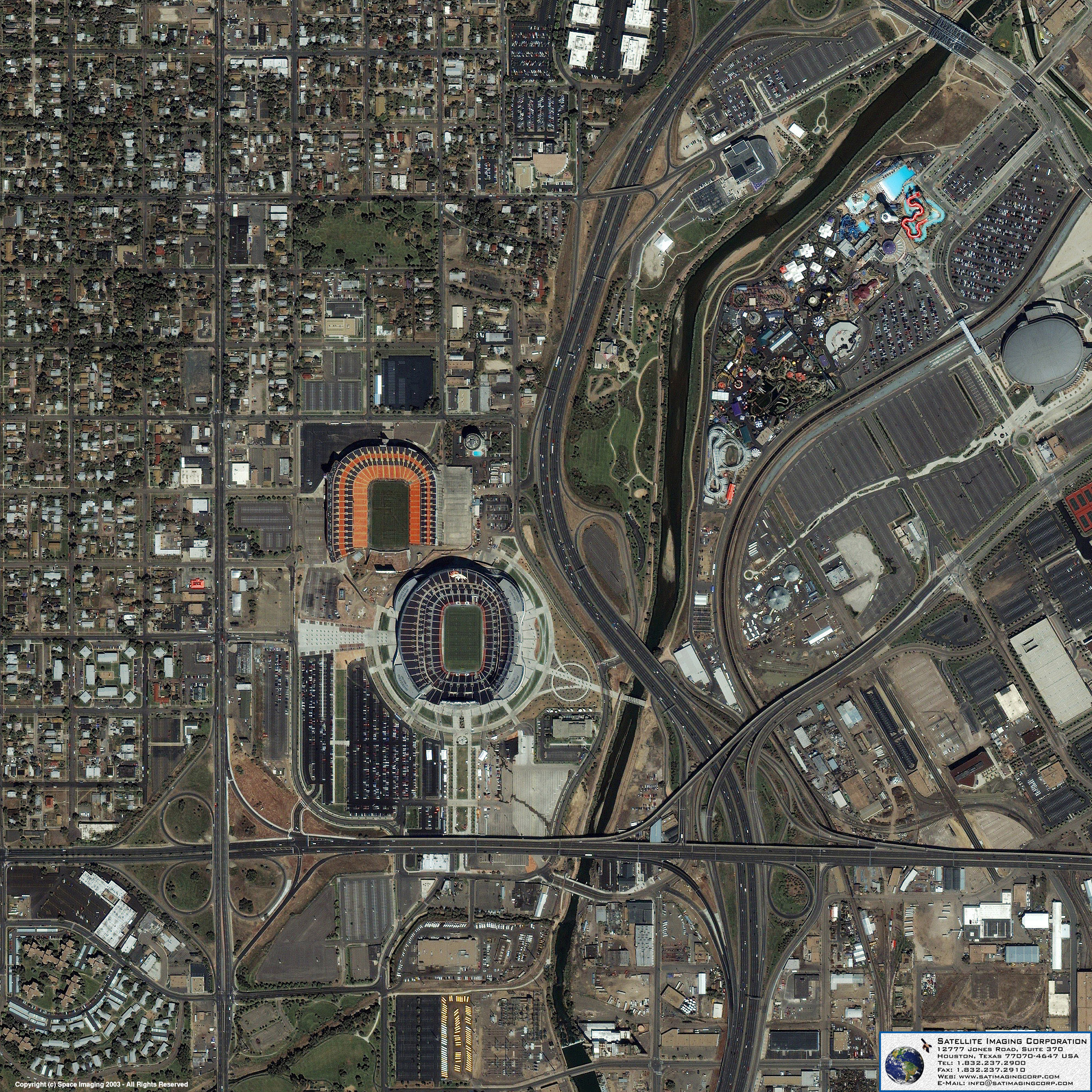
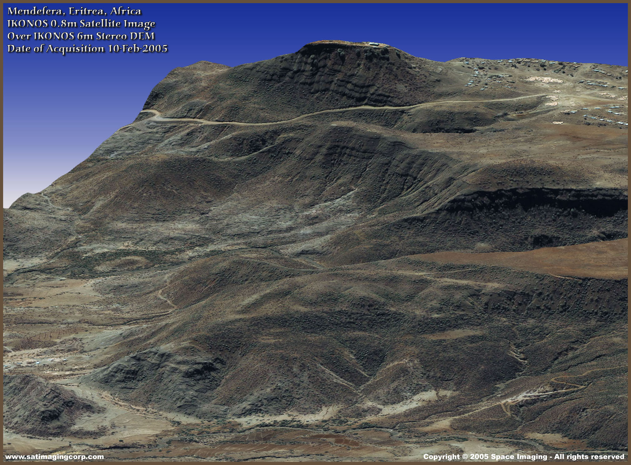
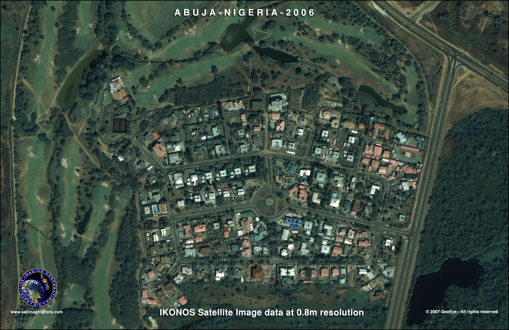
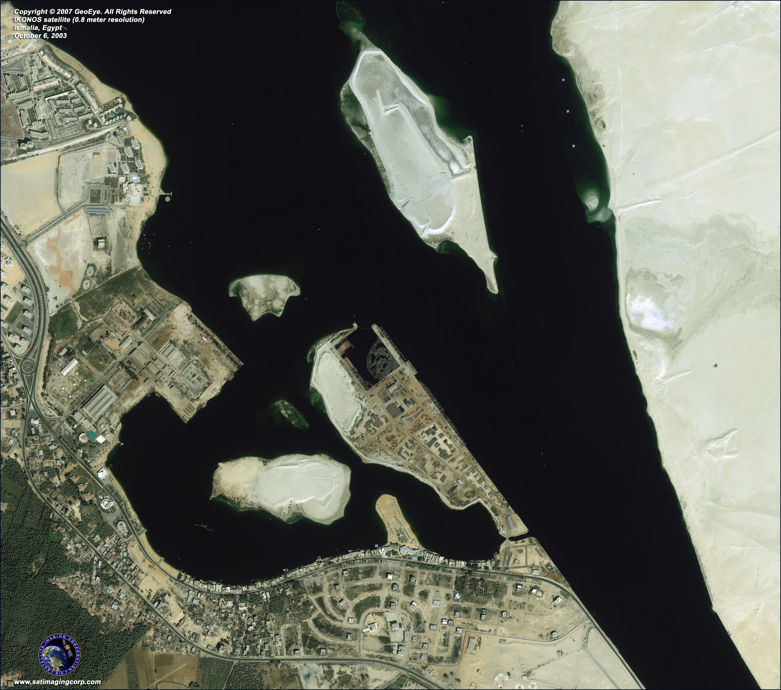
The IKONOS satellite sensor is a high-resolution satellite operated by MAXAR Technologies Inc. Its capabilities include capturing a 3.2m multispectral, Near-Infrared (NIR) 0.80-meter panchromatic resolution at nadir. Its applications include both urban and rural mapping of natural resources and natural disasters, tax mapping, agriculture and forestry analysis, mining, engineering, construction, and change detection. It can yield relevant data for nearly all aspects of environmental study. IKONOS images have also been procured by Satellite Imaging Corporation for use in the media and motion picture industries, providing aerial views and satellite photos for many areas around the world. Its high-resolution data makes an integral contribution to homeland security, coastal monitoring and facilitates 3D Digital Terrain Models (DTMs) and Digital Elevation Models (DEMs).
More information on Stereo IKONOS Satellite.
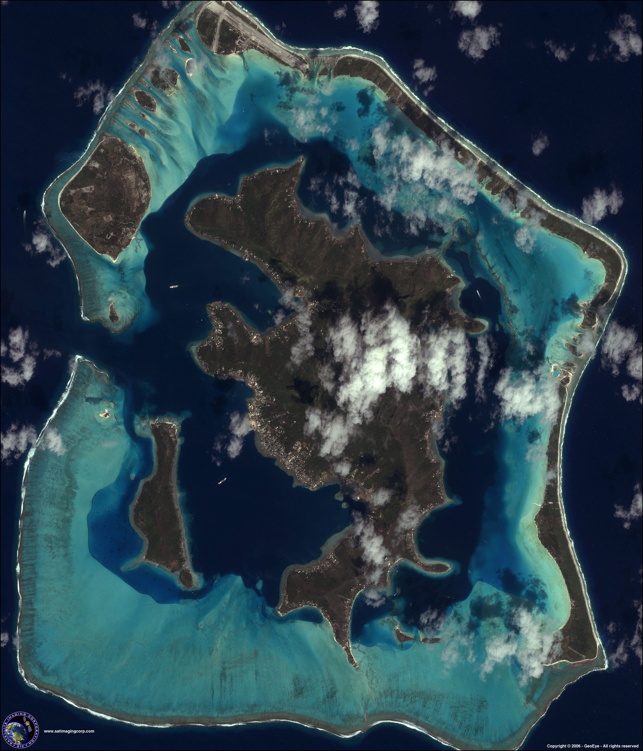
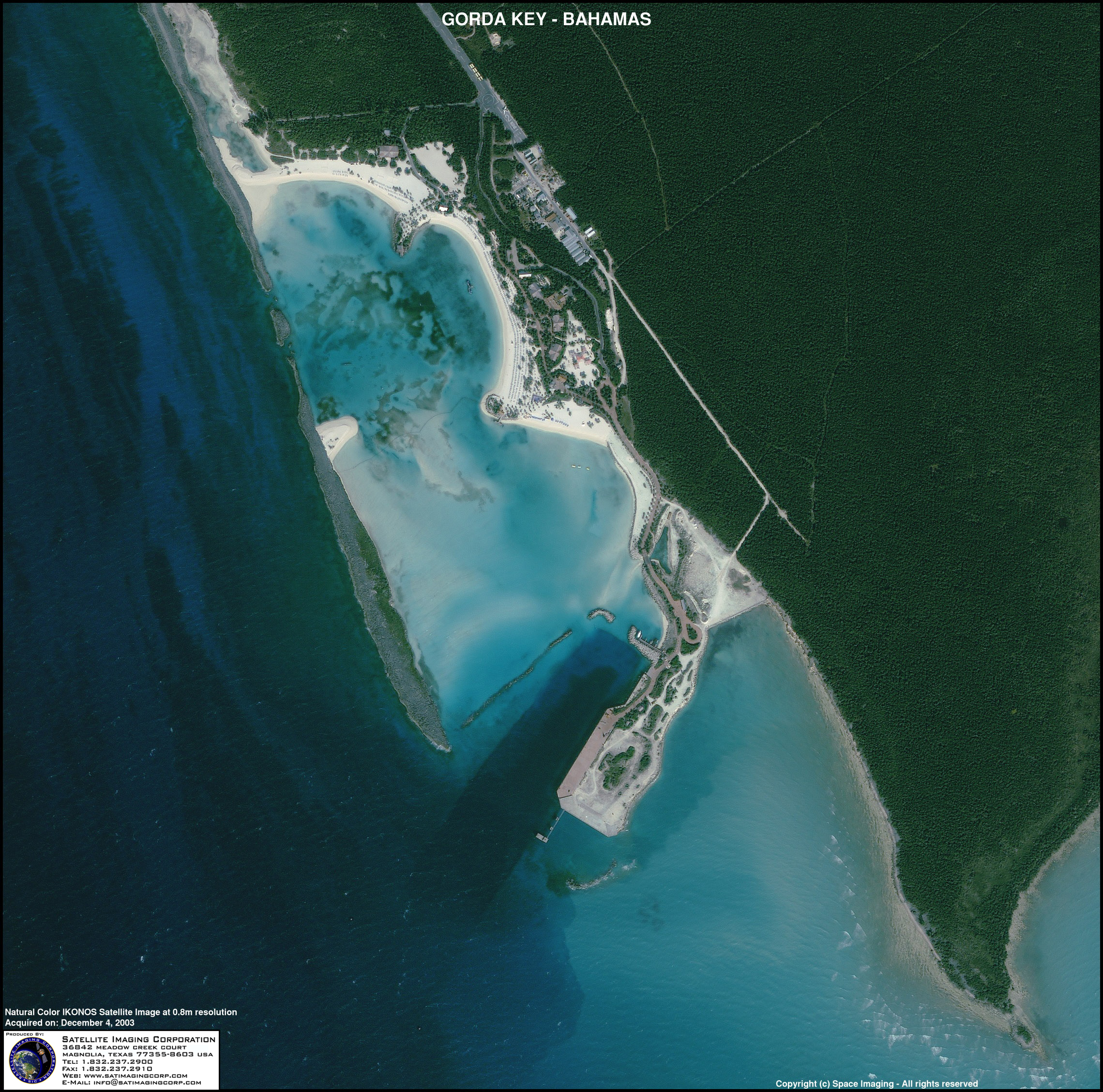
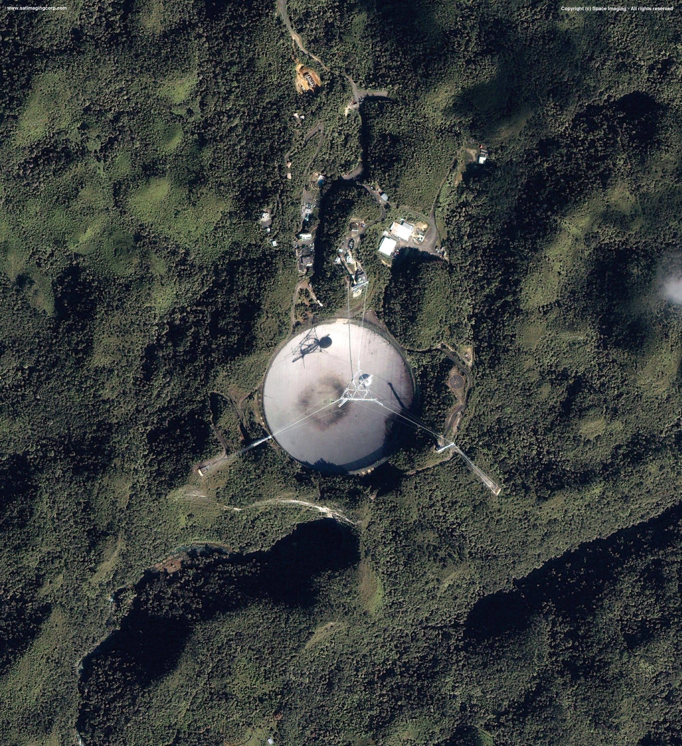
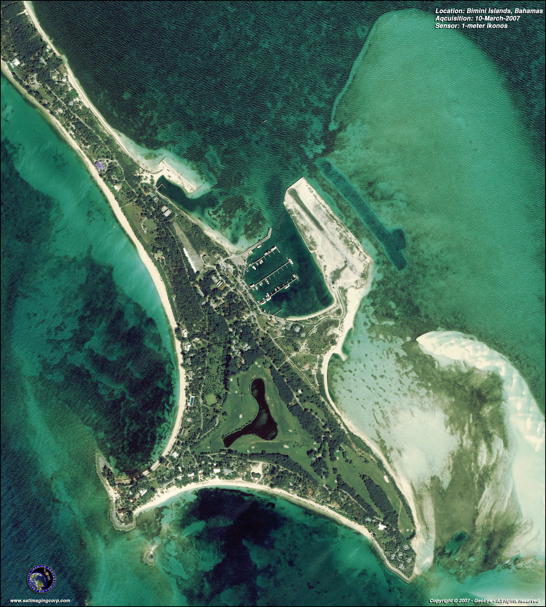
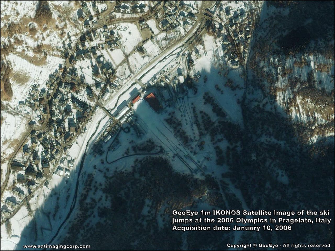
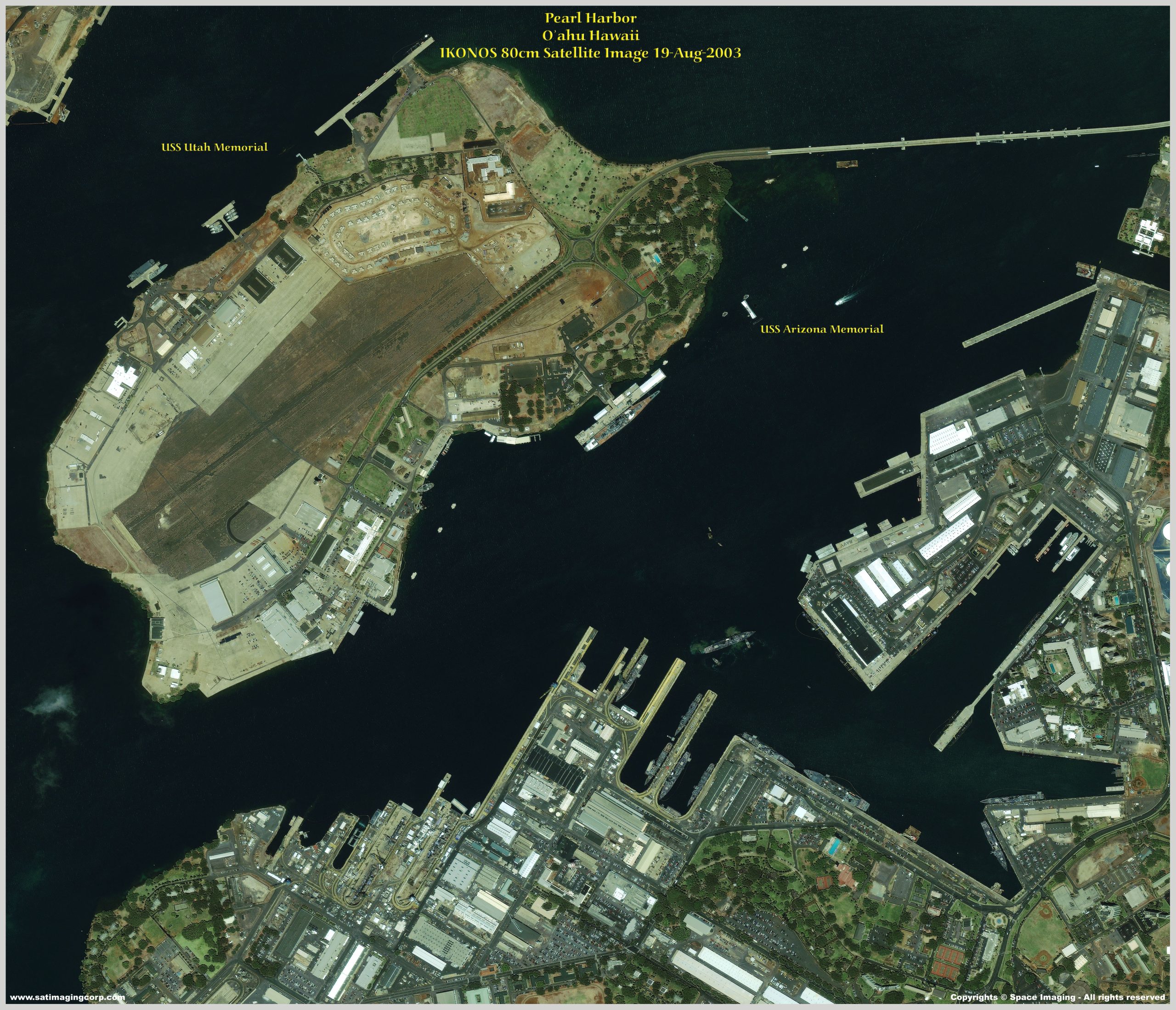
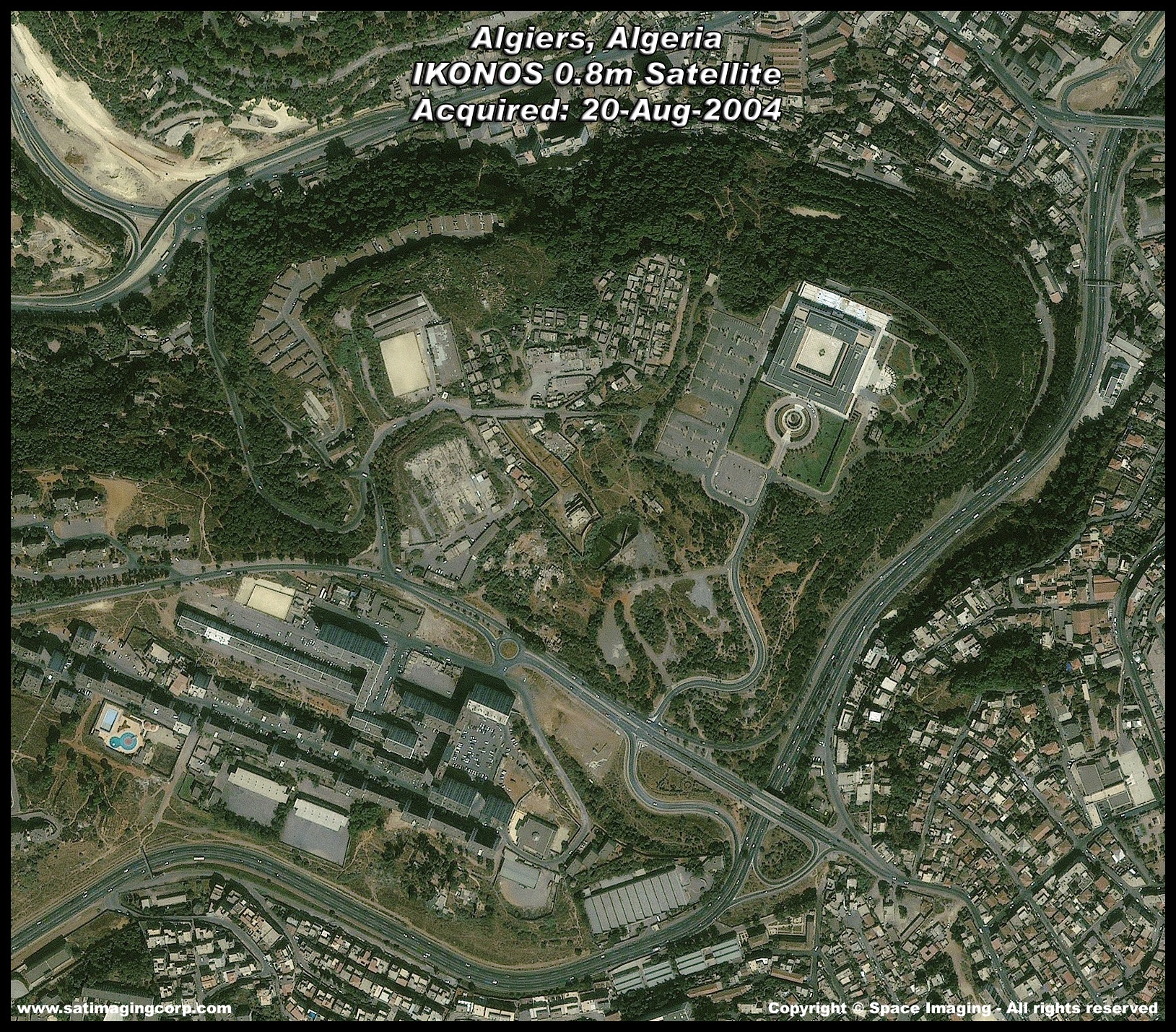
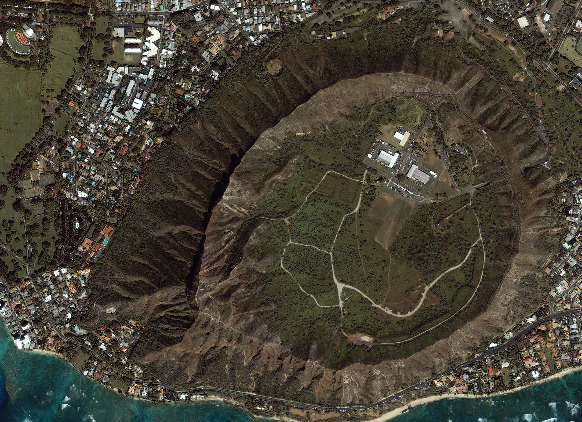
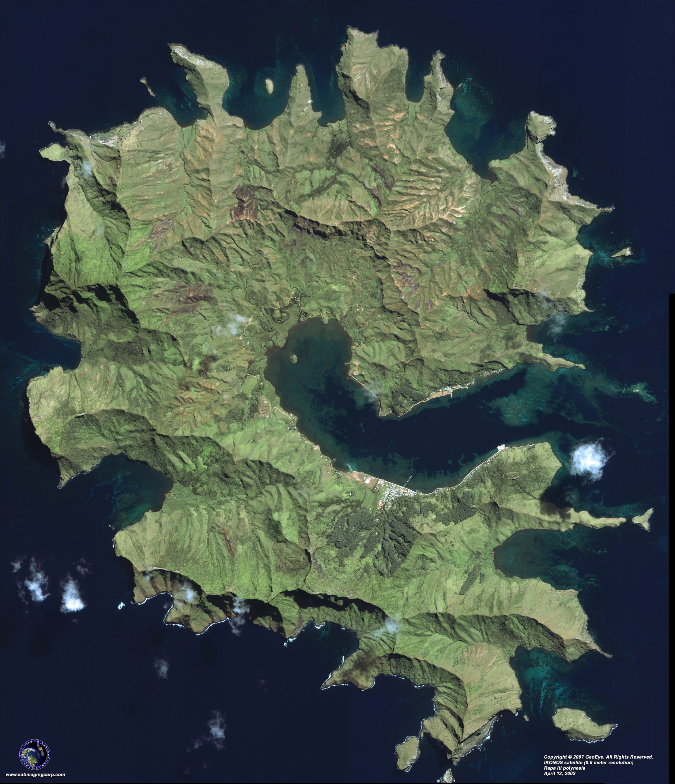
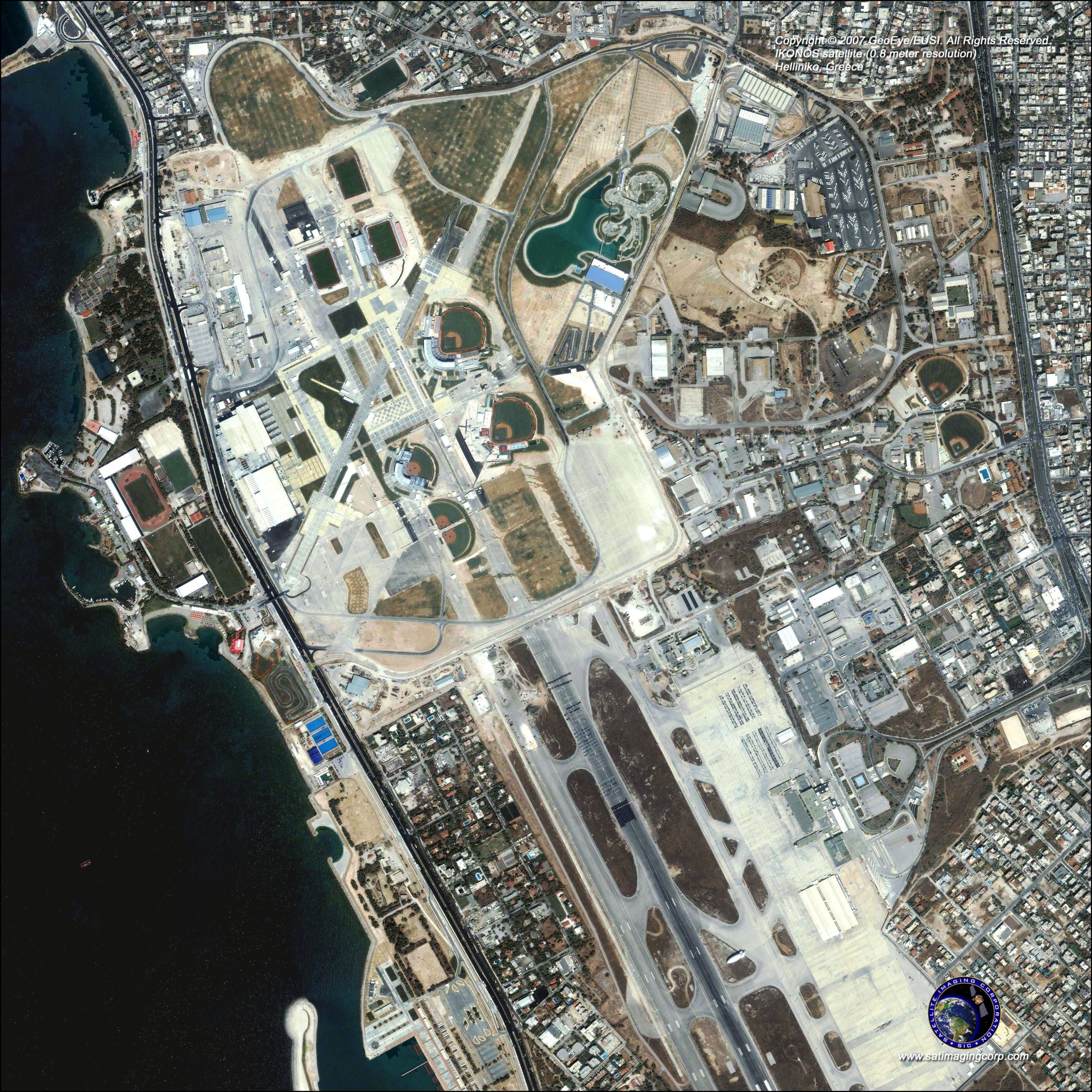
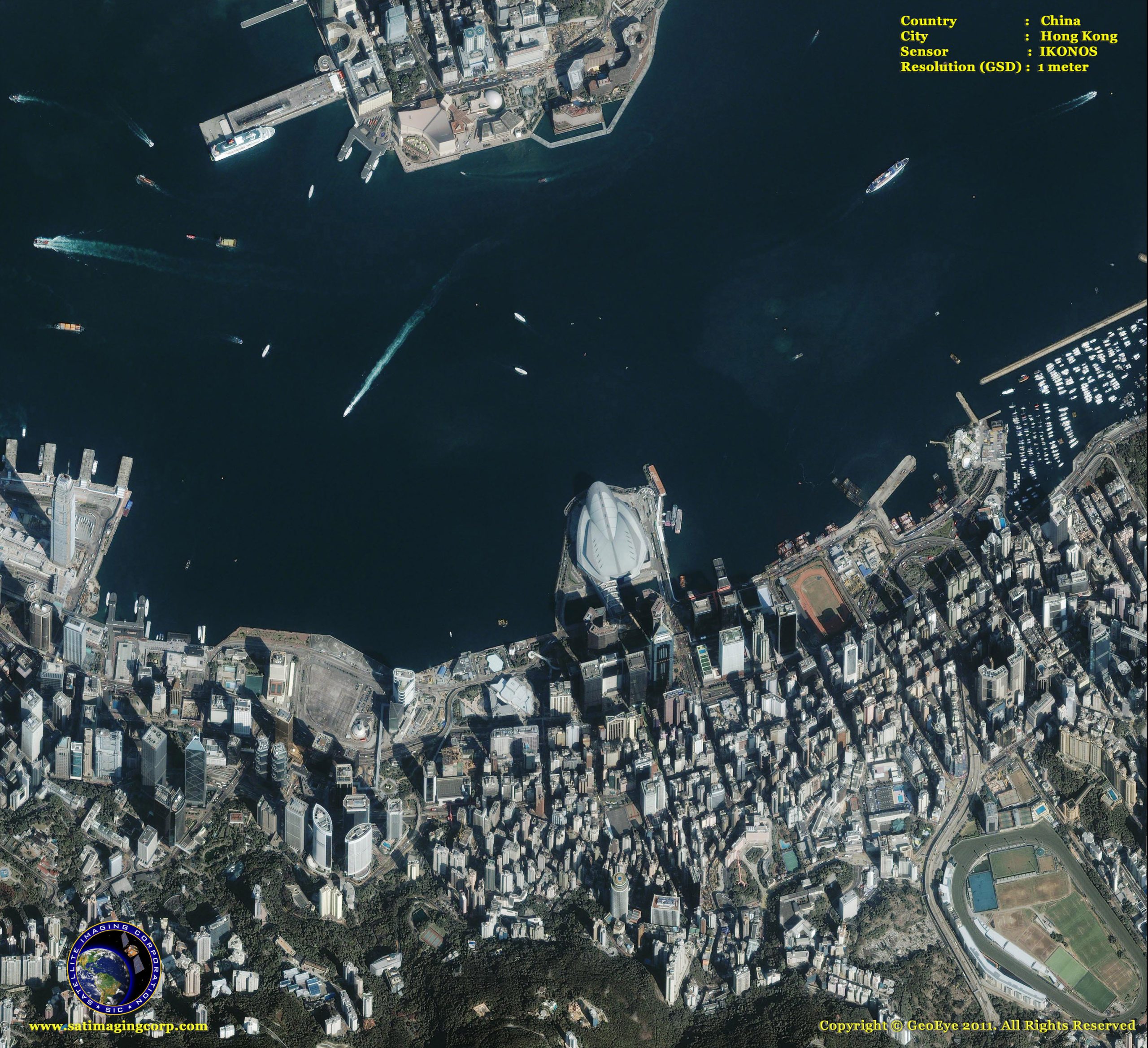
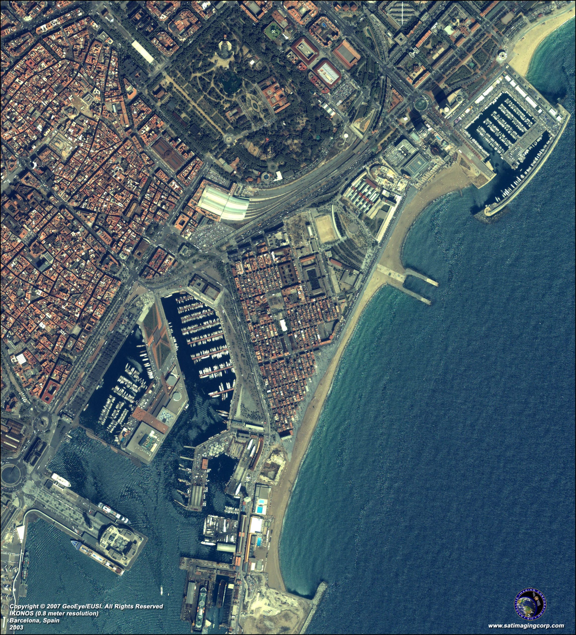
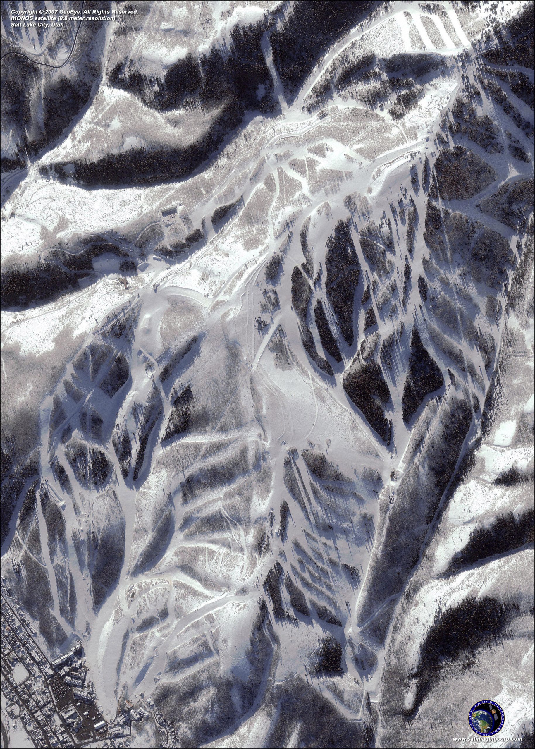
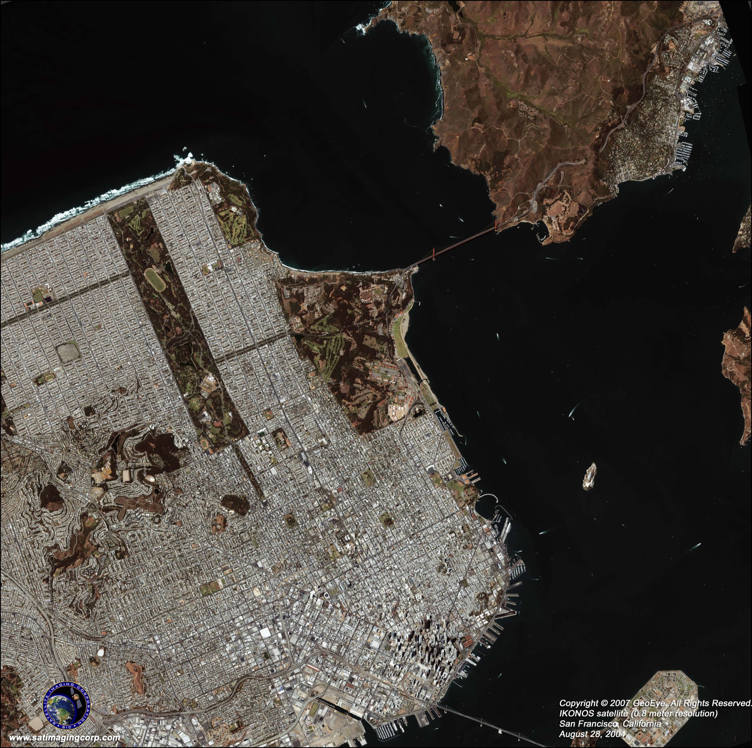
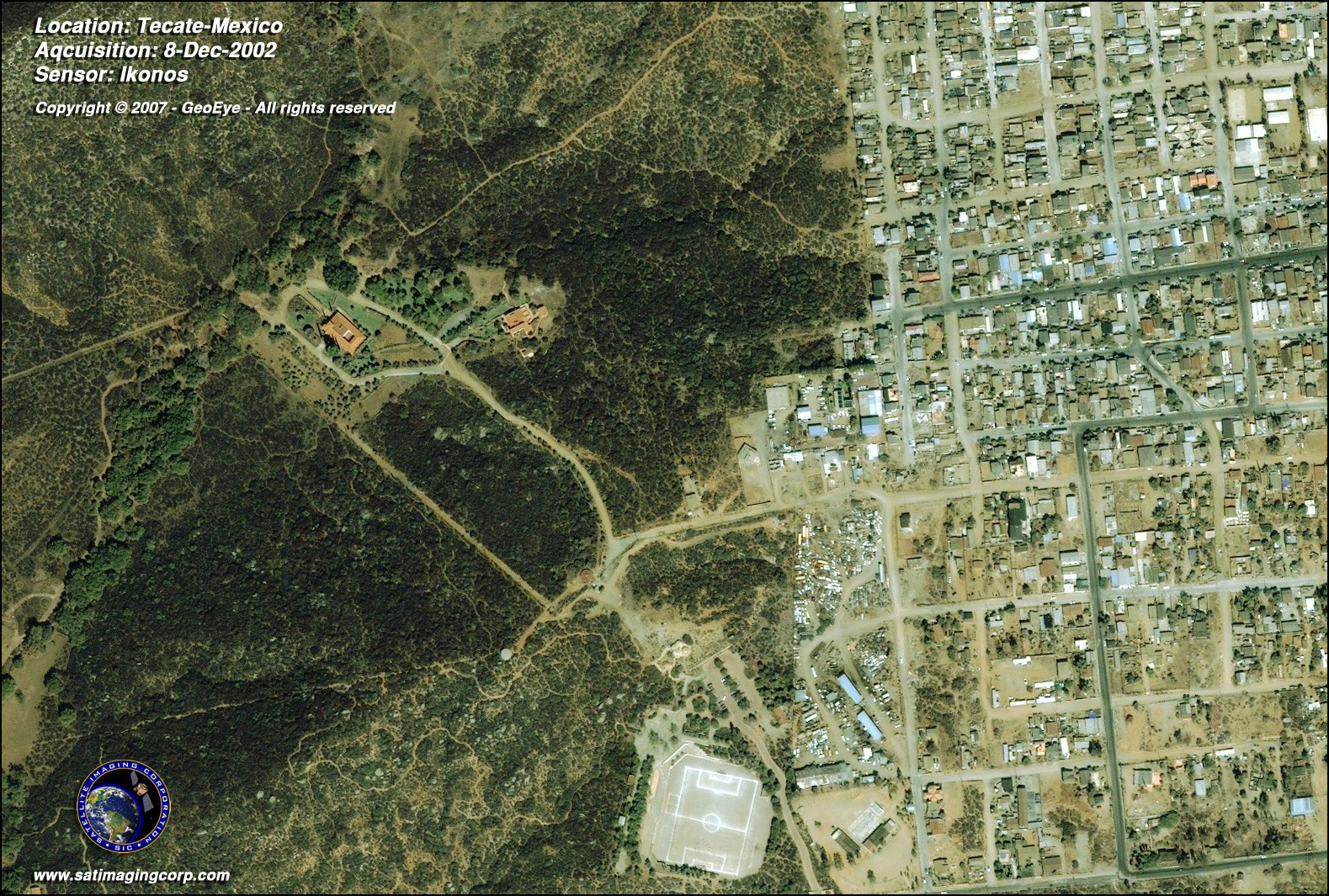
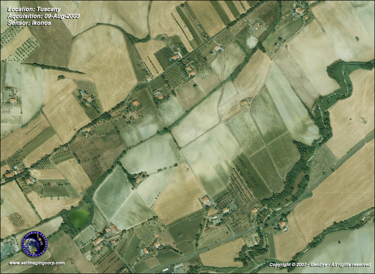
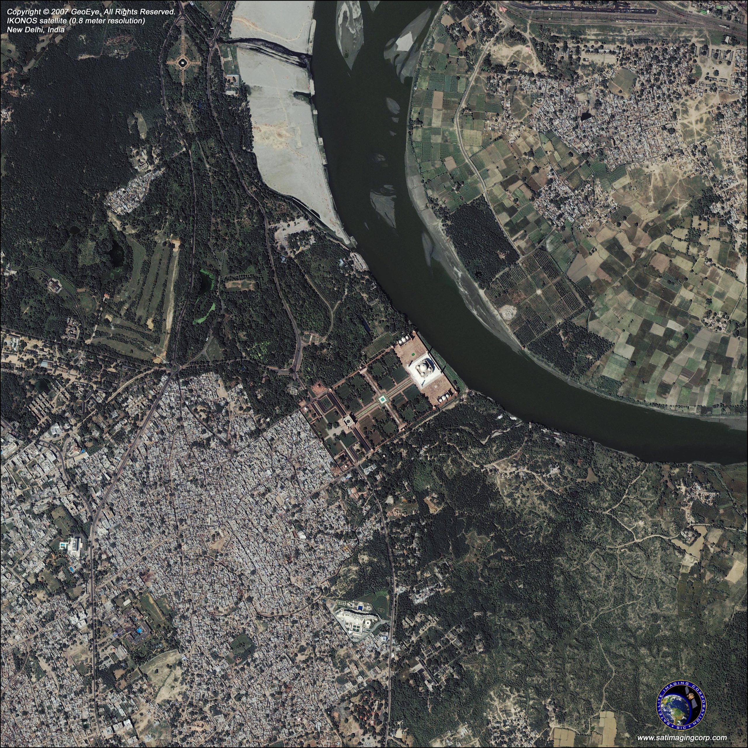
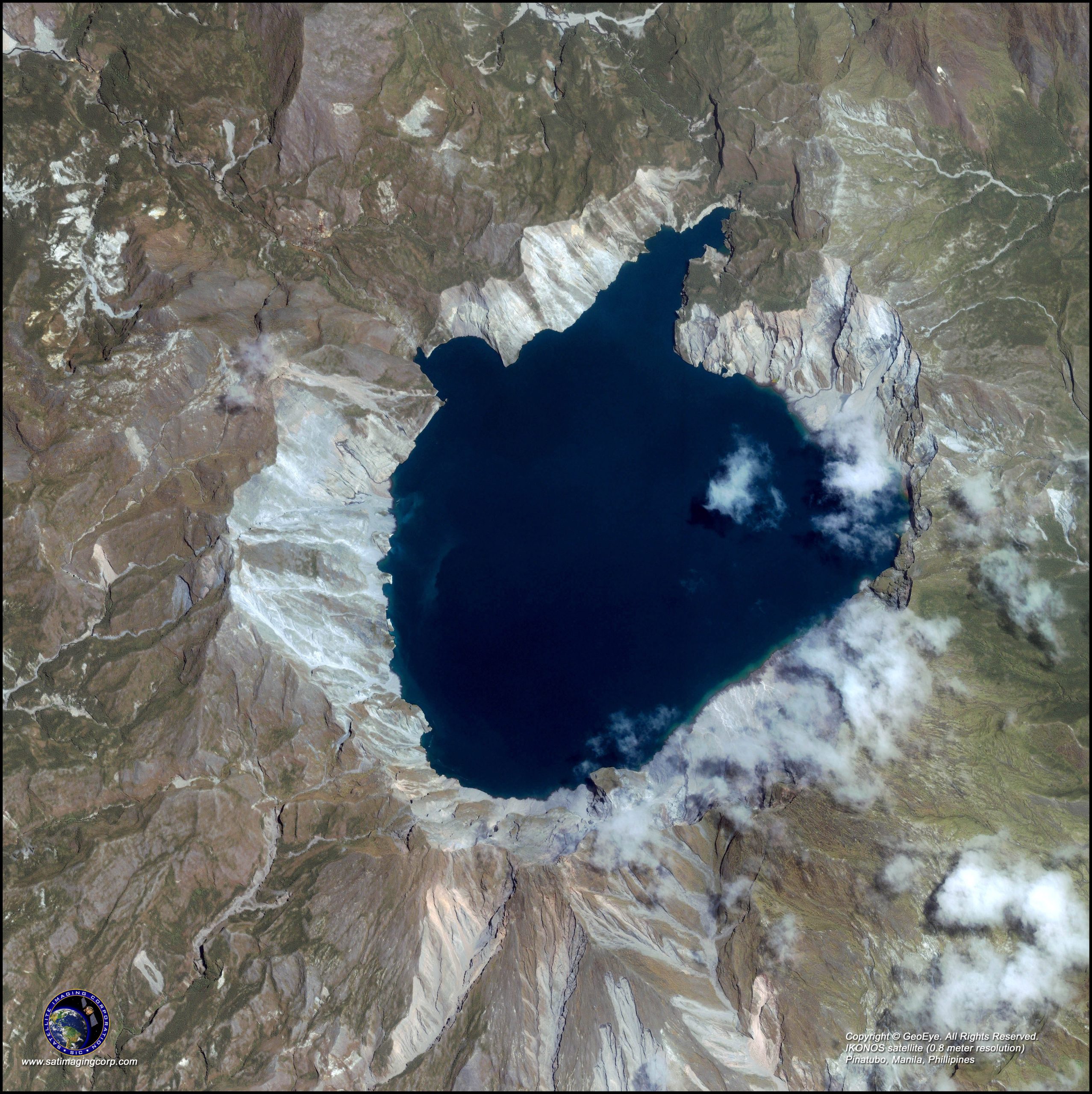
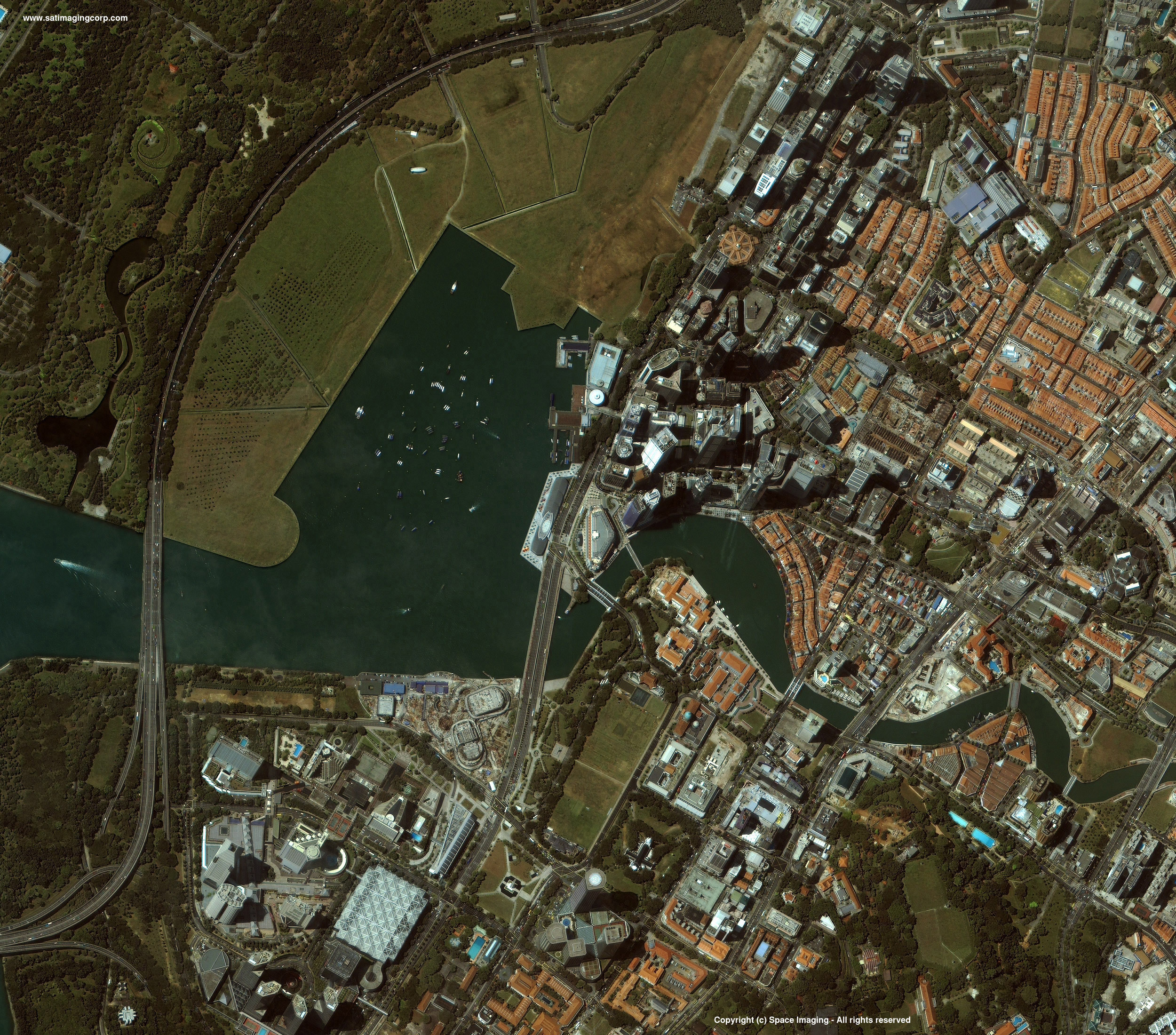
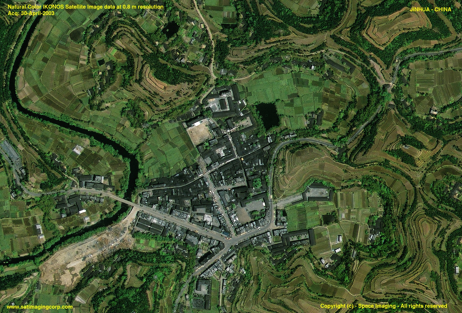
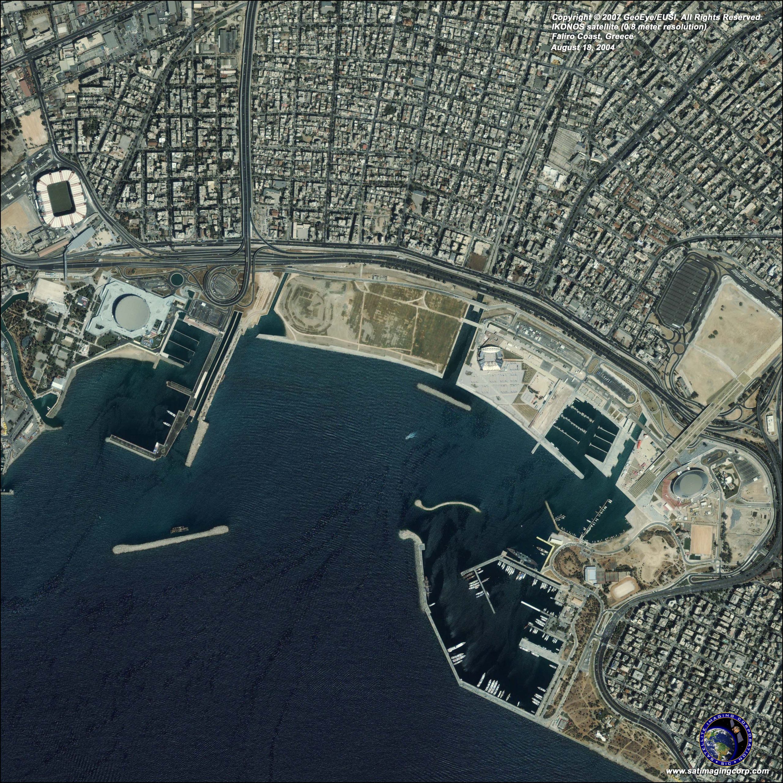
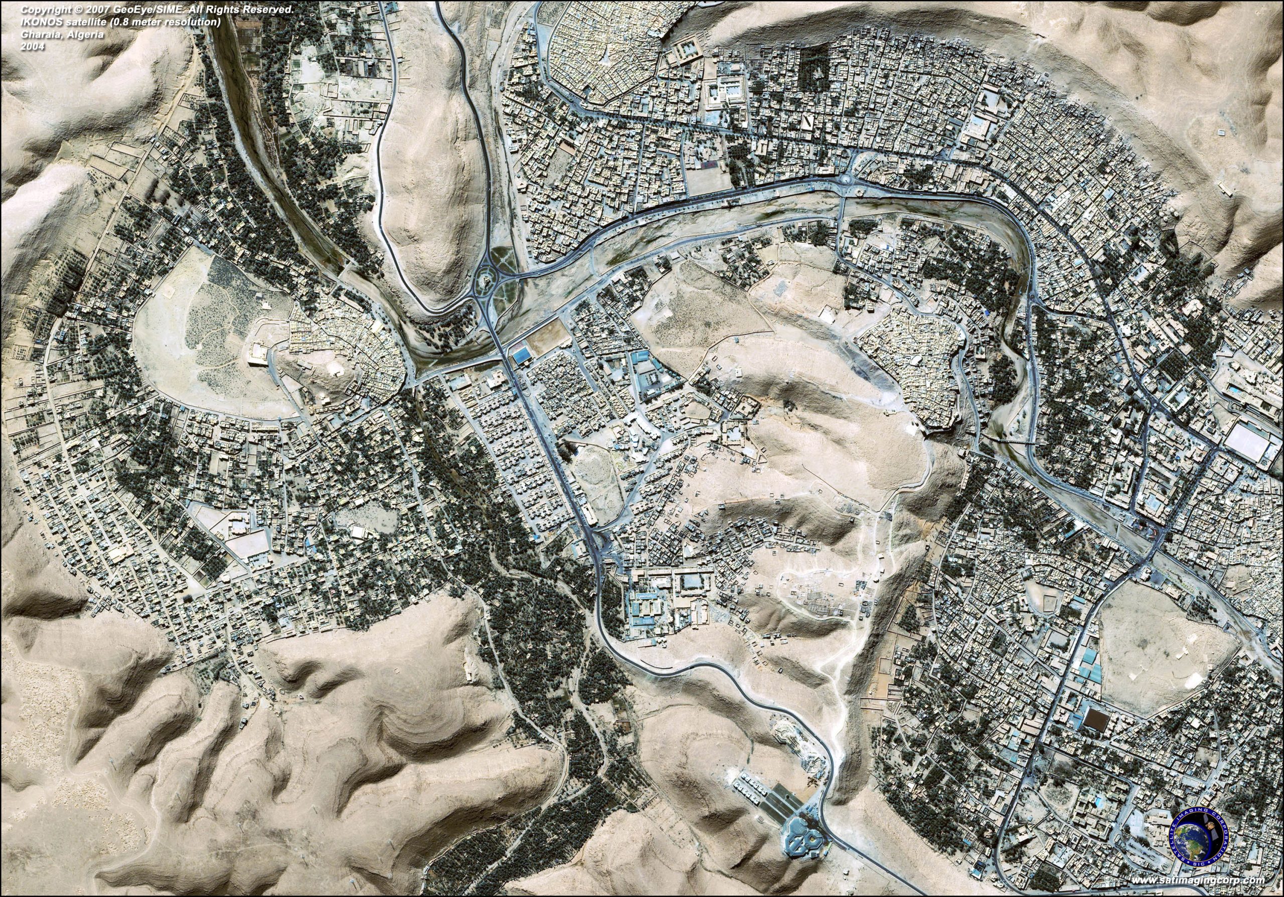
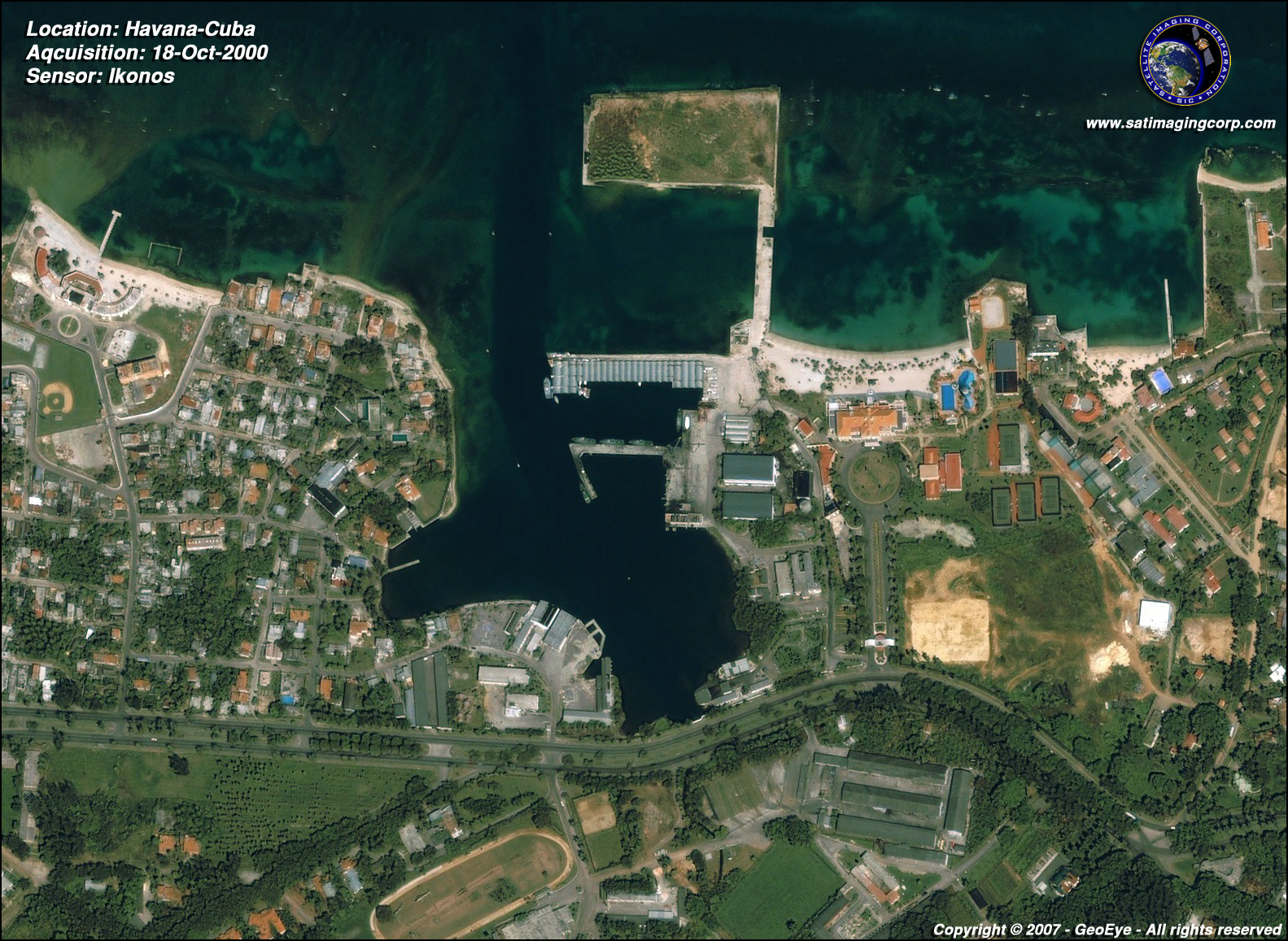
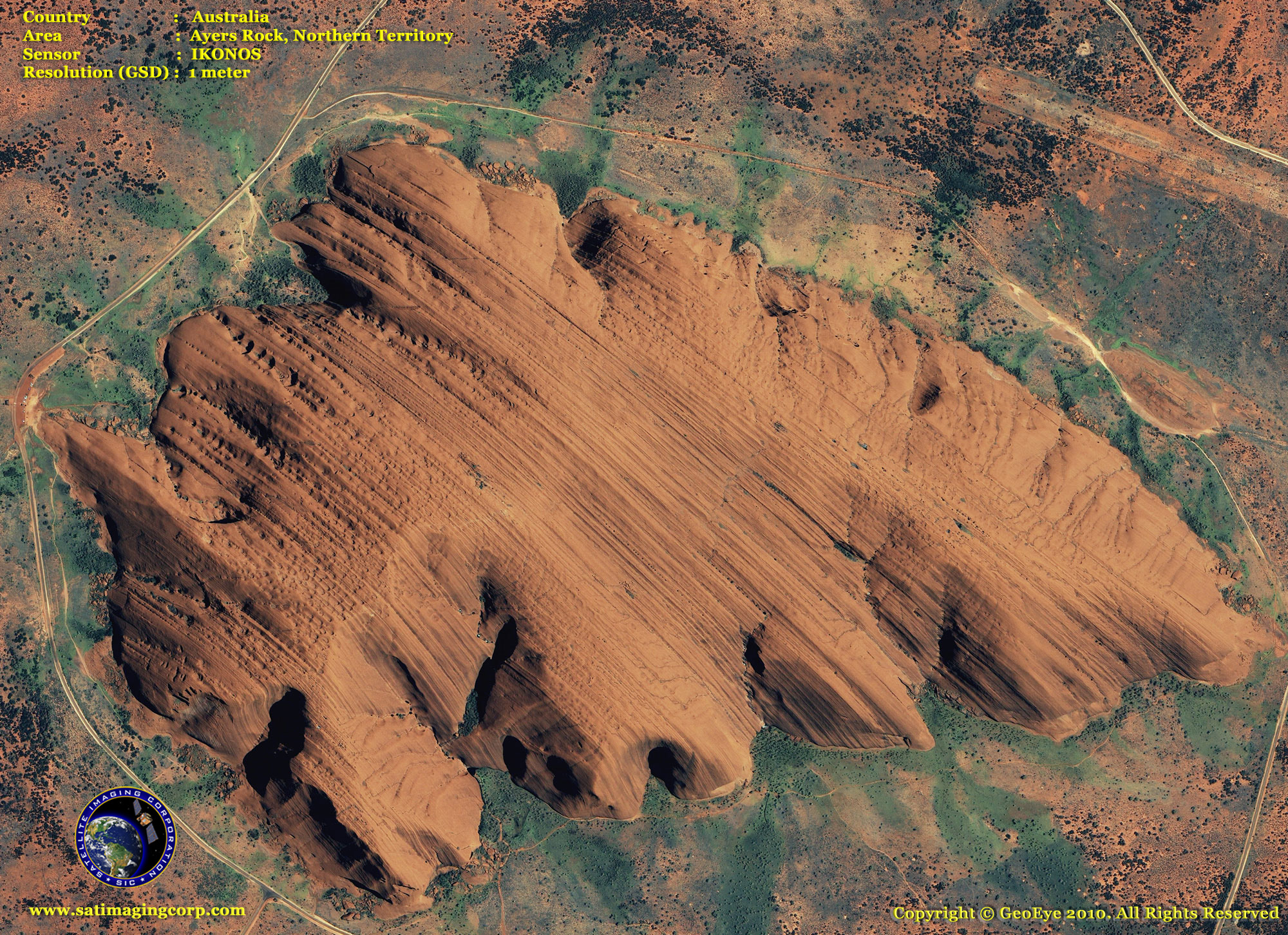
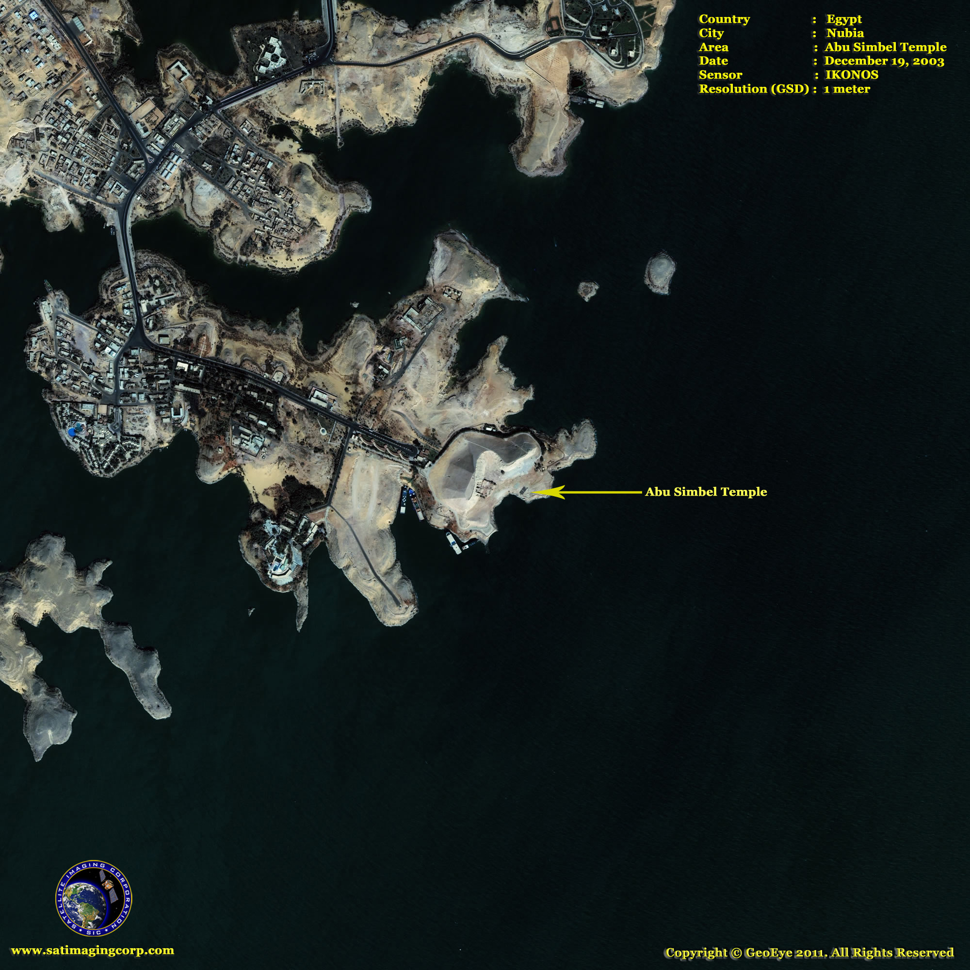
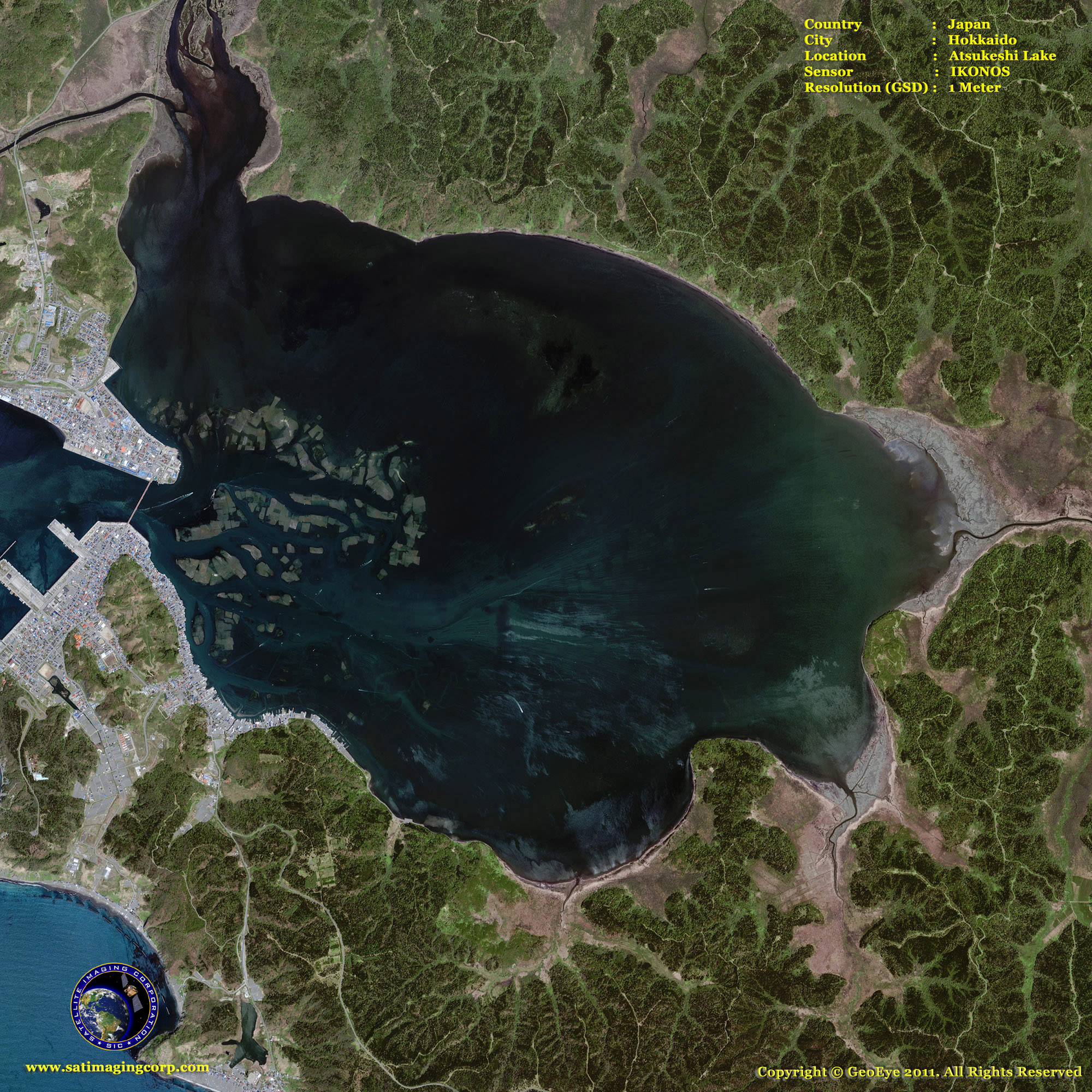
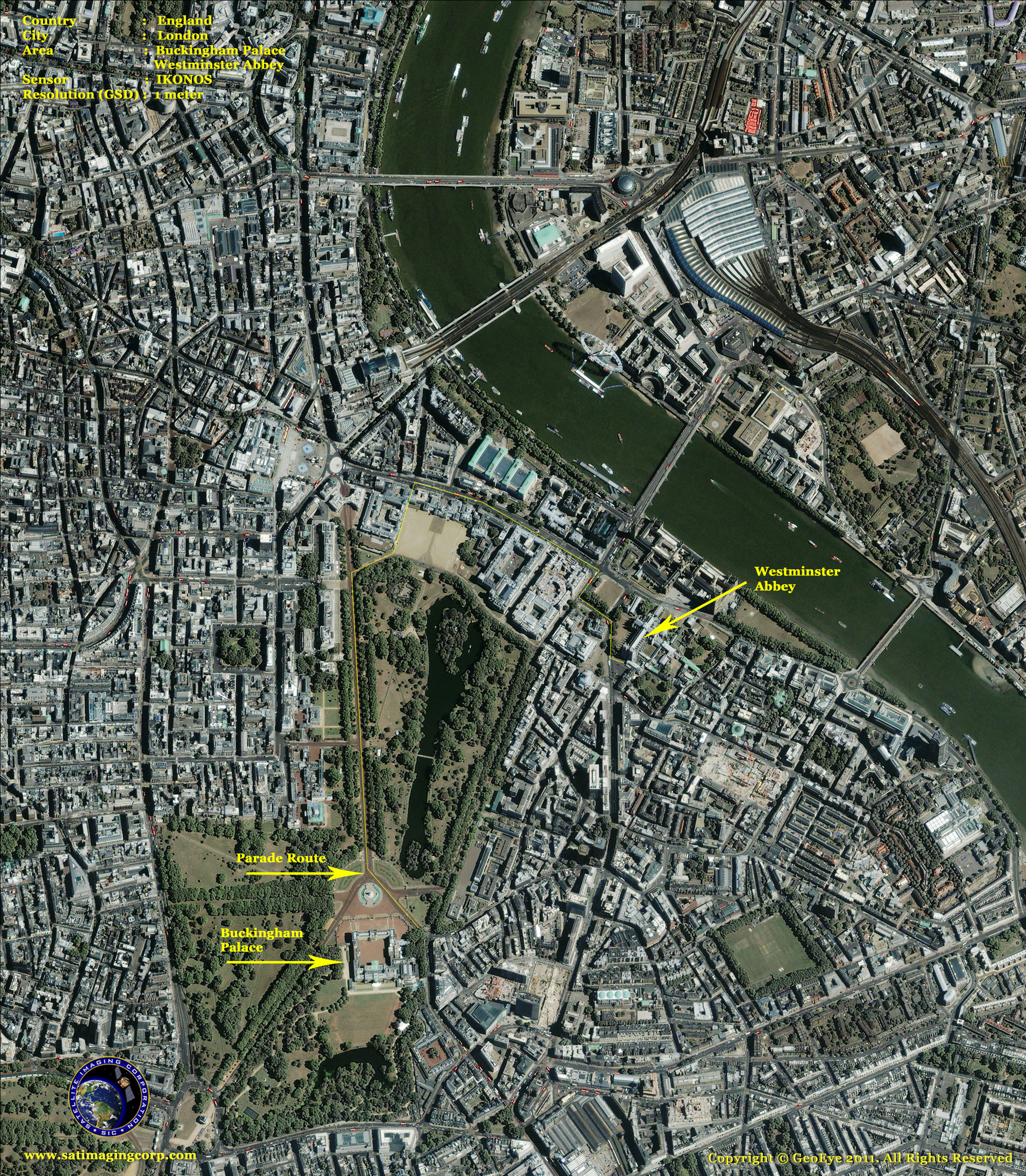
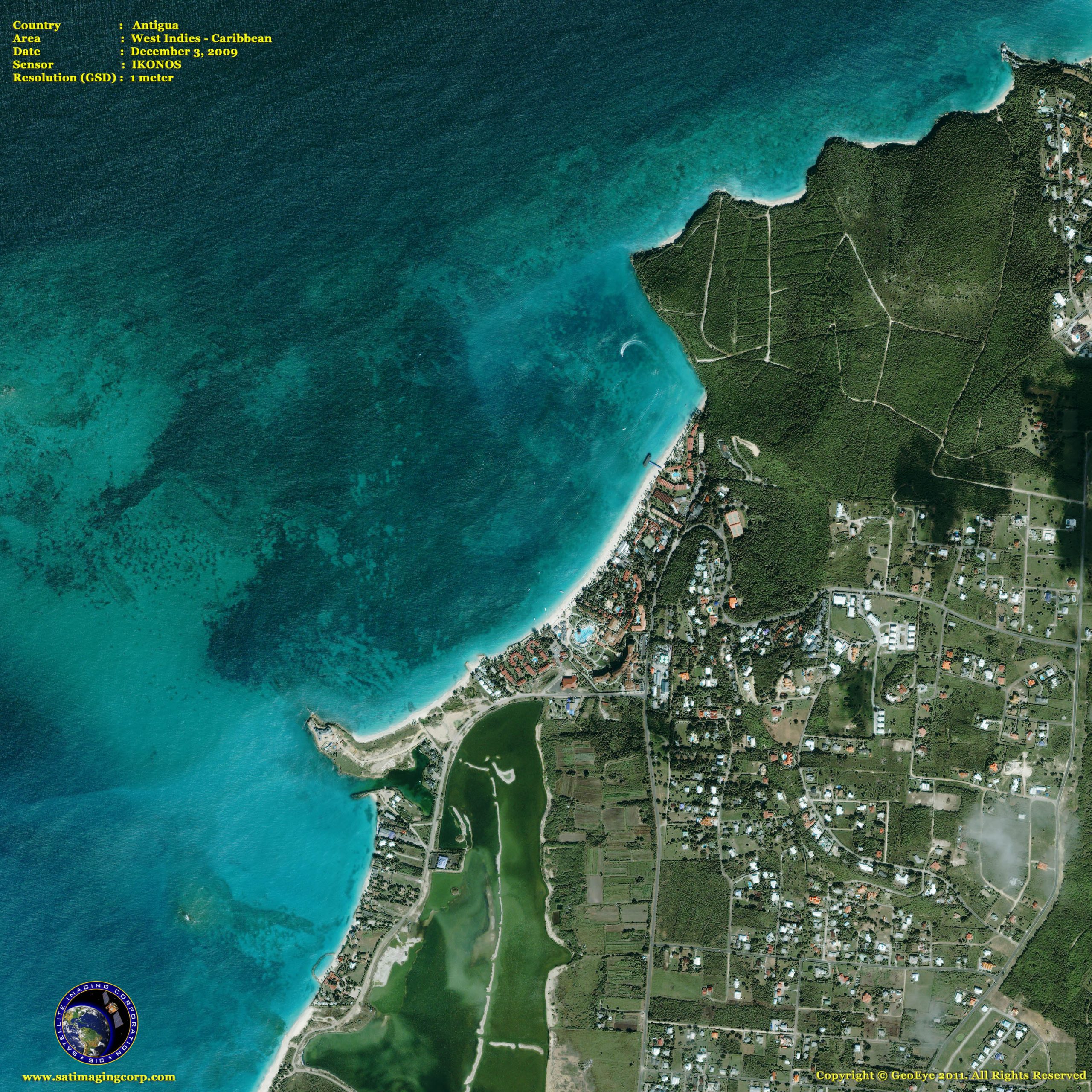
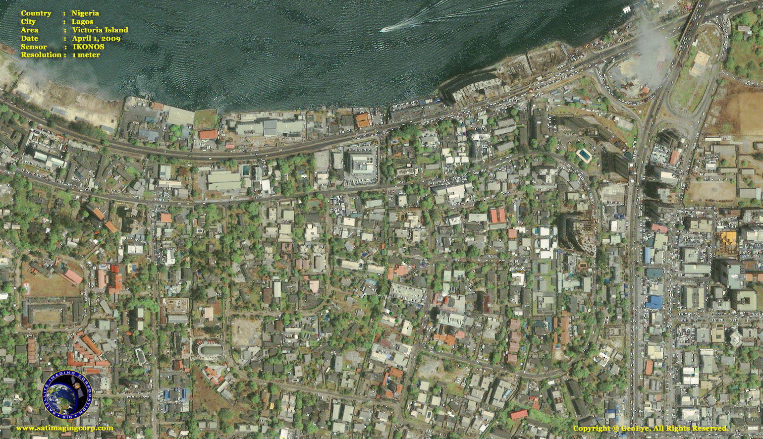
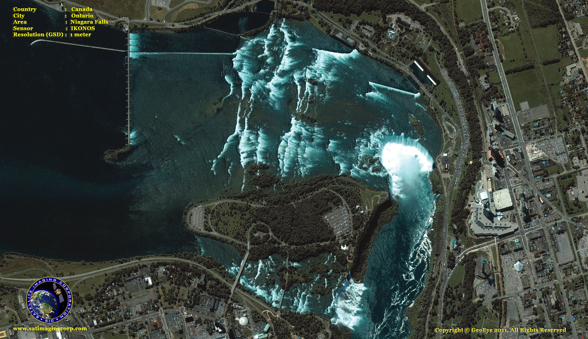
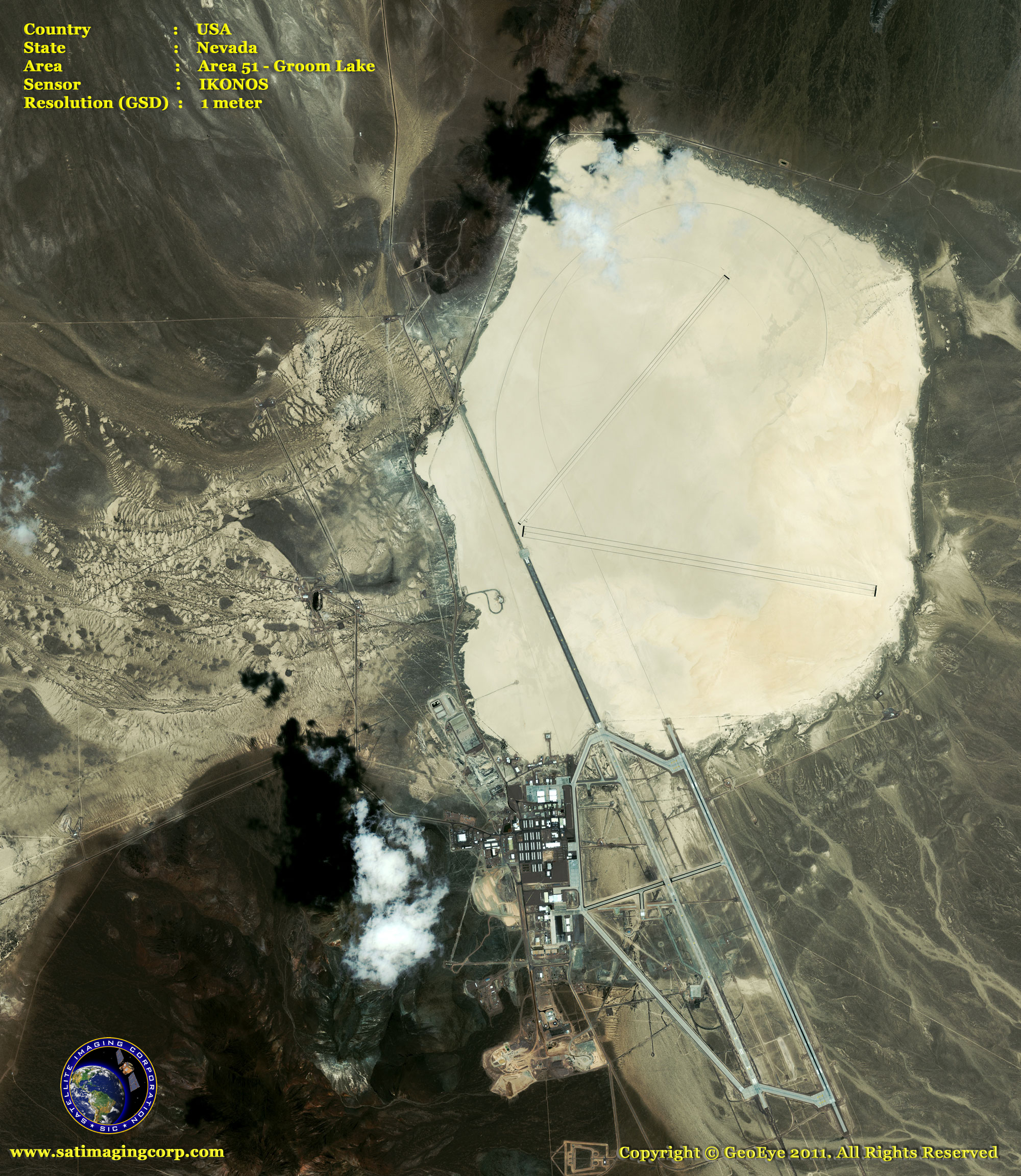
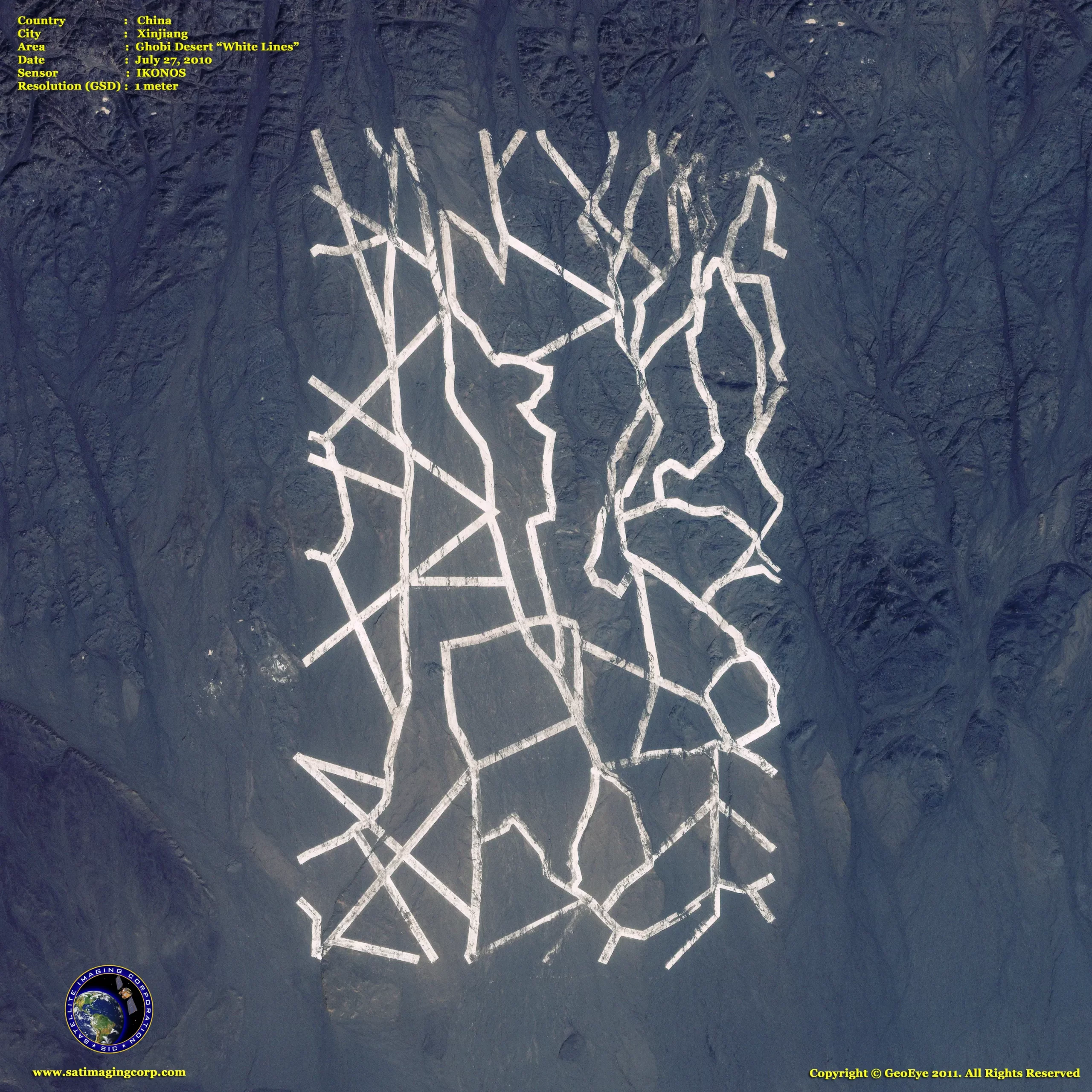
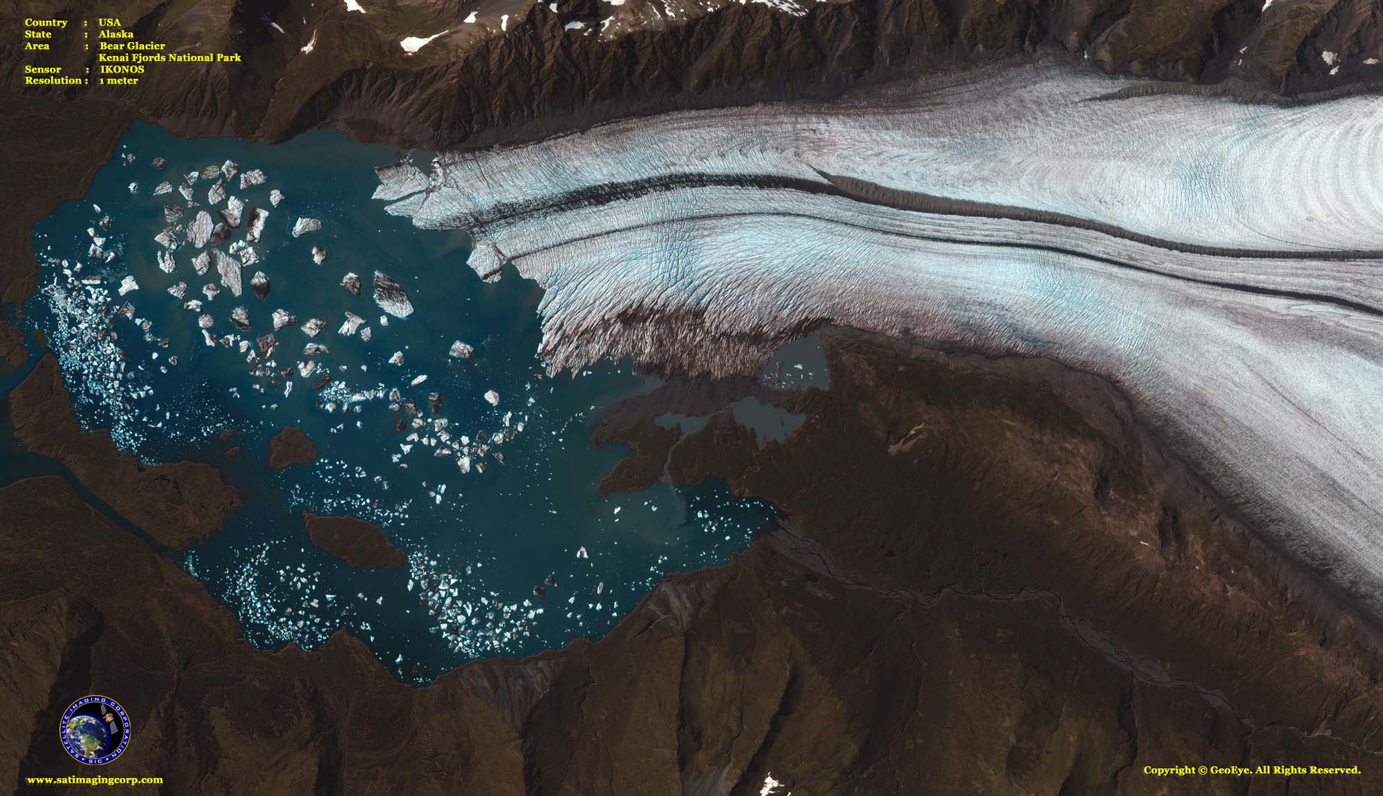
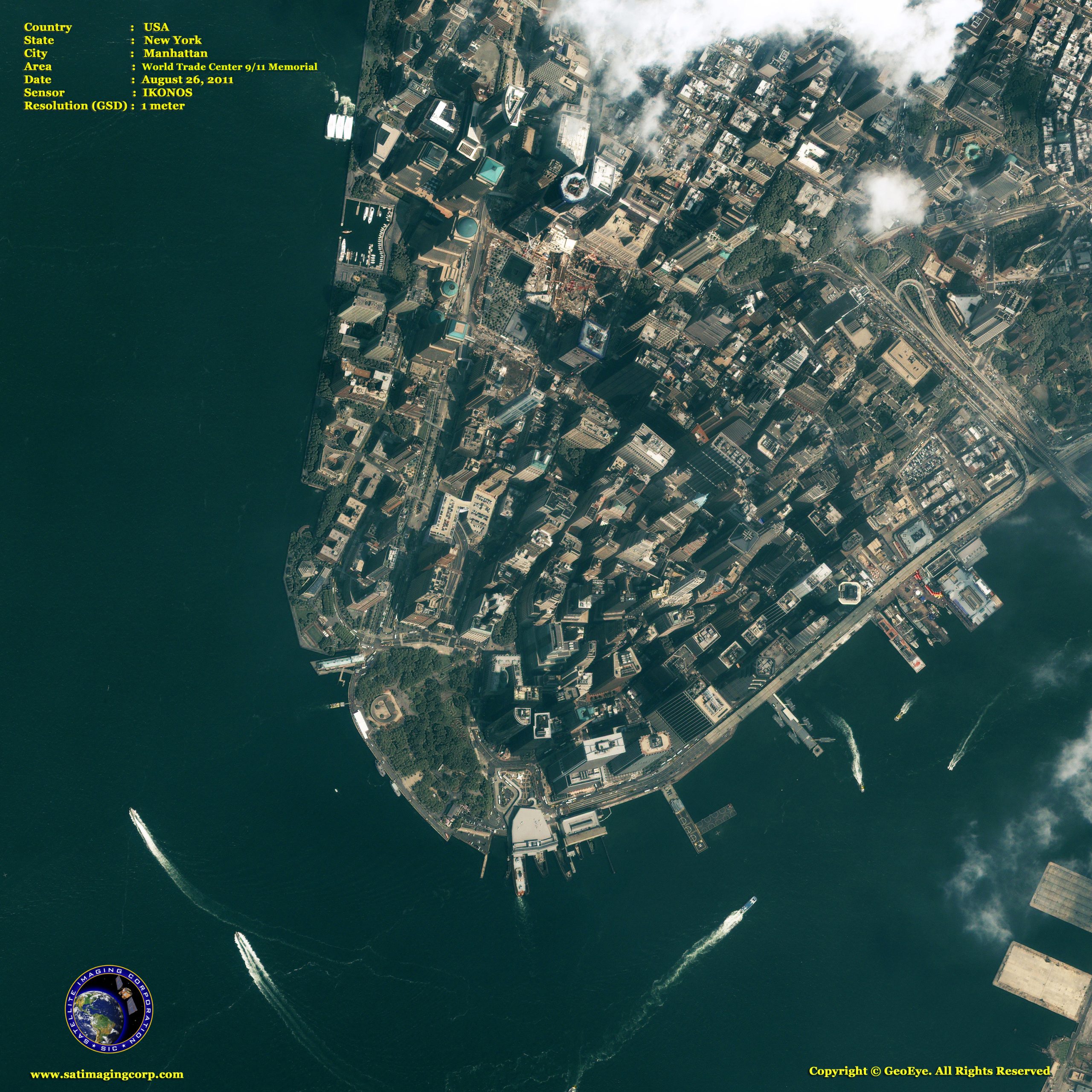
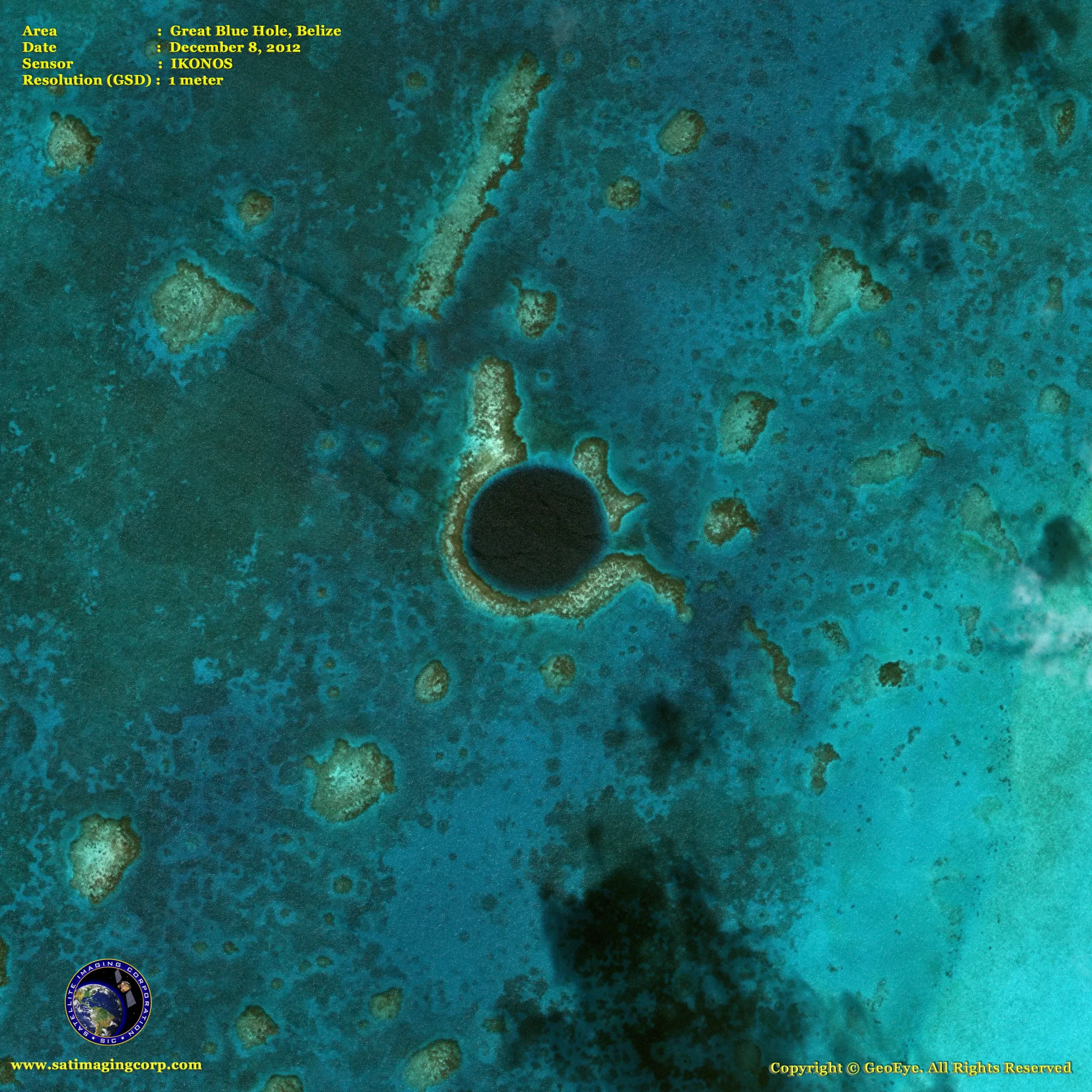
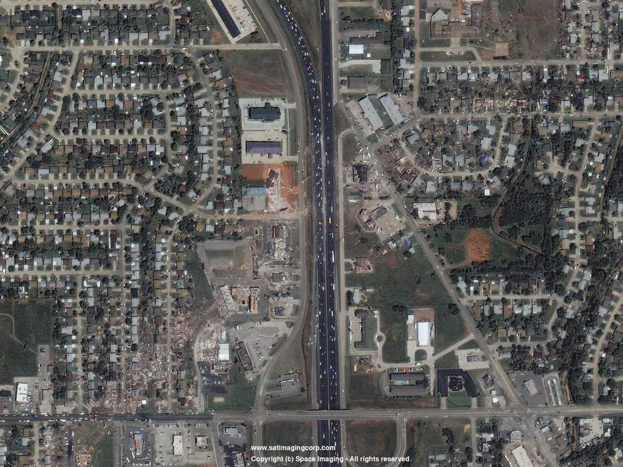
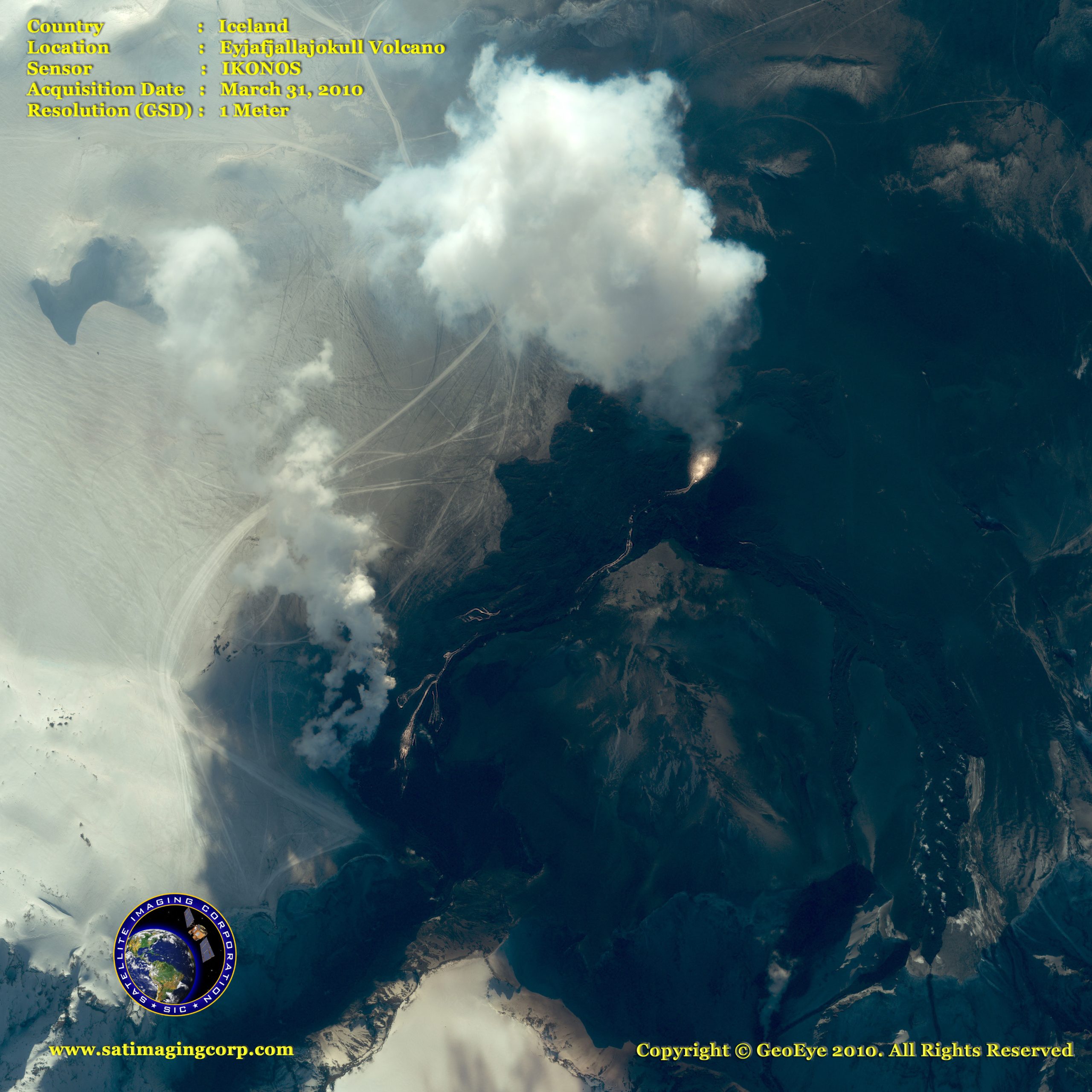
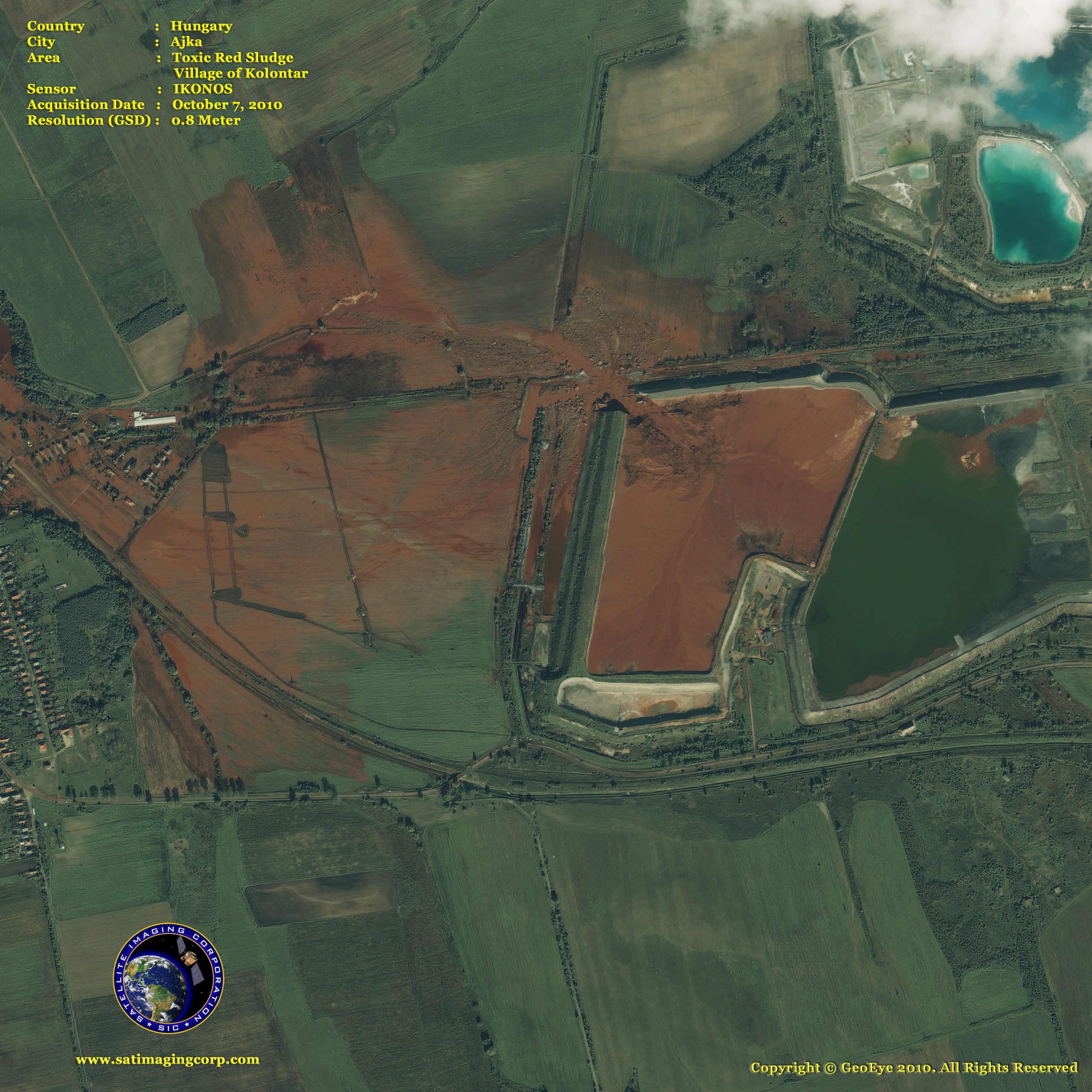
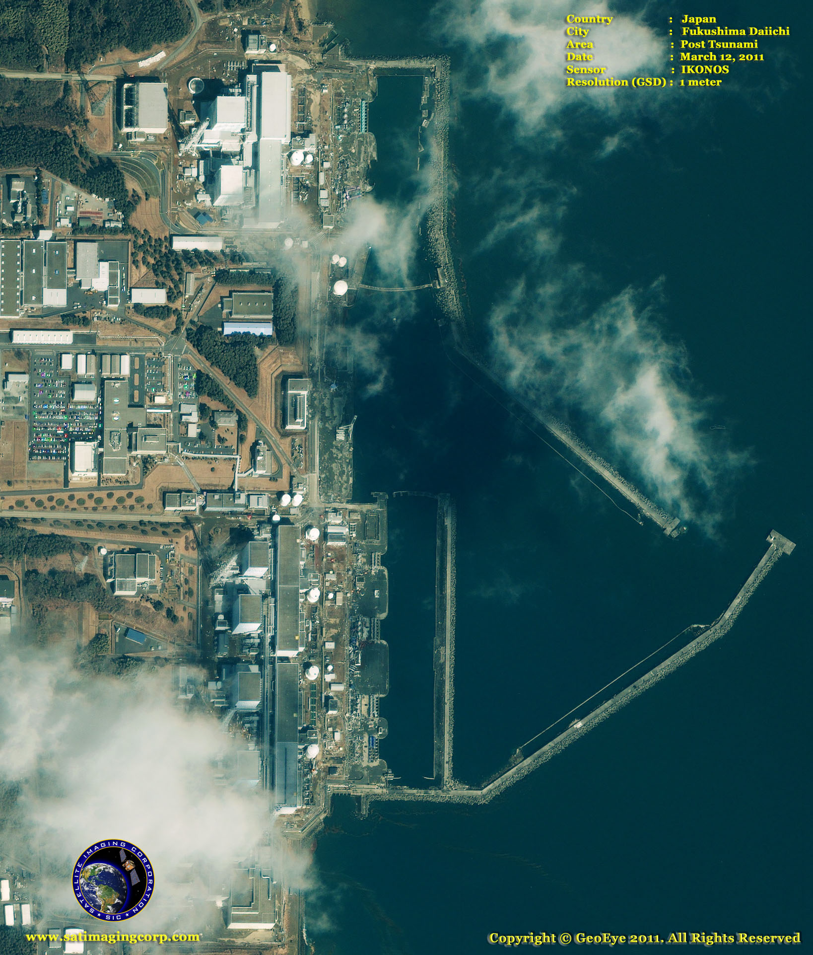
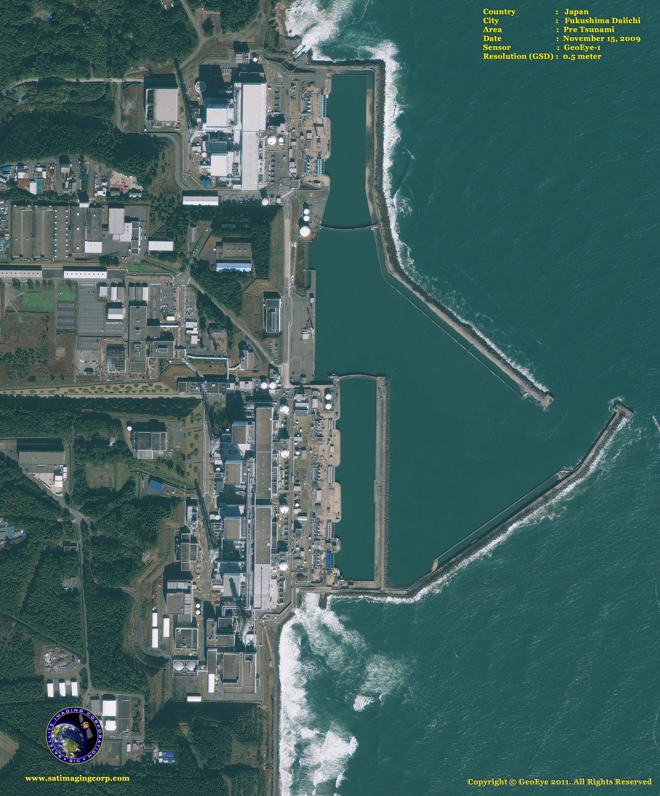
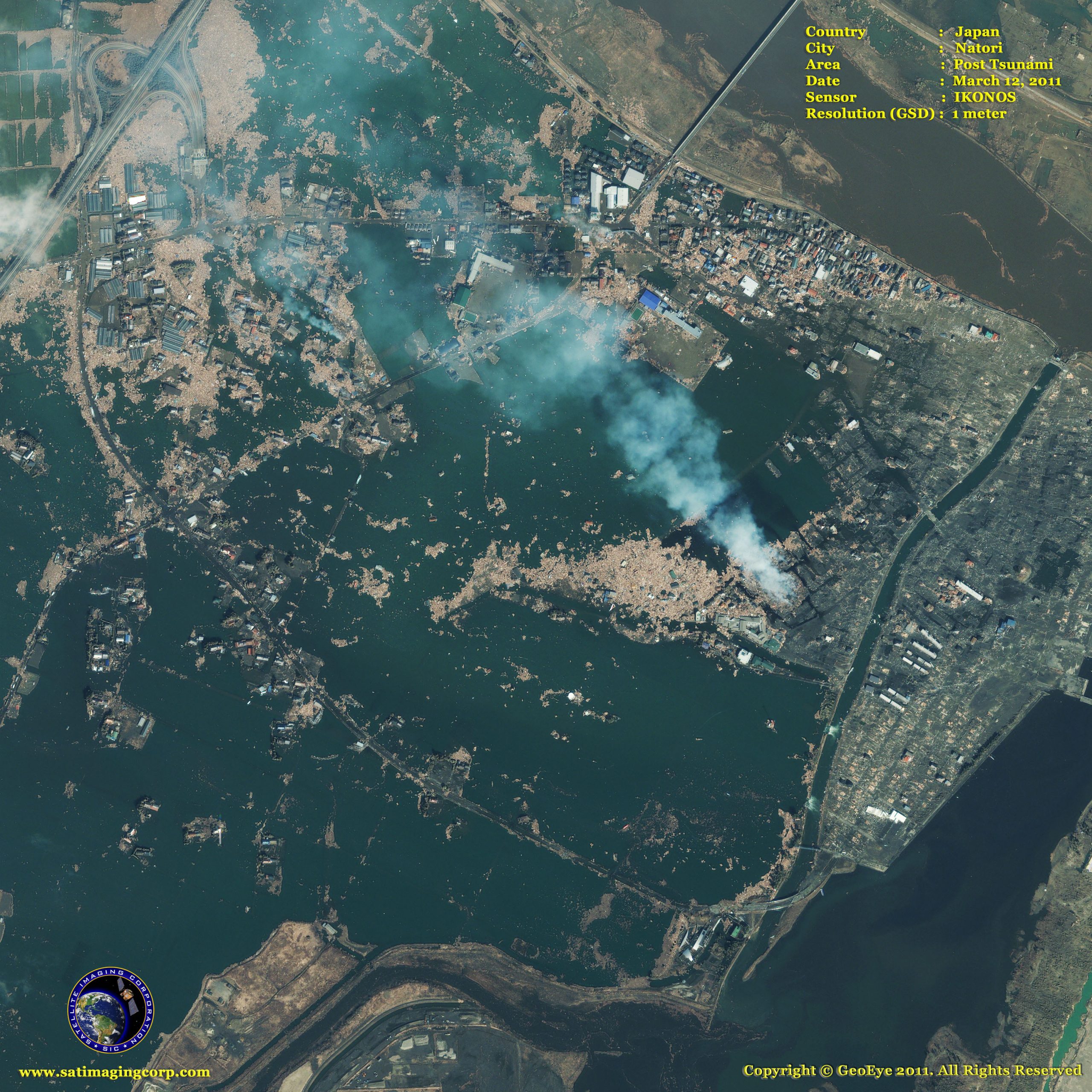
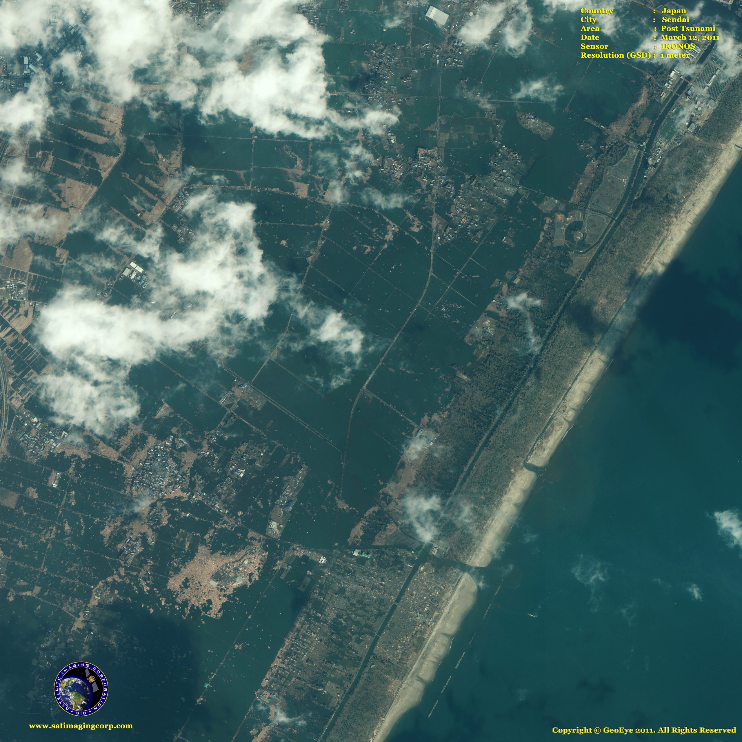
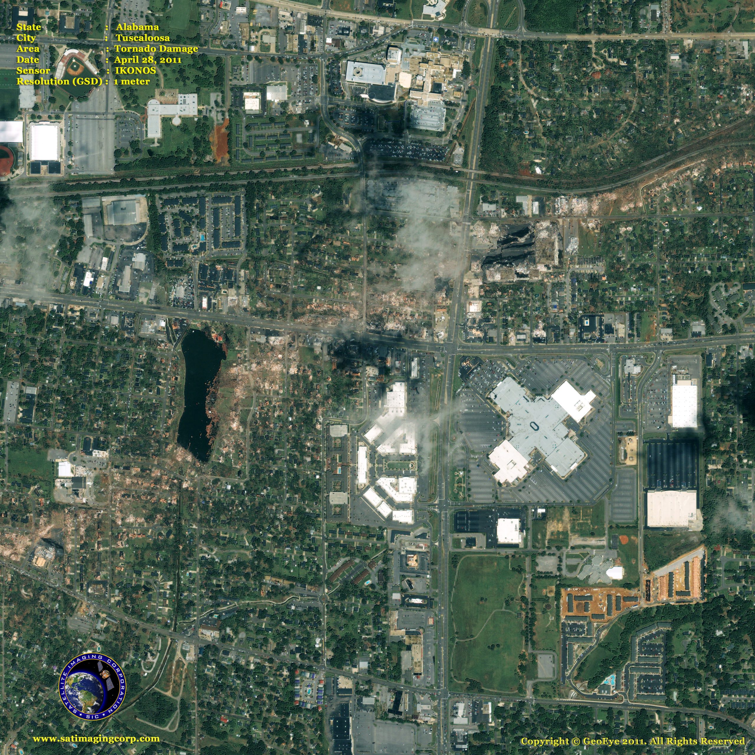
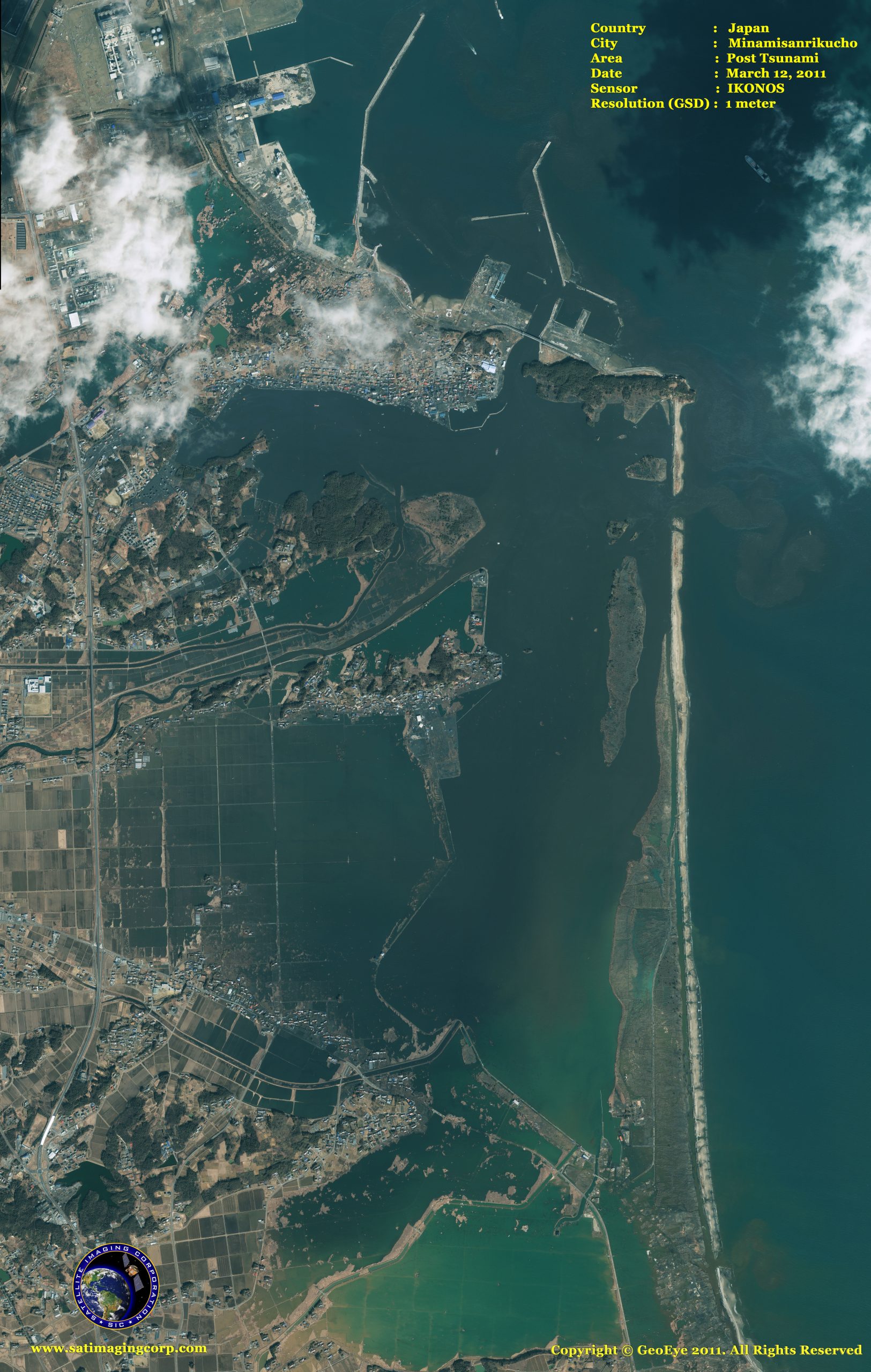
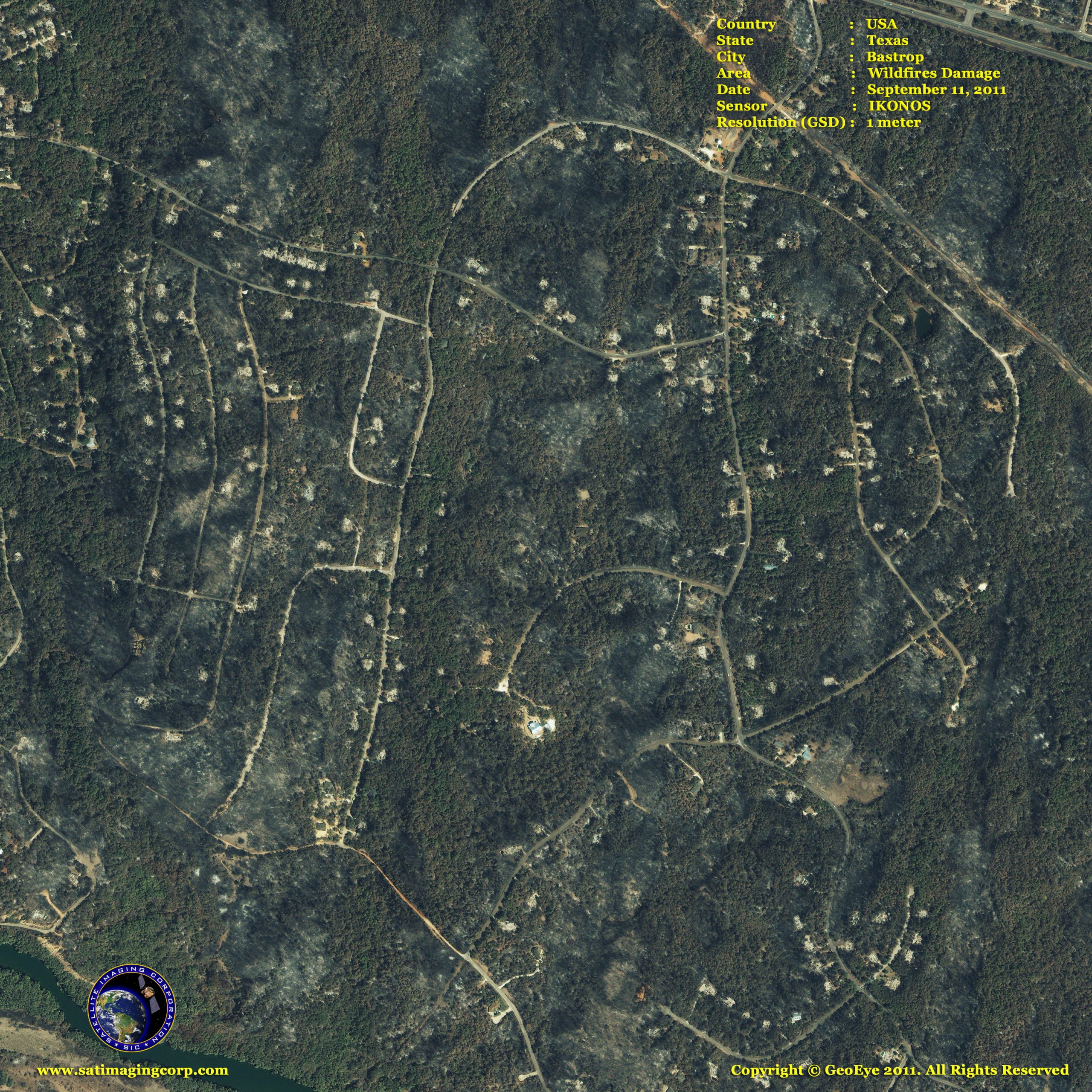
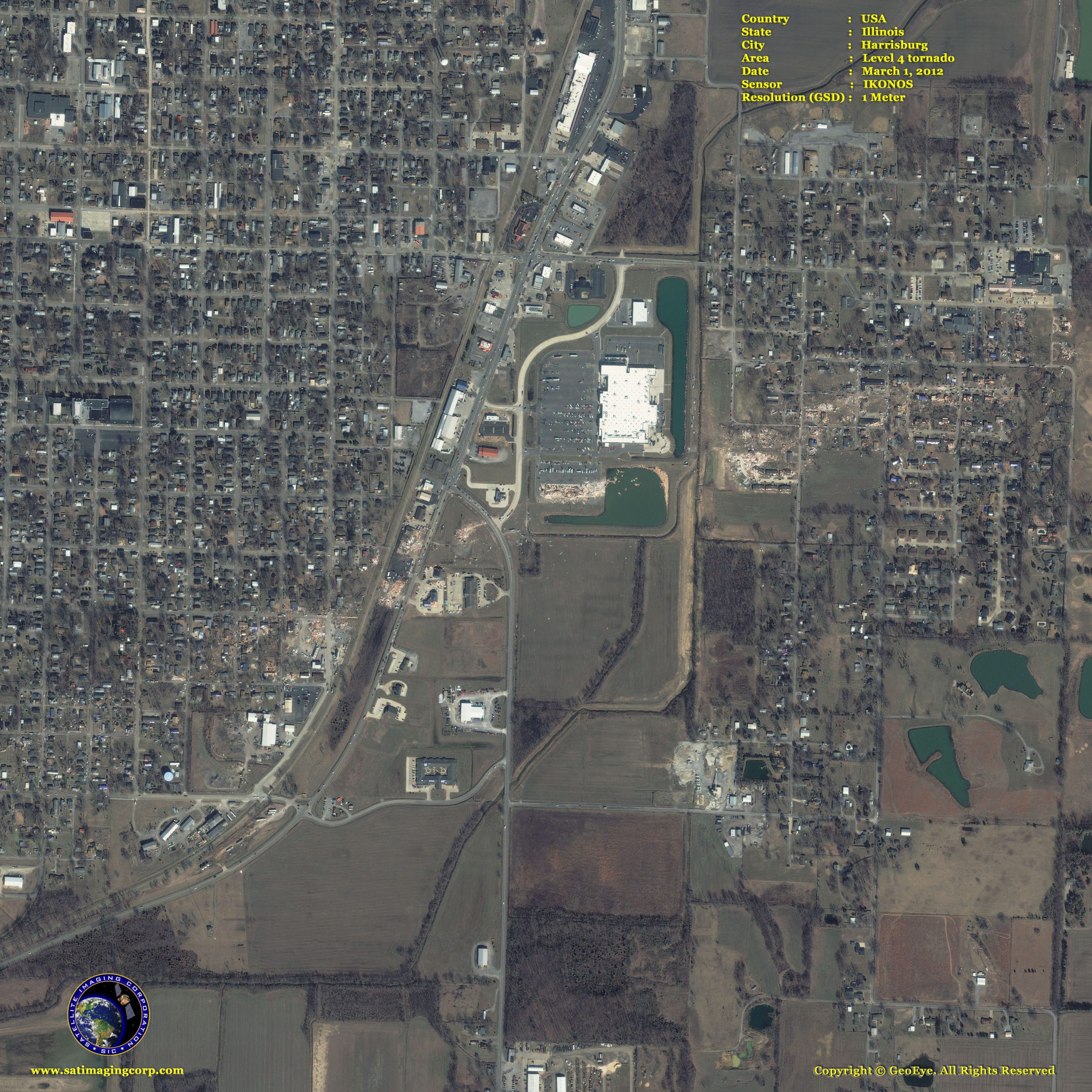
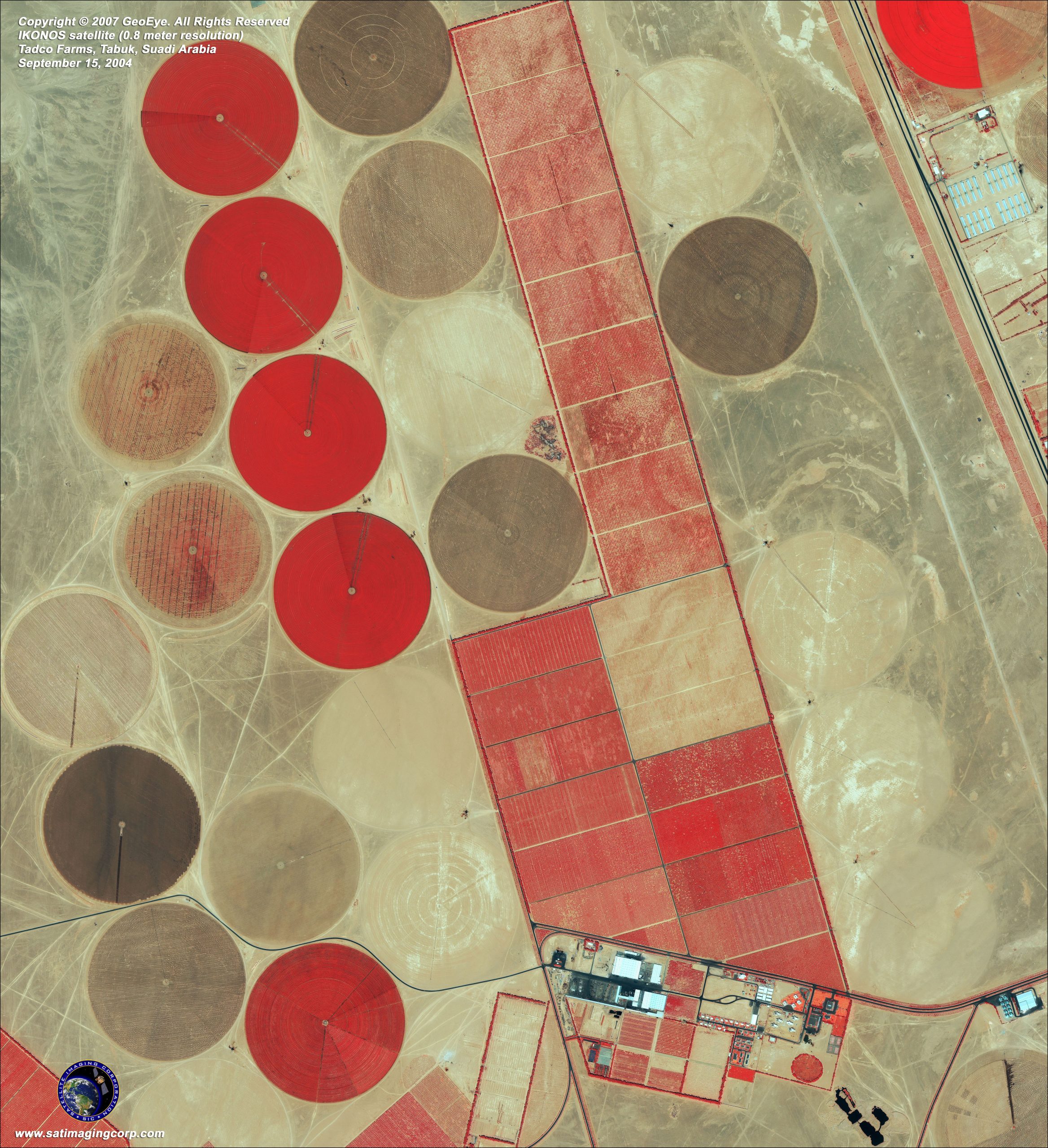
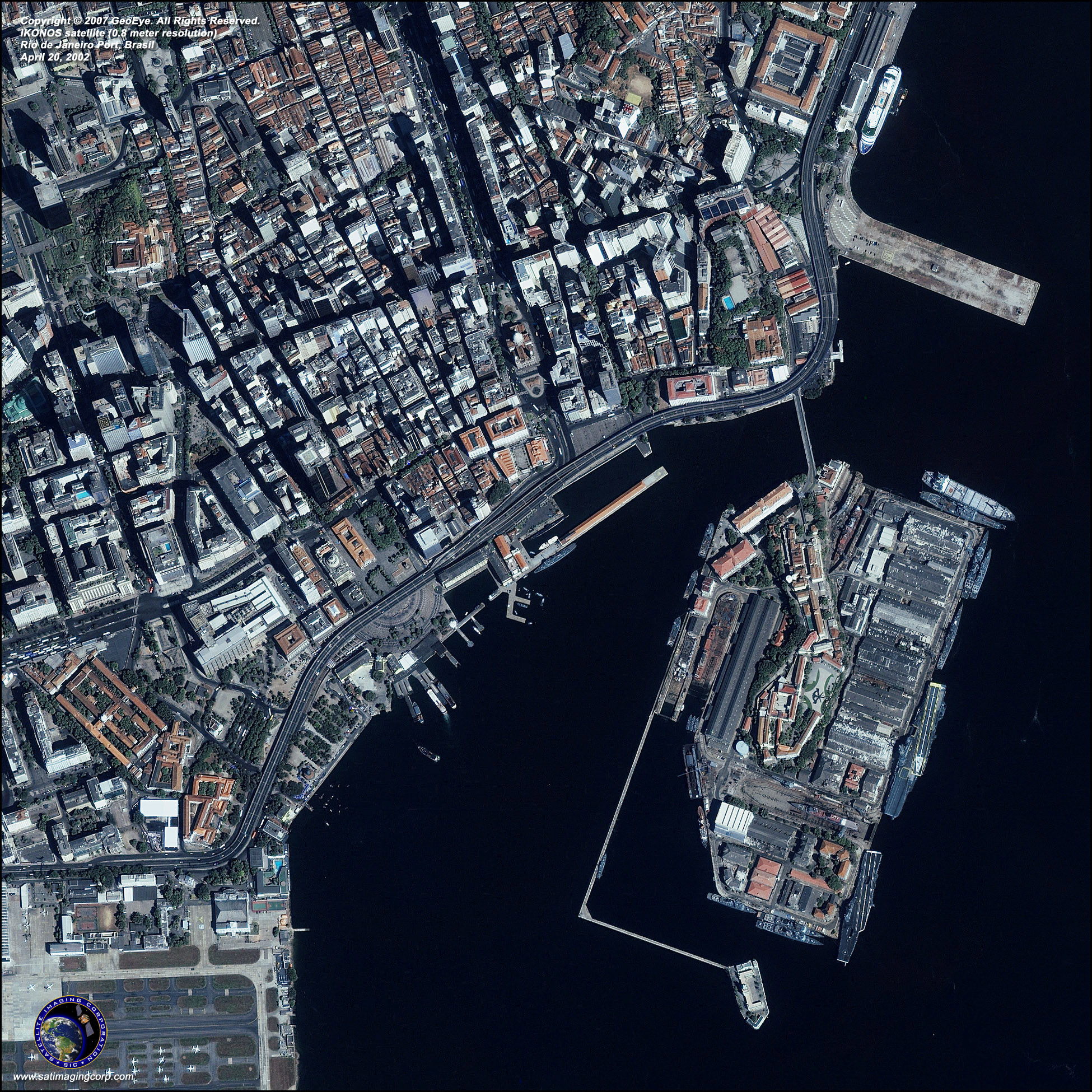
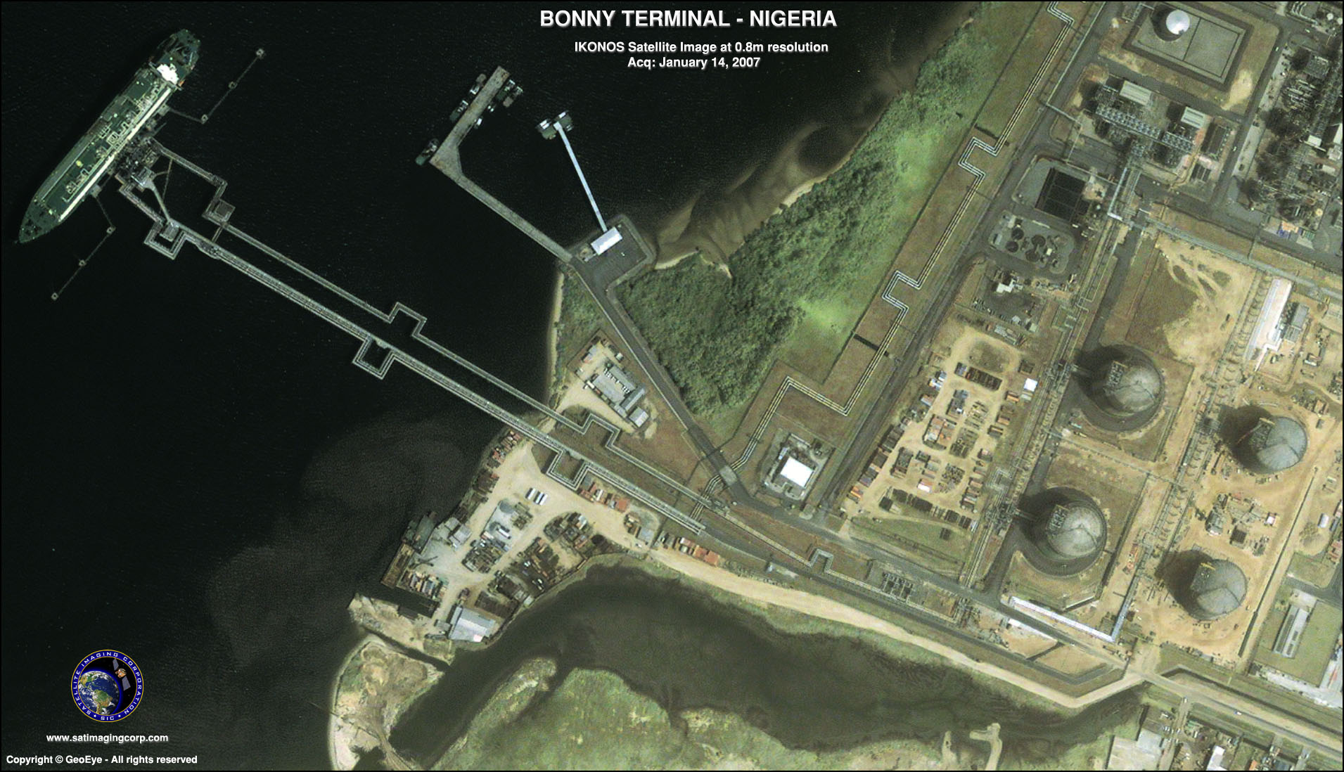
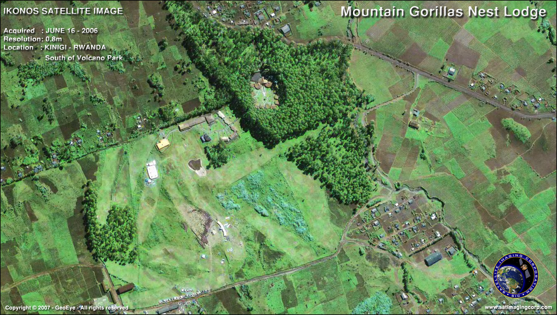
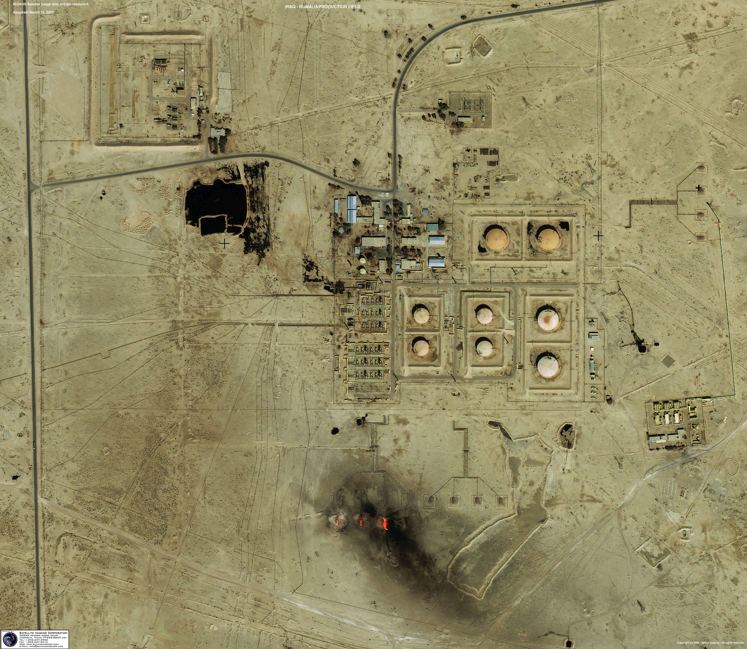
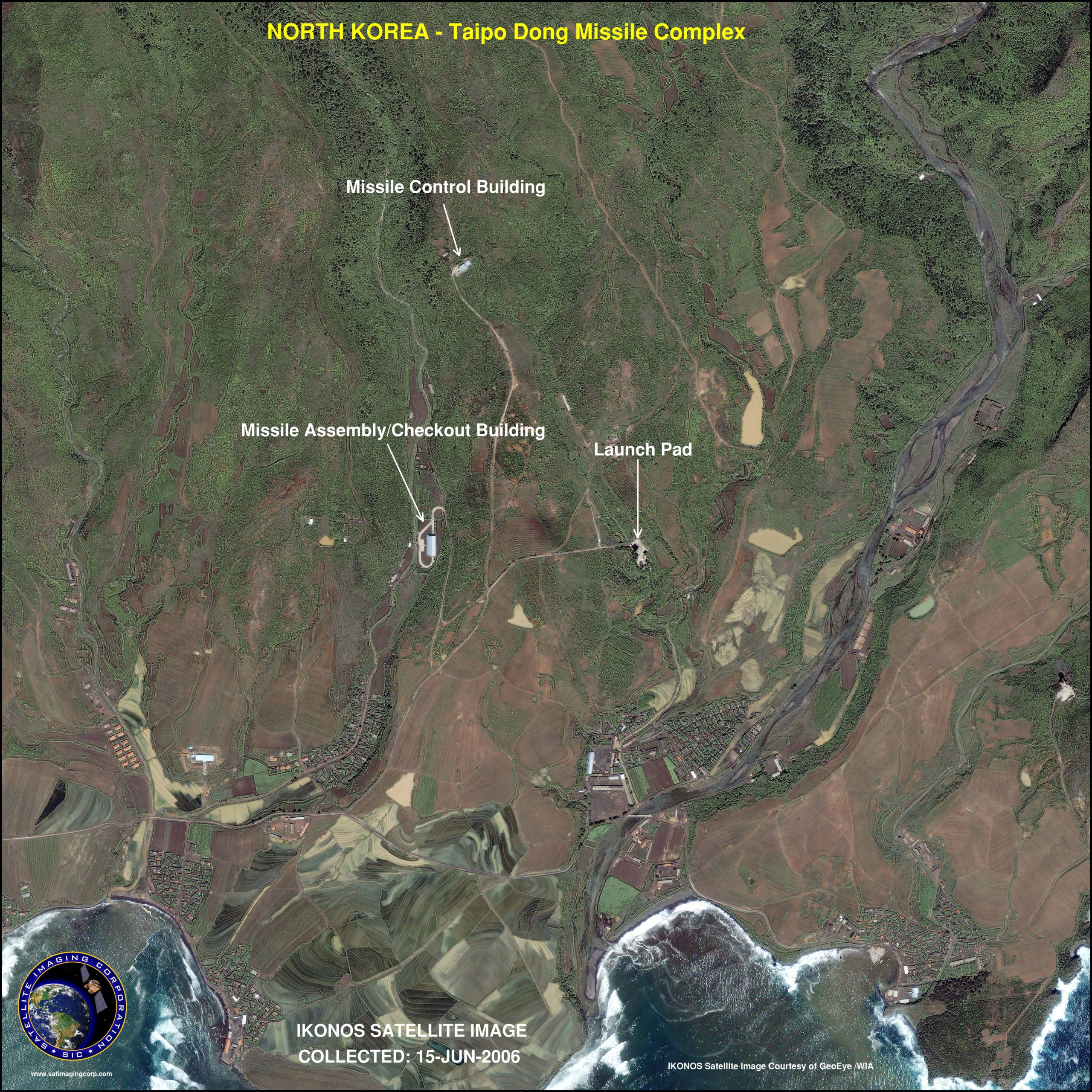
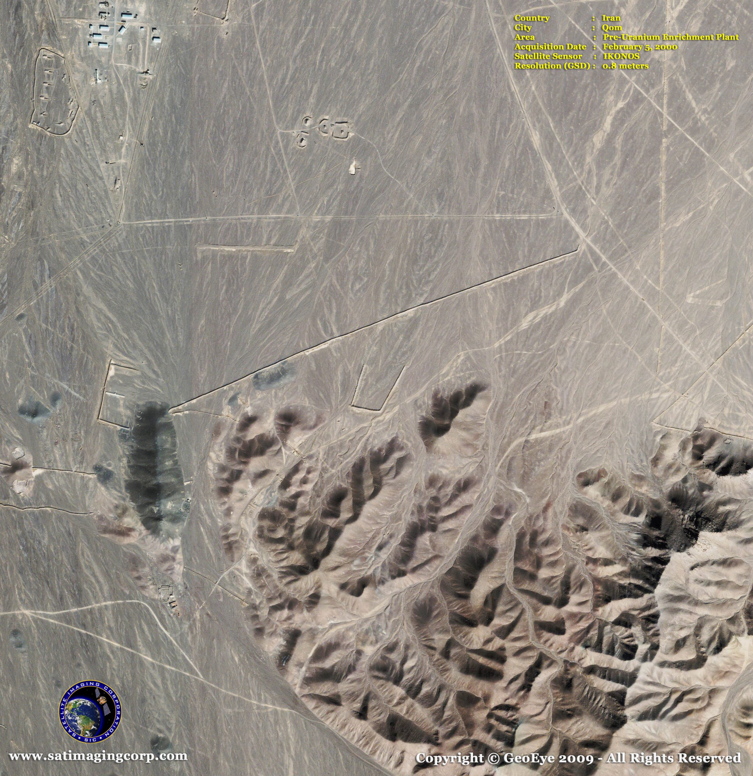
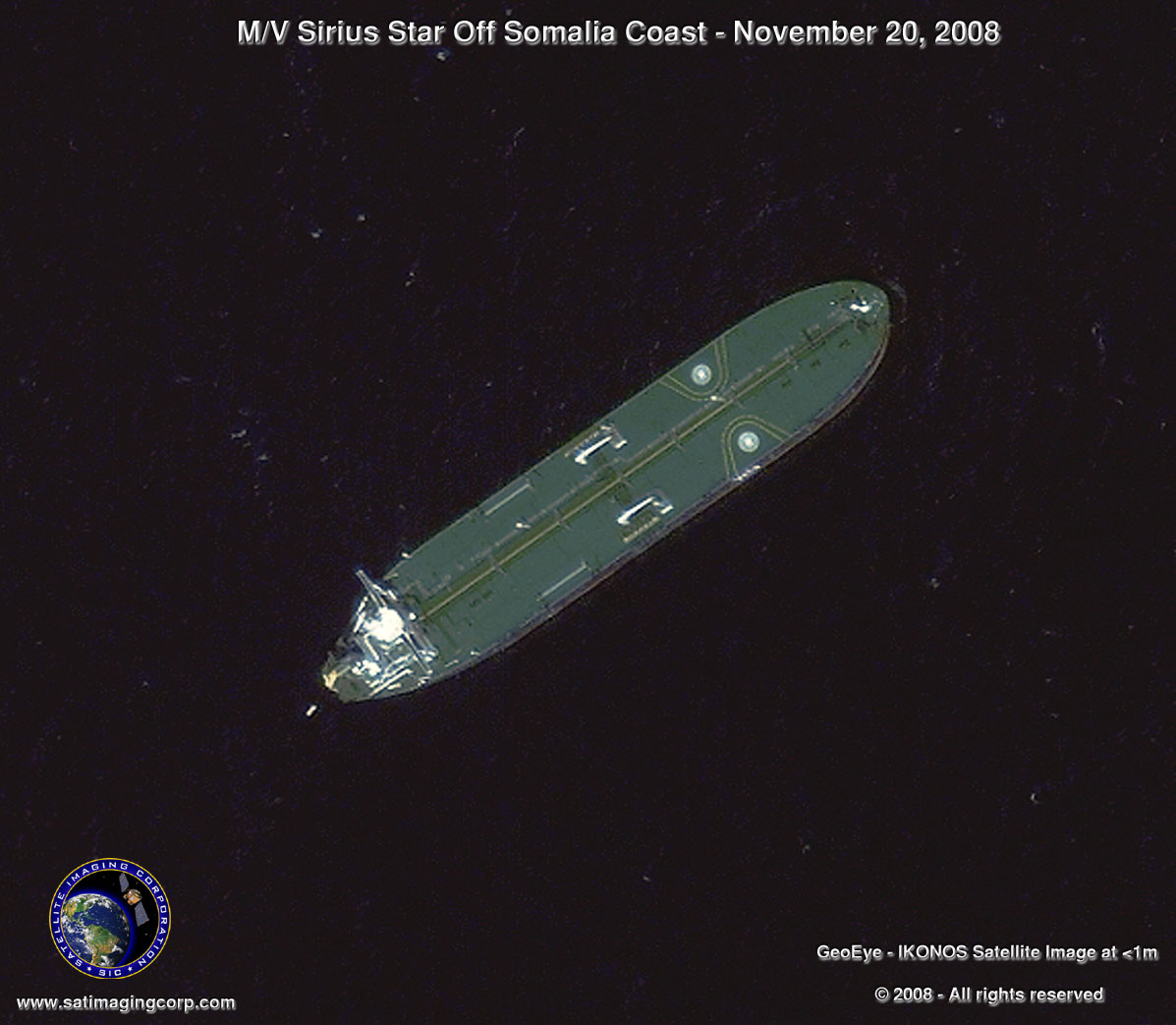
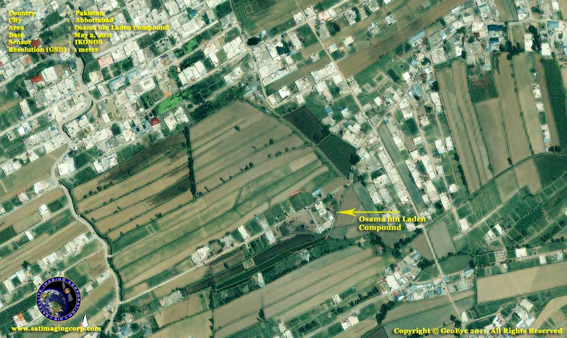
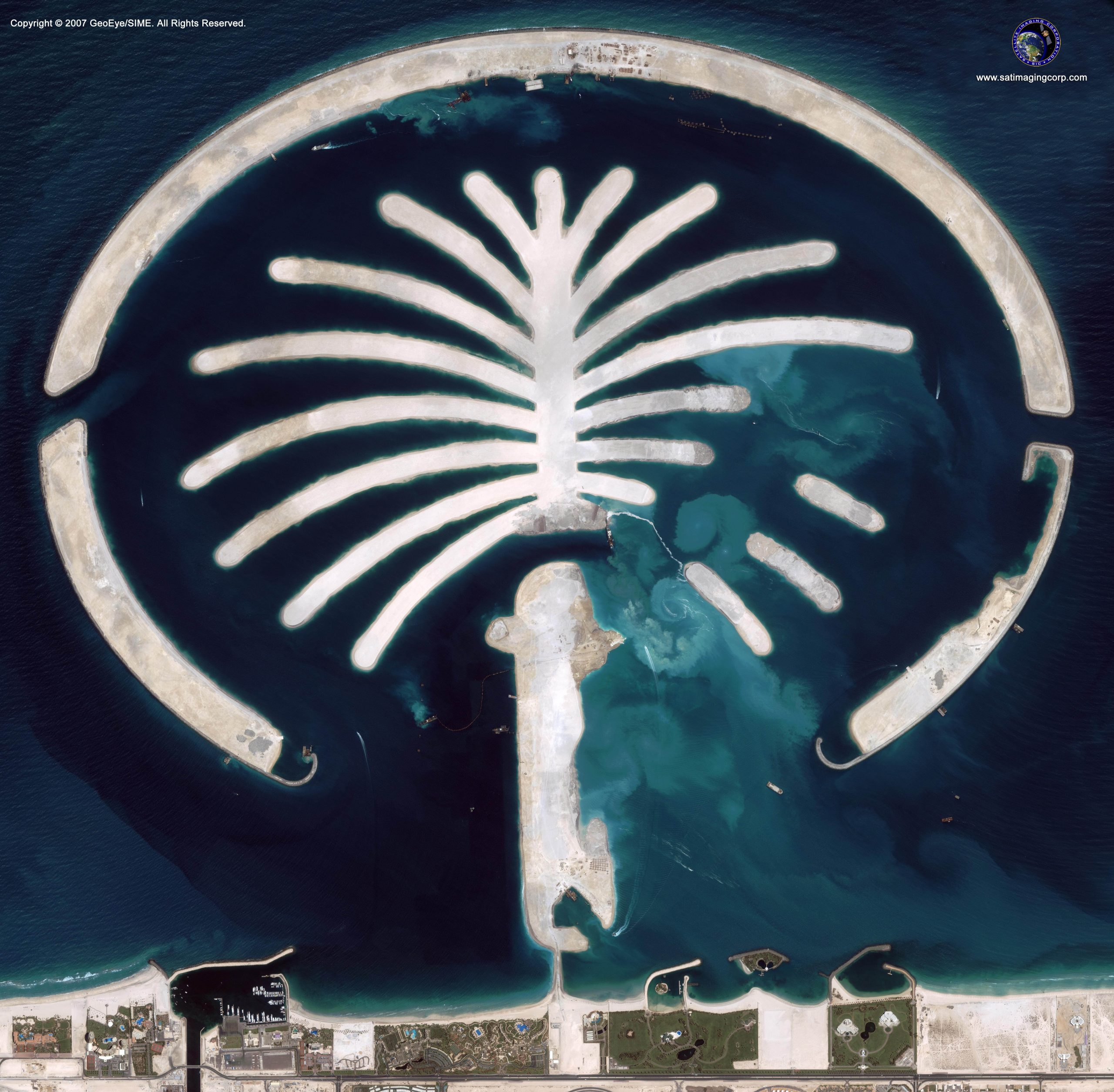
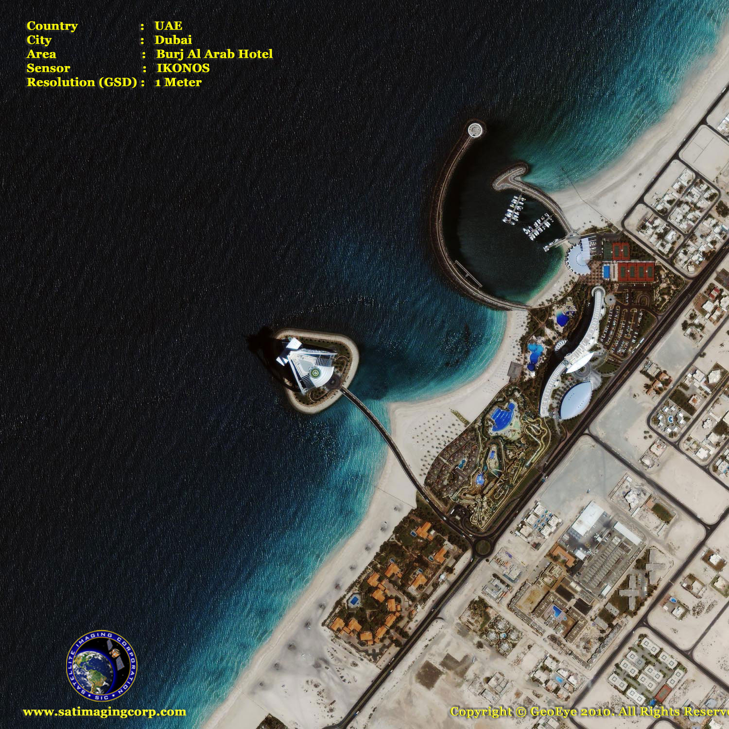
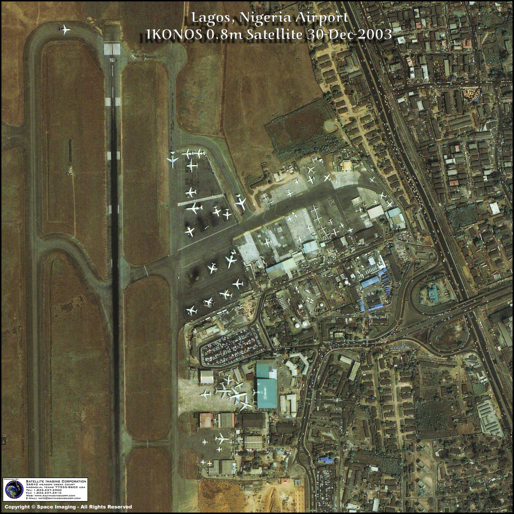
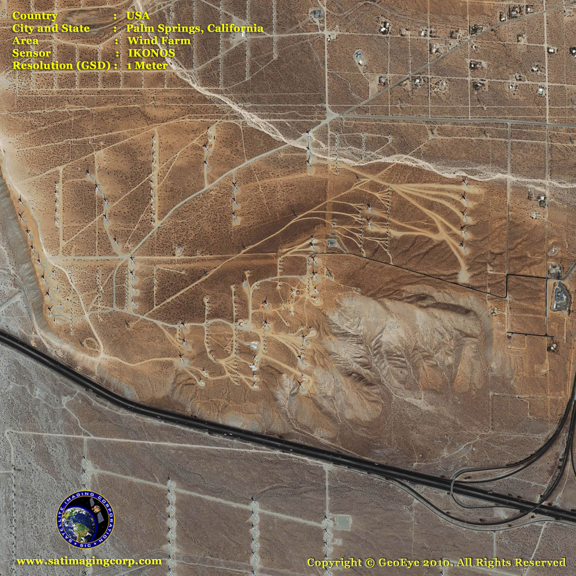
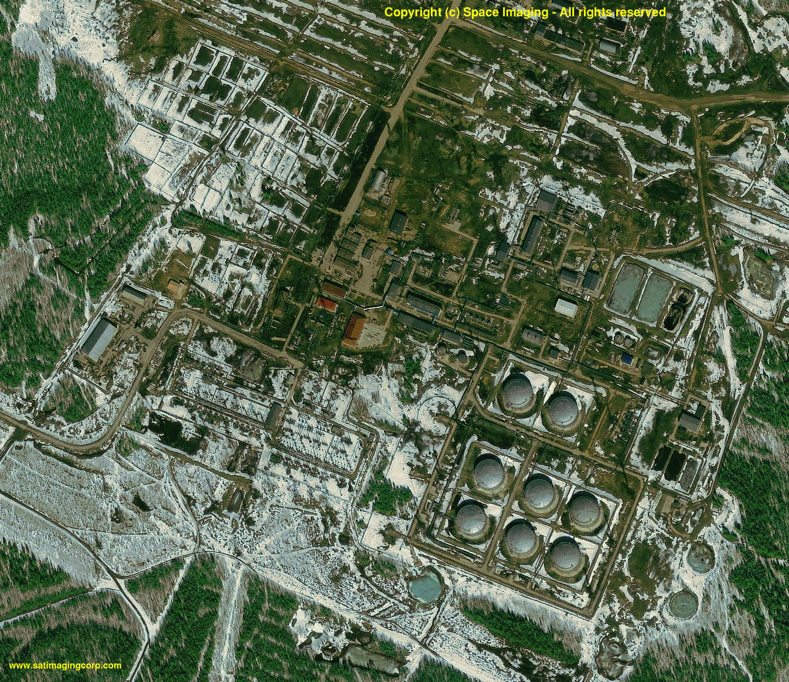
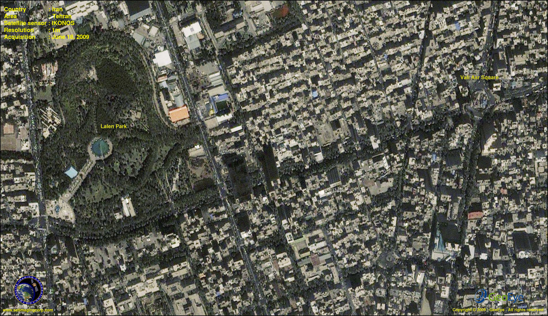
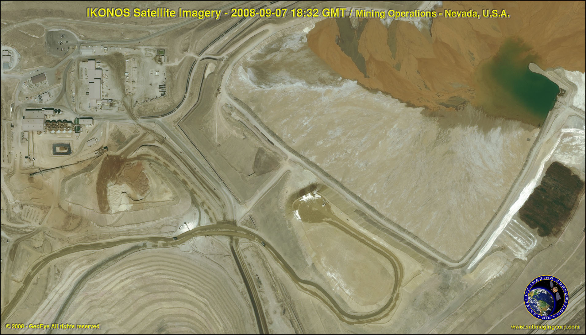
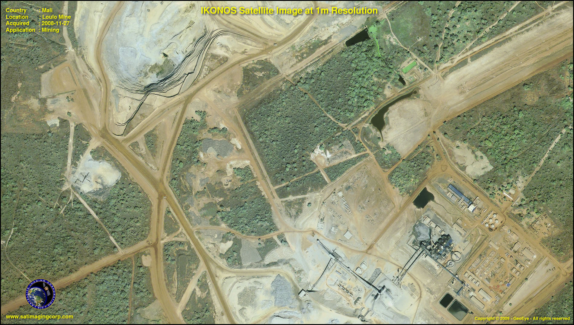
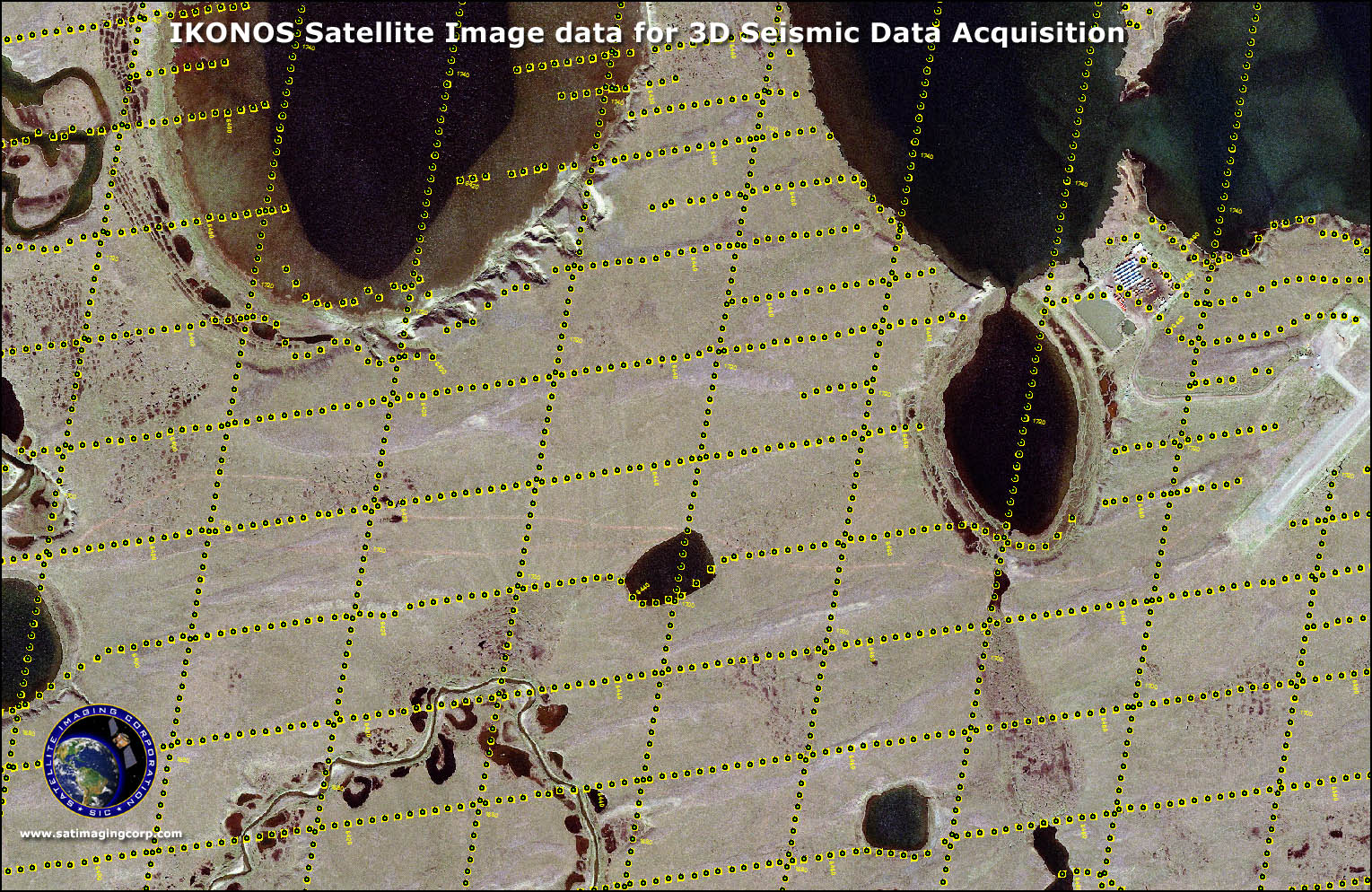
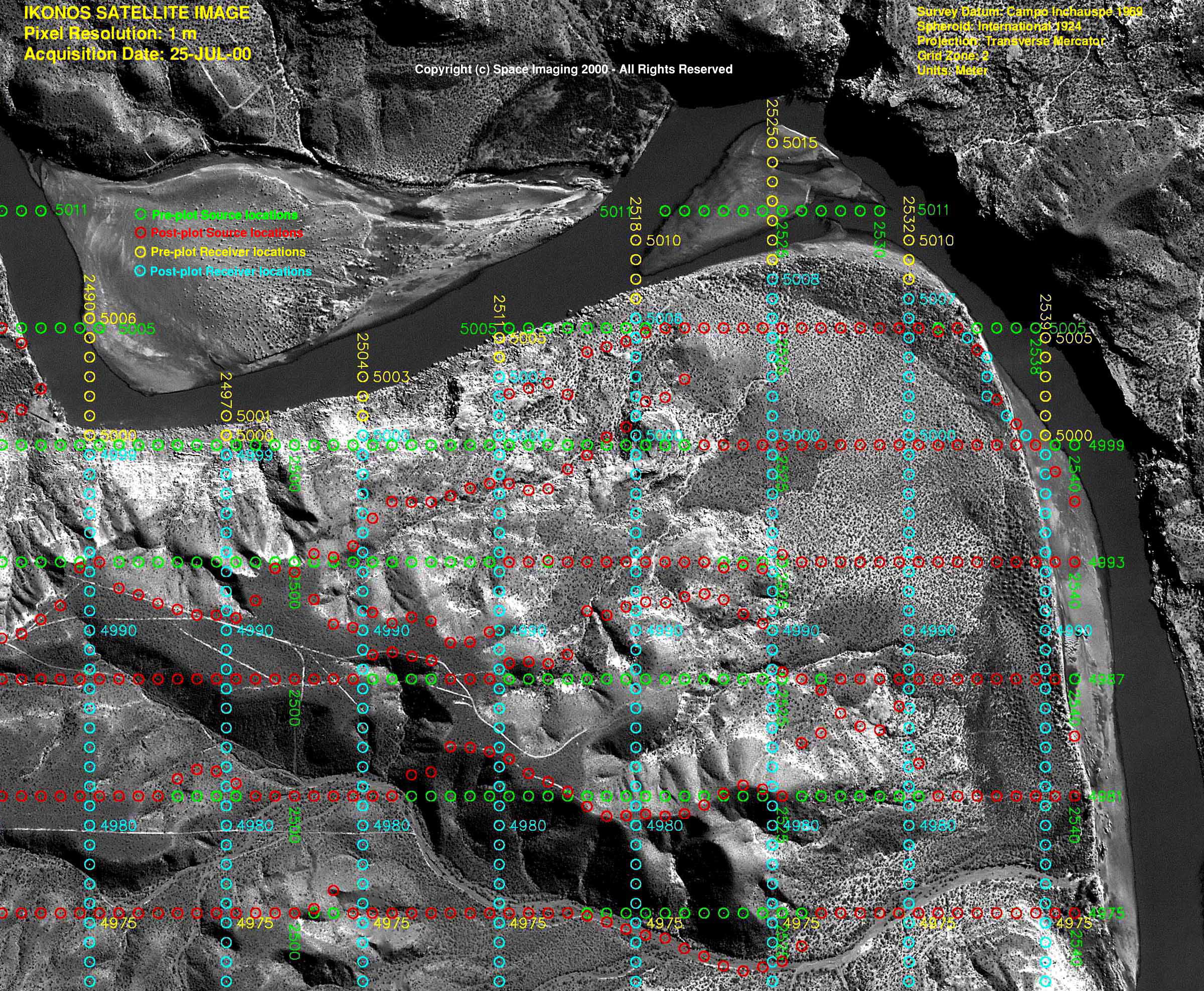
Sample Images
Pleiades-1A Satellite Image Gallery
* Click on thumbnail to view in full resolution.
For more information on any of our products and image processing services, please contact us for a complimentary consultation.
IKONOS Satellite Sensor Characteristics
Launch Date
24 September 1999 at Vandenberg Air Force Base, California, USA
Operational Life
Over 7 years
Orbit
98.1 degree, sun synchronous
Speed on Orbit
7.5 kilometers per second
Speed Over the Ground
6.8 kilometers per second
Revolutions Around the Earth
14.7, every 24 hours
Altitude
681 kilometers
Resolution at Nadir
0.80 meters panchromatic; 3.28 meters multispectral
Resolution 26° Off-Nadir
1.0 meter panchromatic; 4.0 meters multispectral
Image Swath
11.3 kilometers at nadir; 13.8 kilometers at 26° off-nadir
Equator Crossing Time
Nominally 10:30 AM solar time
Revisit Time
Approximately 3 days at 40° latitude
Dynamic Range
11-bits per pixel
Image Bands
Panchromatic, blue, green, red, near IR


