GeoEye-1 Satellite Sensor
(0.50m)
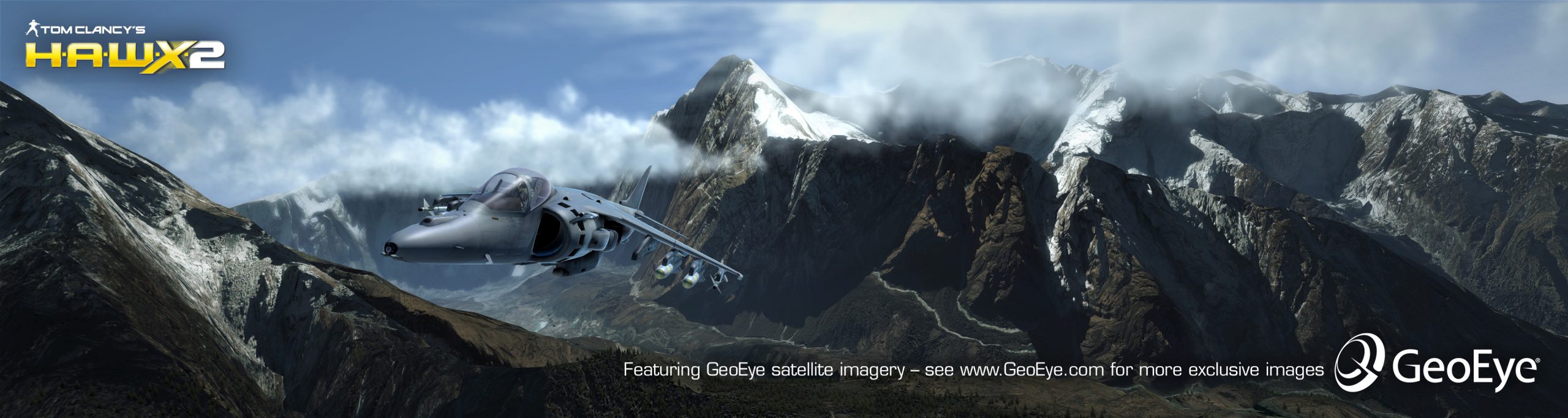
The GeoEye-1 satellite sensor was successfully launched on September 6, 2008. The satellite, which was launched at Vanderberg Air Force Base, California, provides a resolution of 0.46-meters. Watch a video of GeoEye-1 satellite launch. GeoEye-1 is capable of acquiring image data at 0.50-meter panchromatic (B&W) and 1.84-meter multispectral resolution. It also features a revisit time of fewer than three days, as well as the ability to locate an object within just three meters of its physical location.
GeoEye-1 Satellite Sensor

Copyright © MAXAR. All rights reserved.
The GeoEye-1 satellite sensor features the most sophisticated technology ever used in a commercial remote sensing system. This sensor is optimized for large projects, as it can produce over 350,000 square kilometers of pan-sharpened multispectral satellite imagery every day.
GeoEye-1 has been flying at an altitude of about 681 kilometers and is capable of producing imagery with a ground sampling distance of 46-centimeters, meaning it can detect objects of that diameter or greater.
During the late summer of 2013, the orbit altitude of the GeoEye-1 satellite sensor was raised to 770 Km/ 478 Miles. GeoEye-1 new nadir ground sample distance (GSD) is 46cm compared to the previous GSD of 41cm.
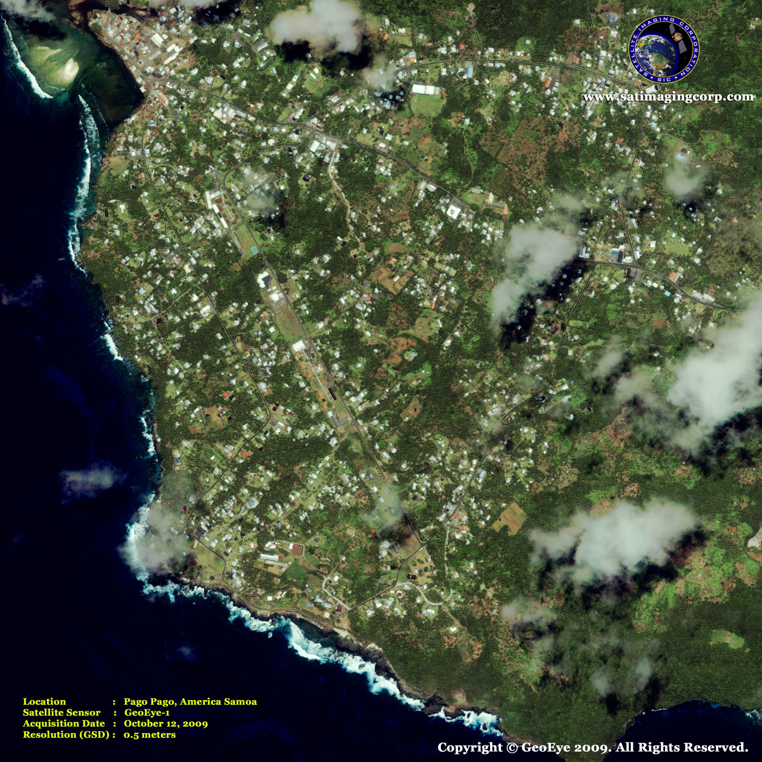
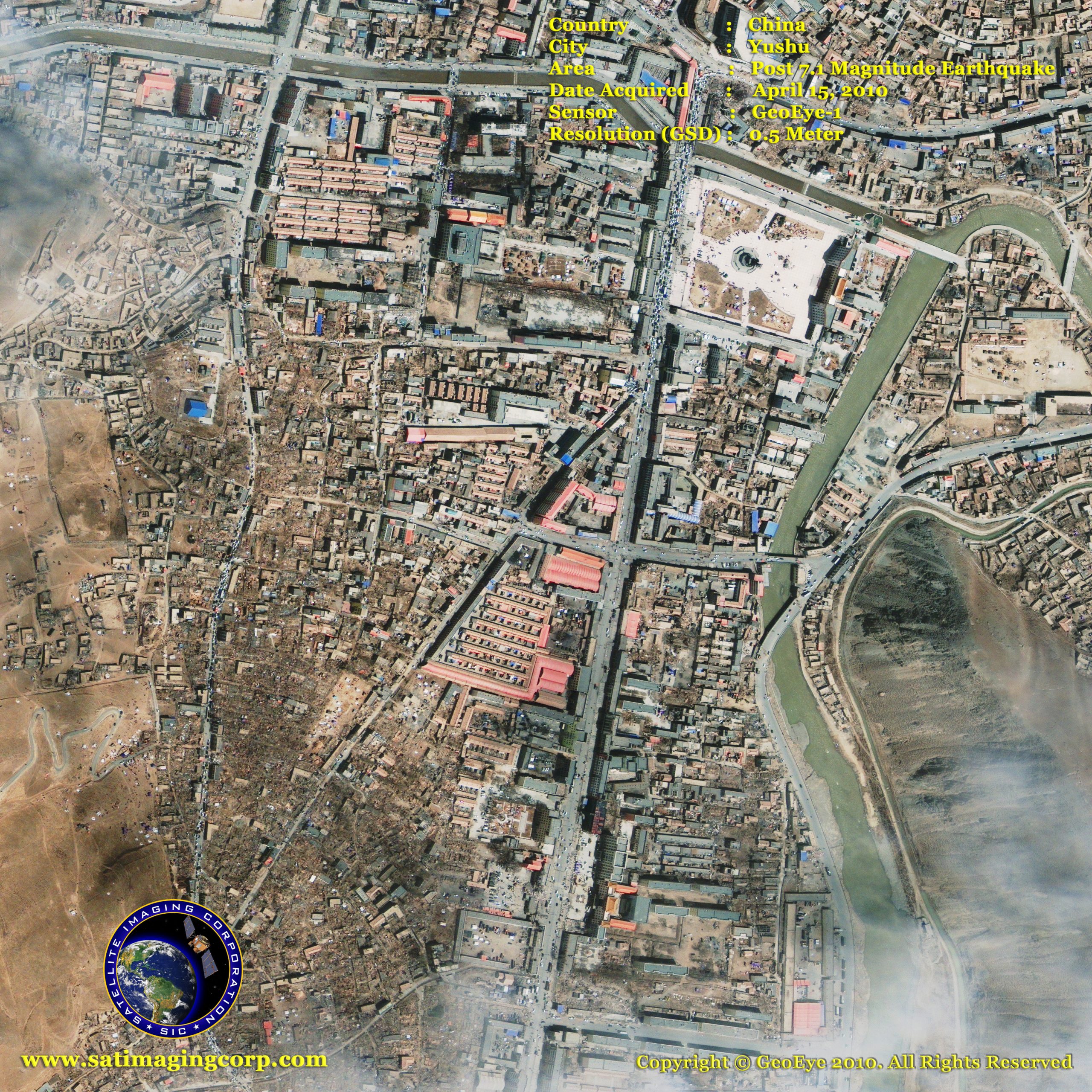
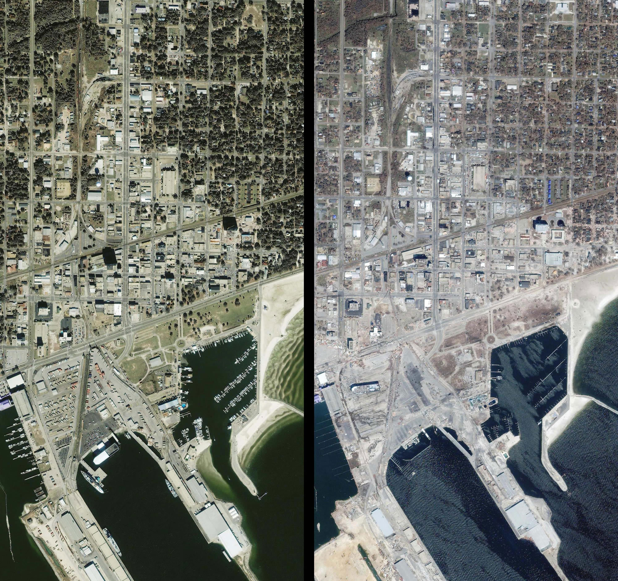
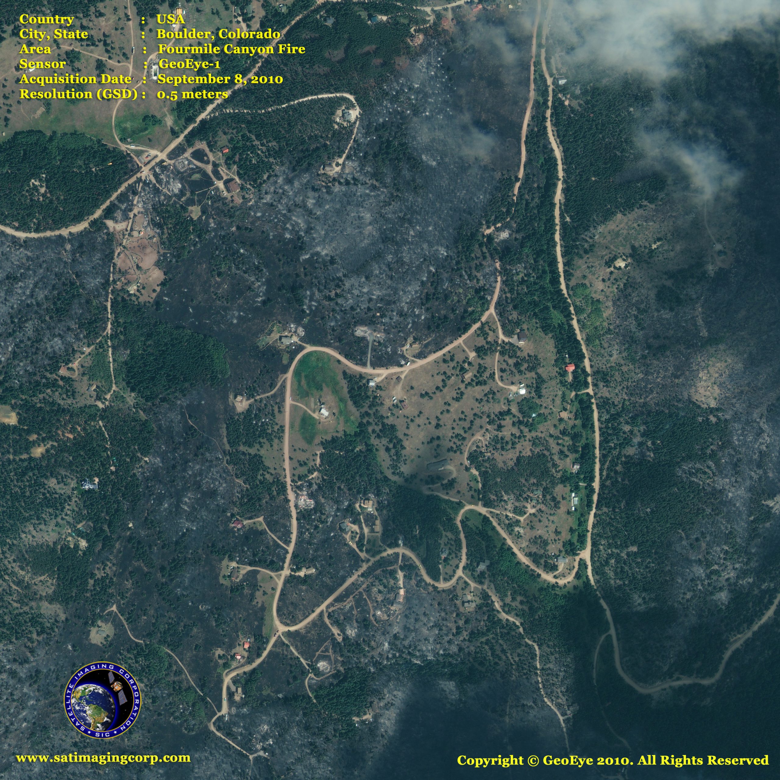
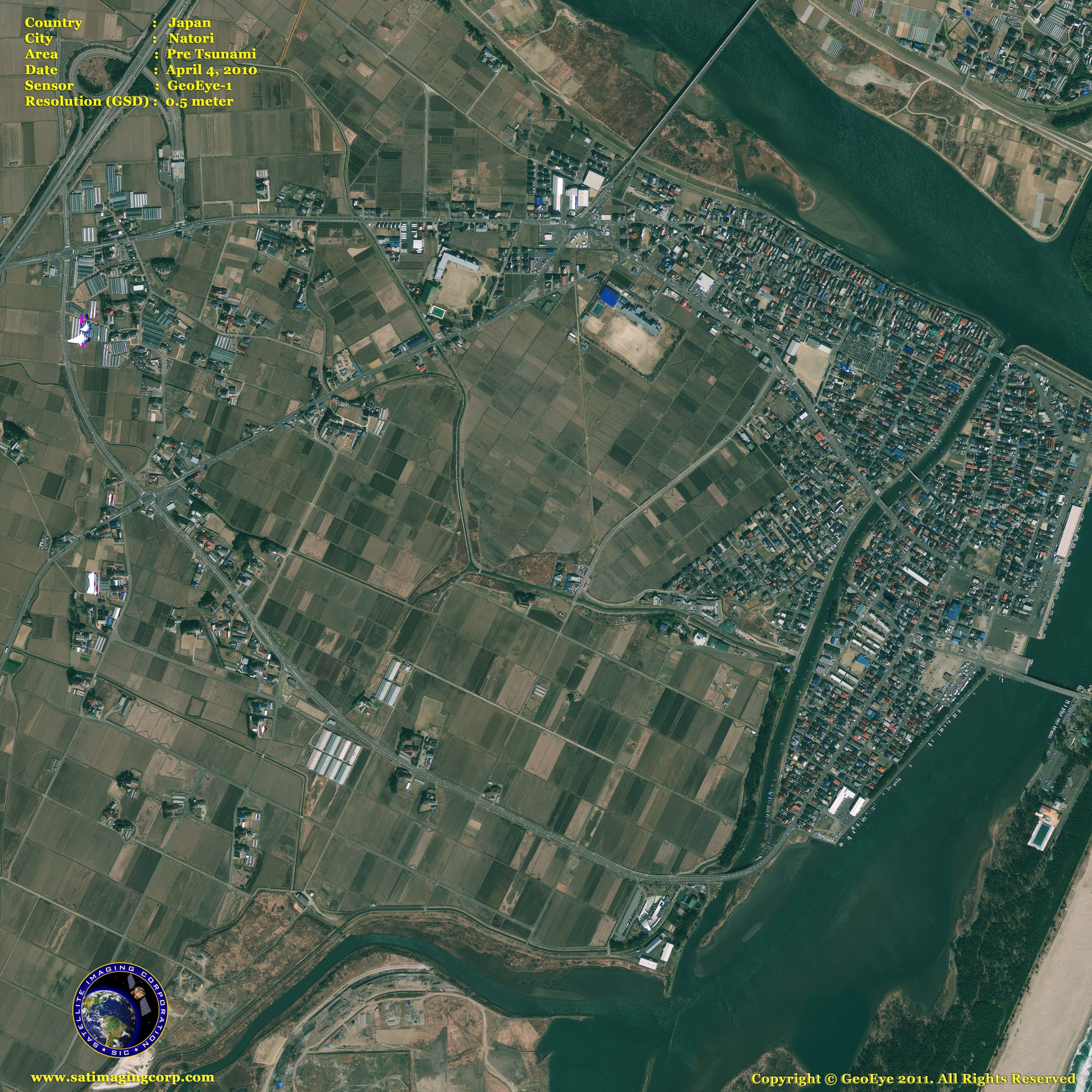
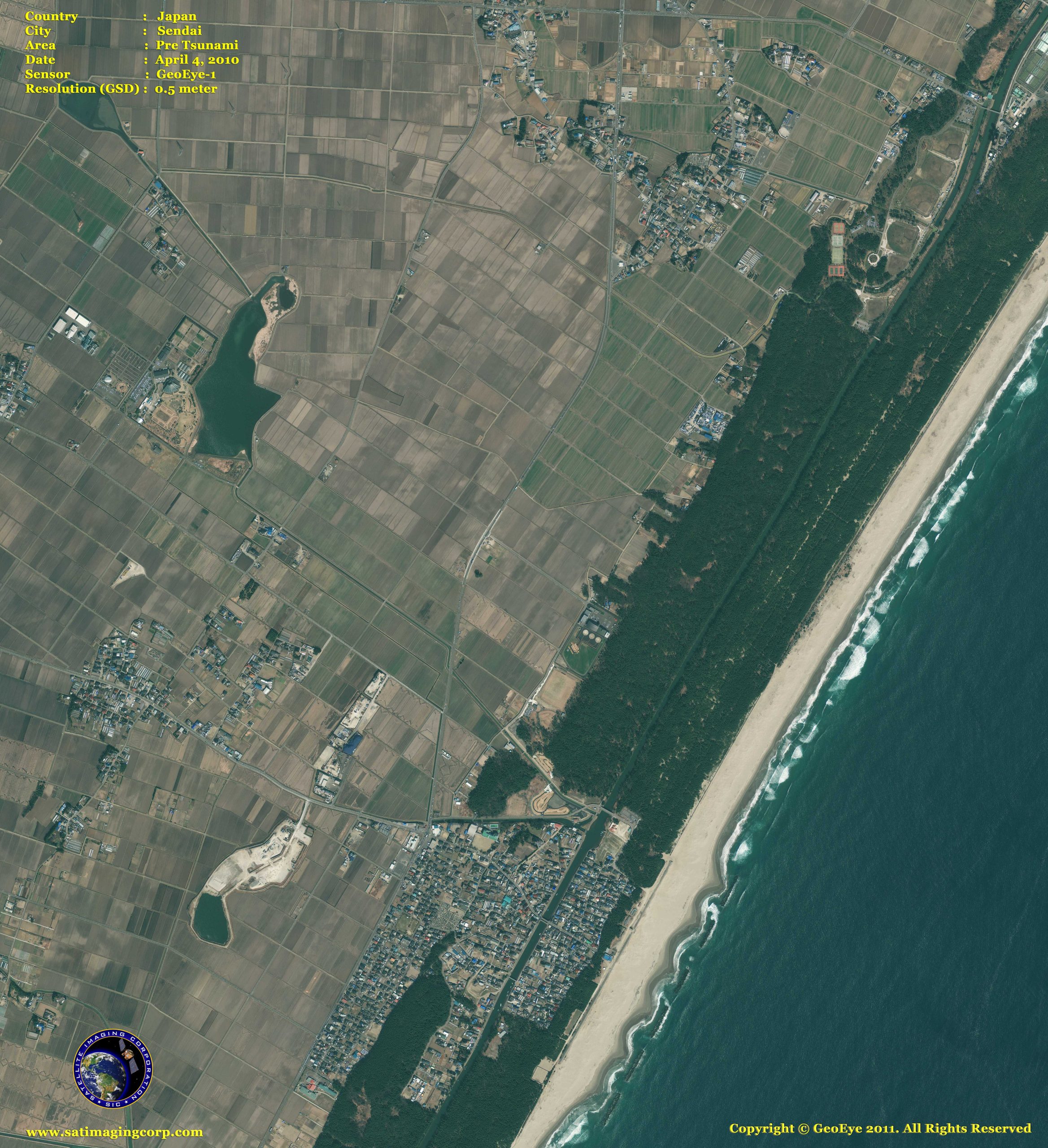
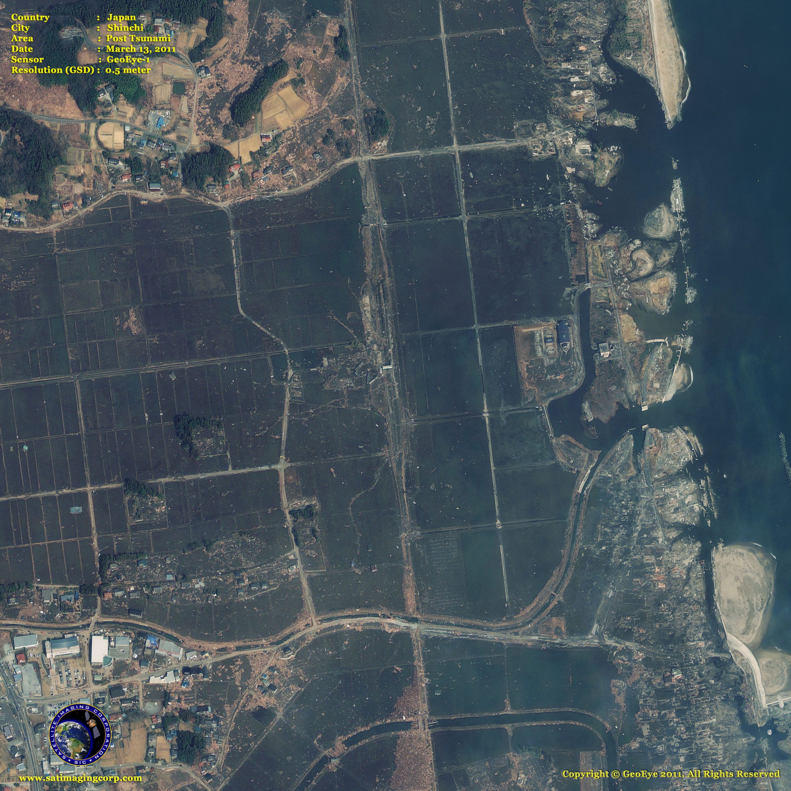
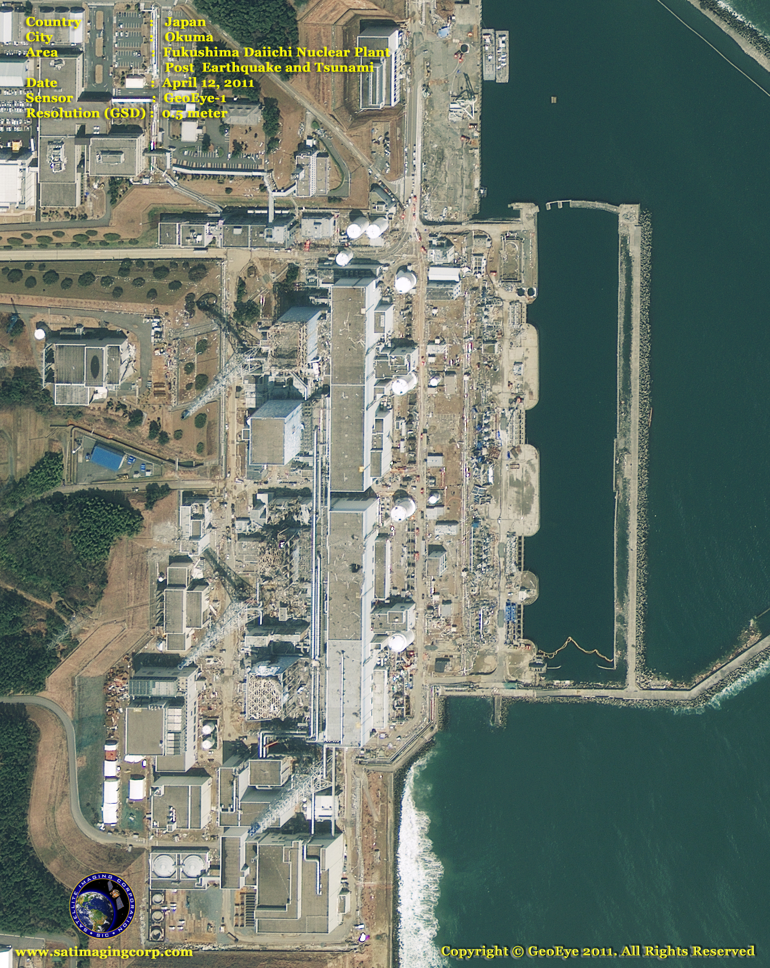
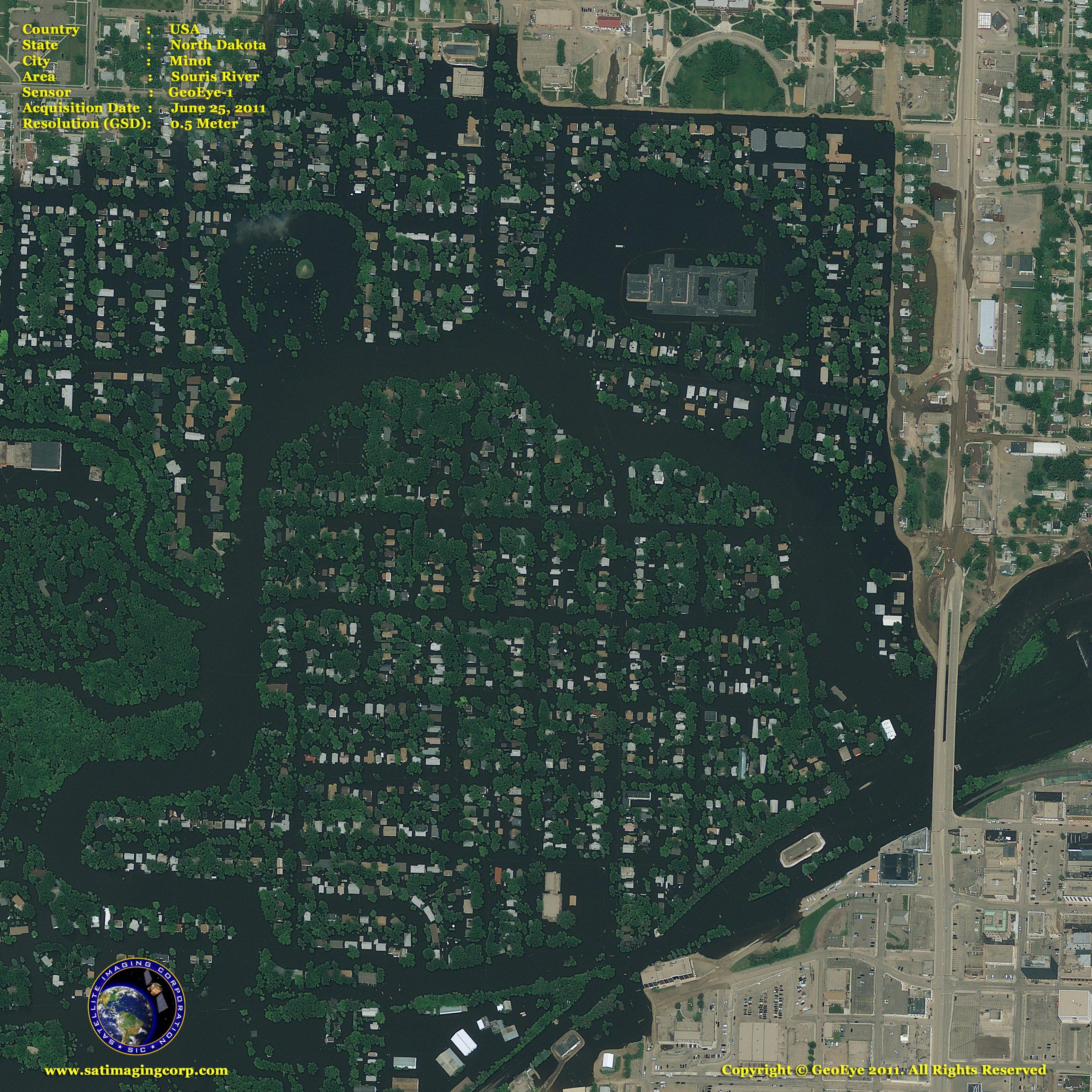
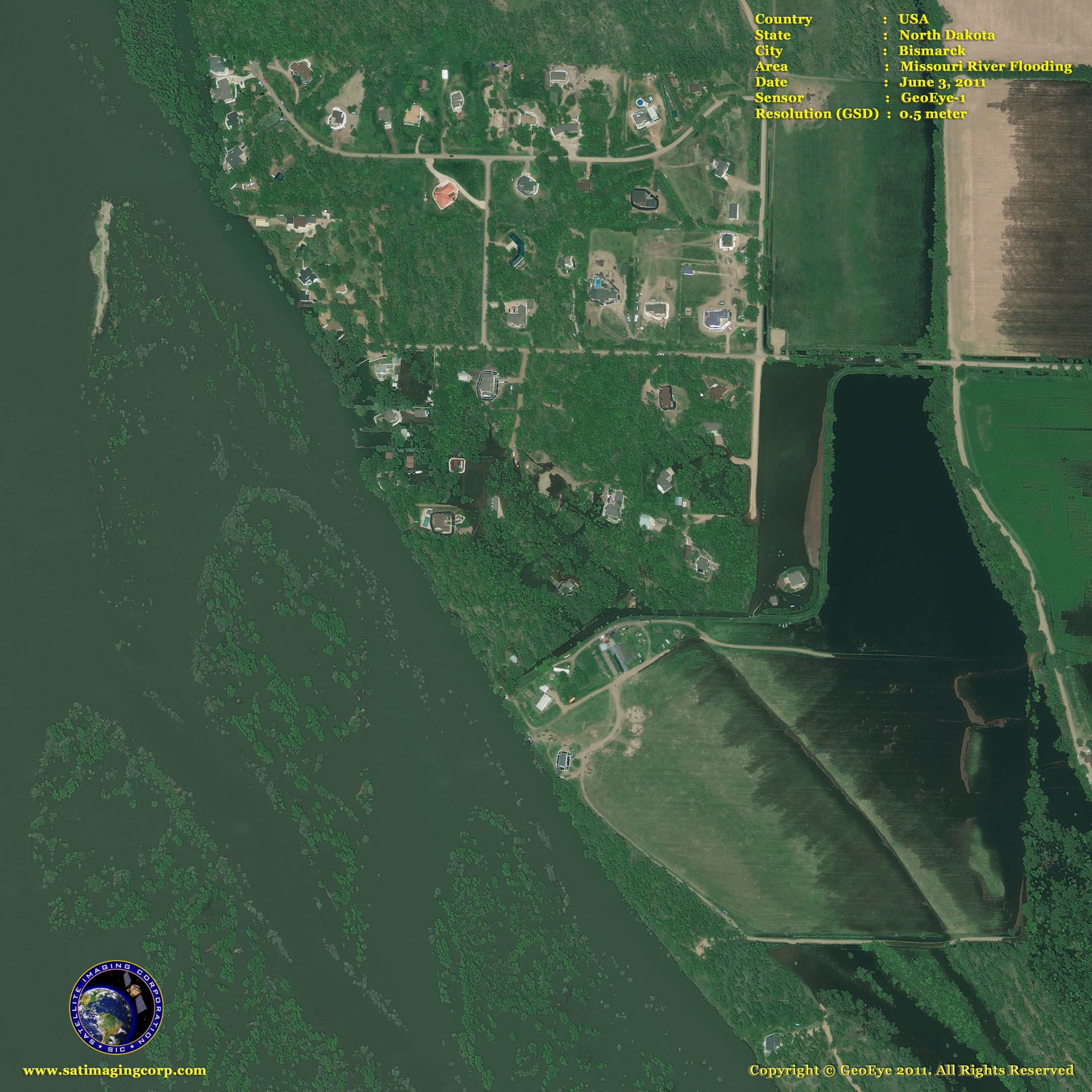
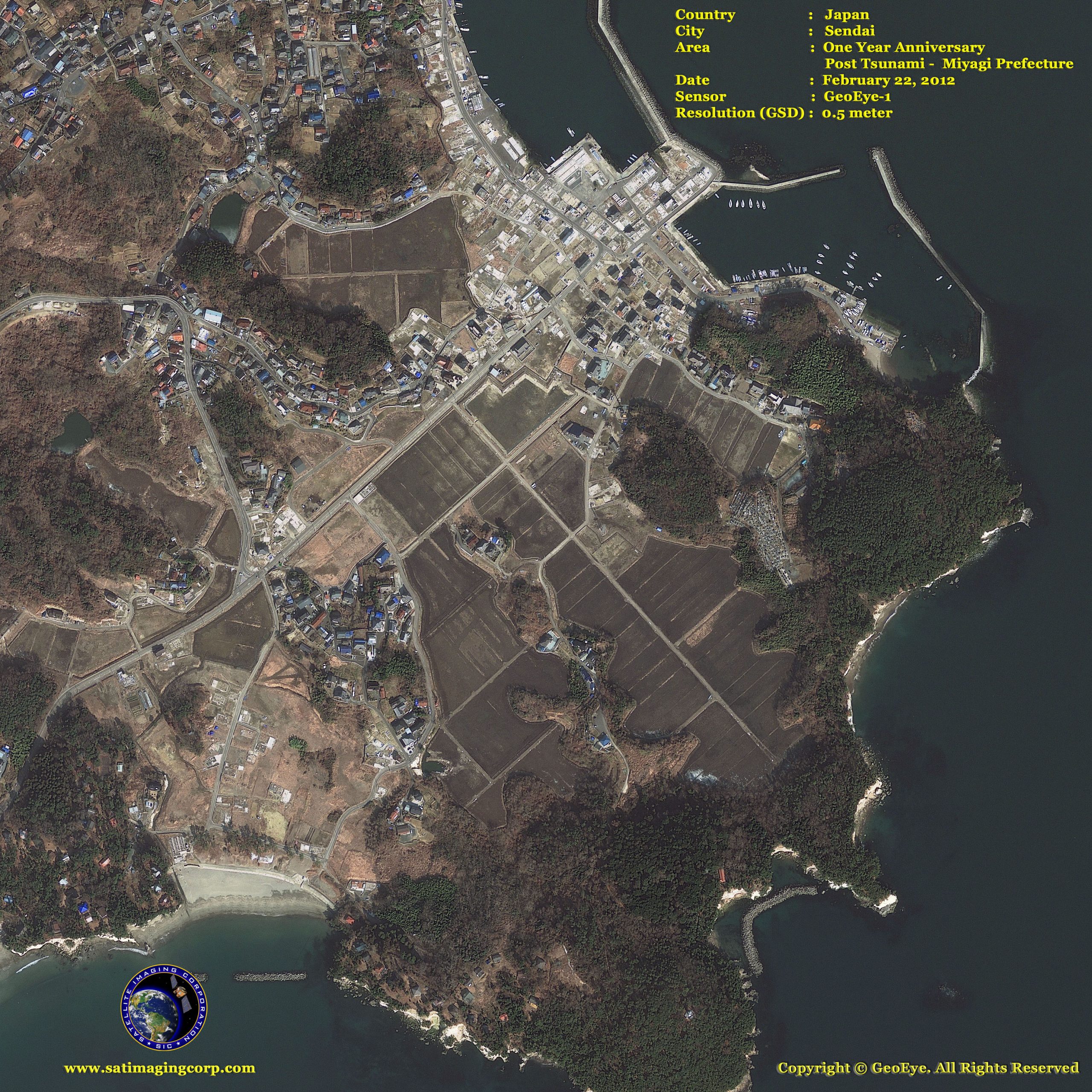
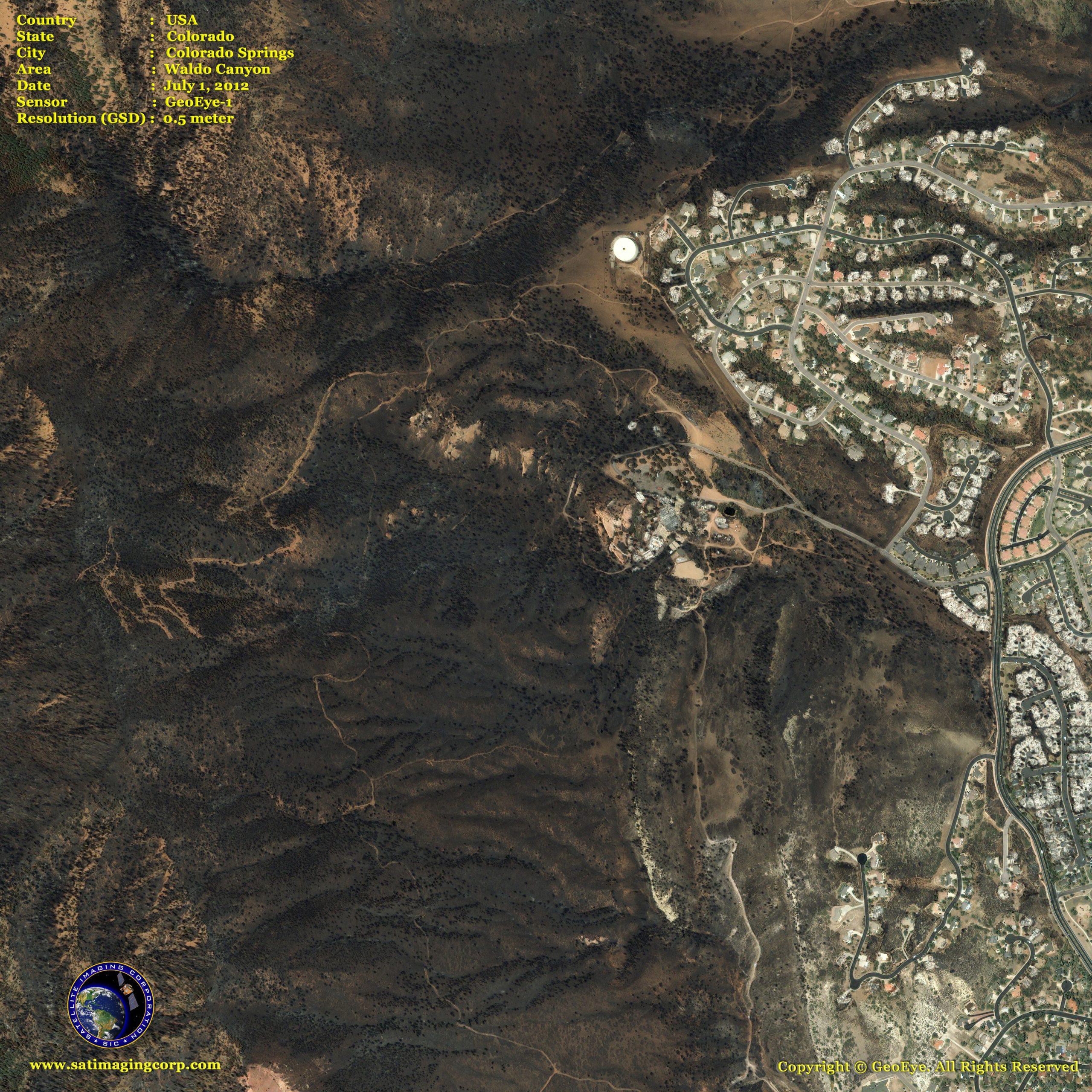
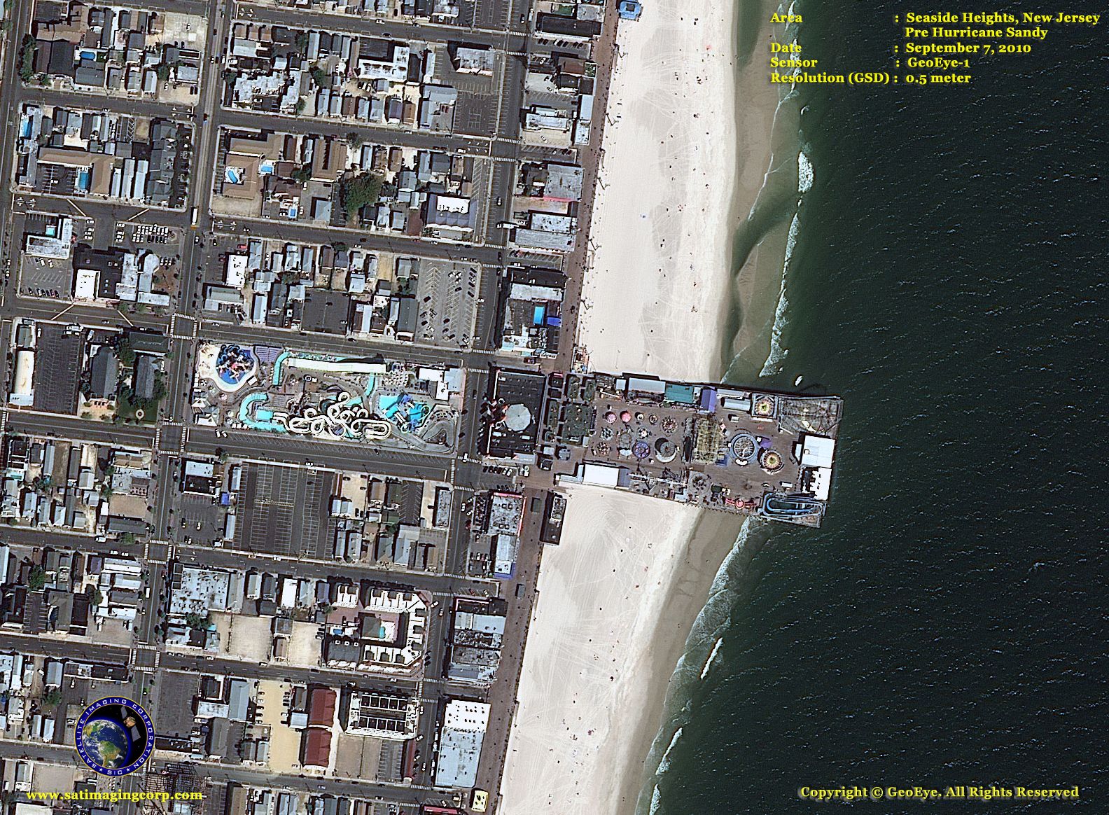
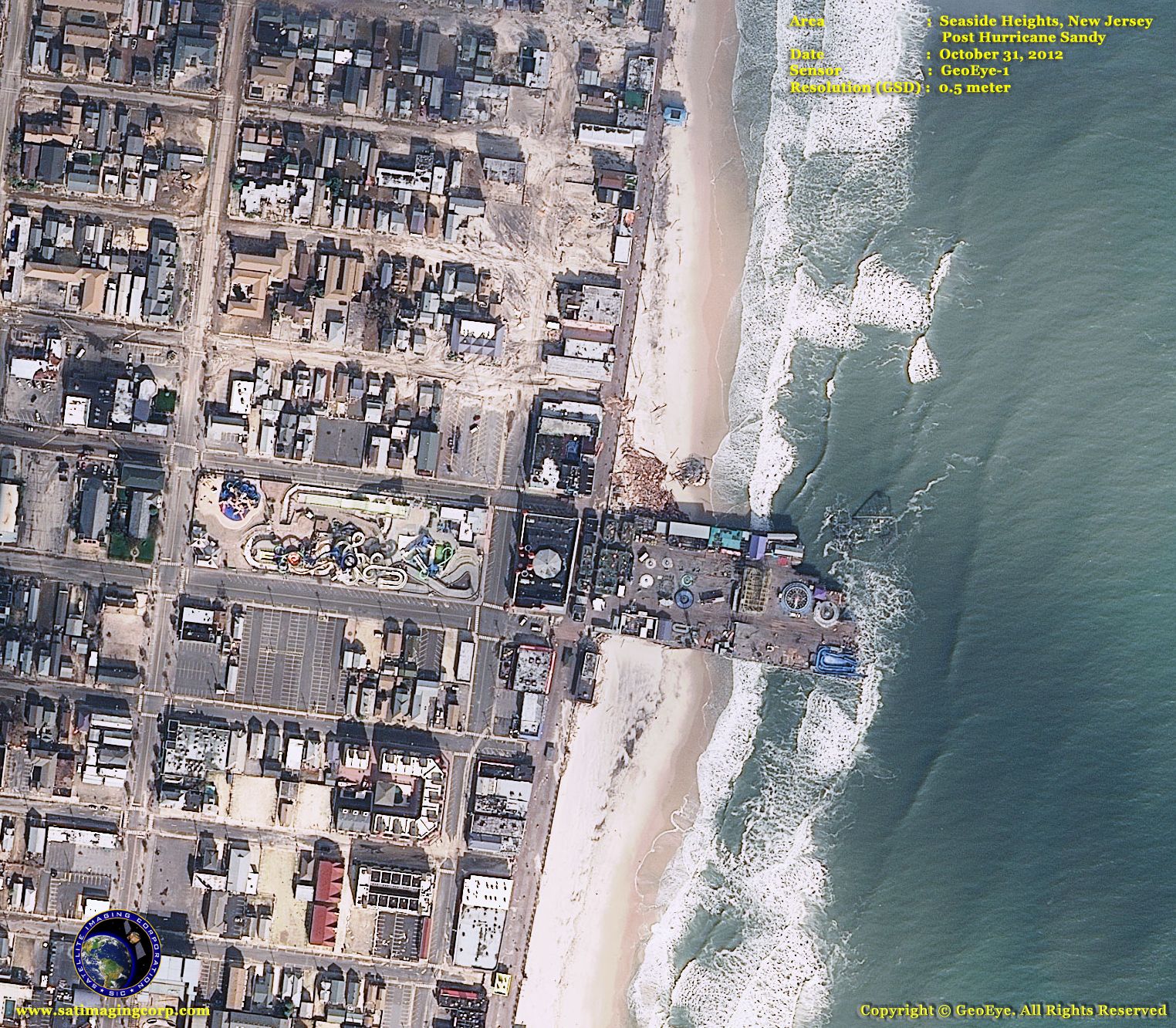
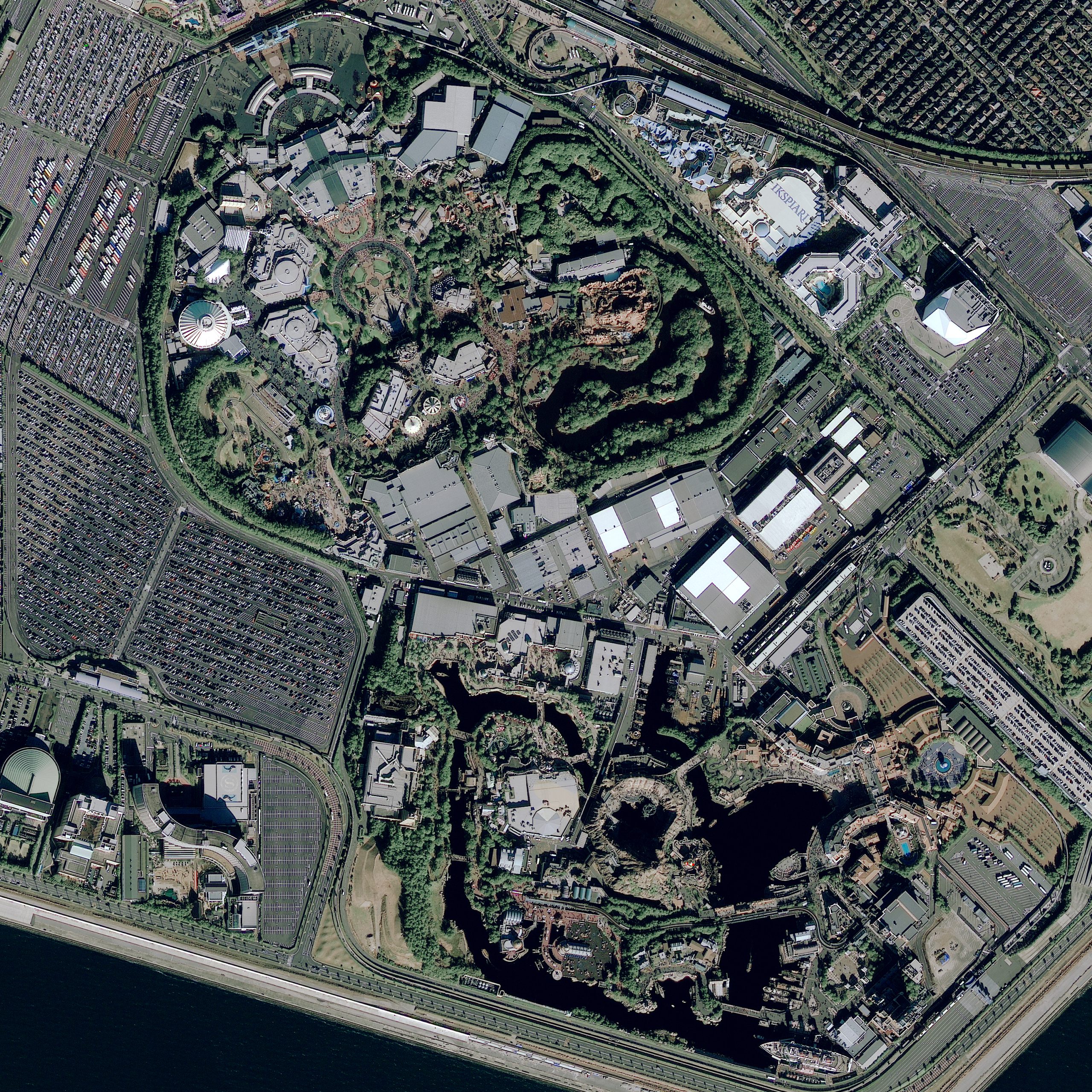
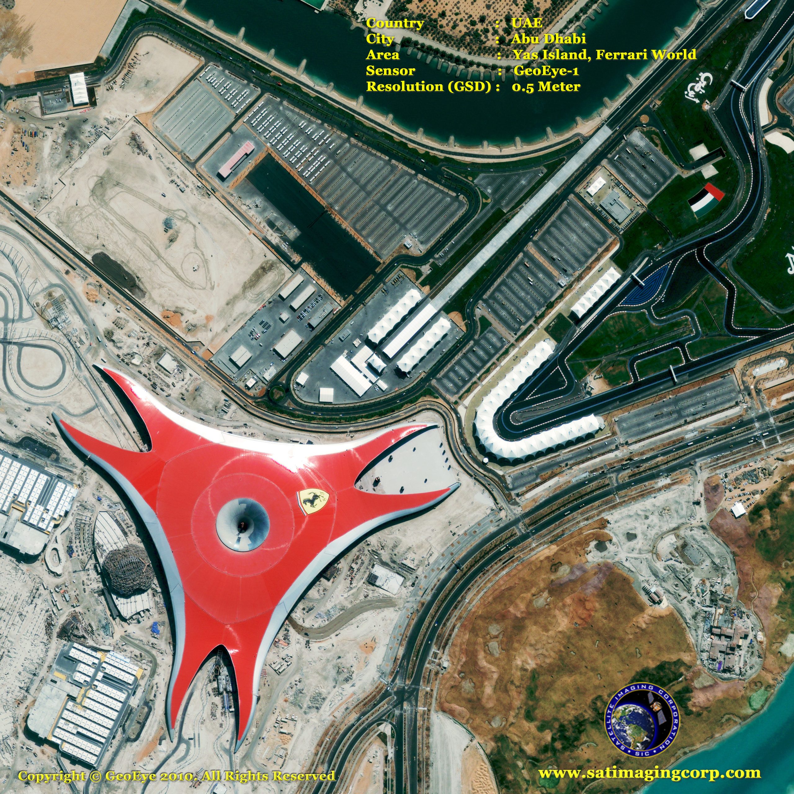
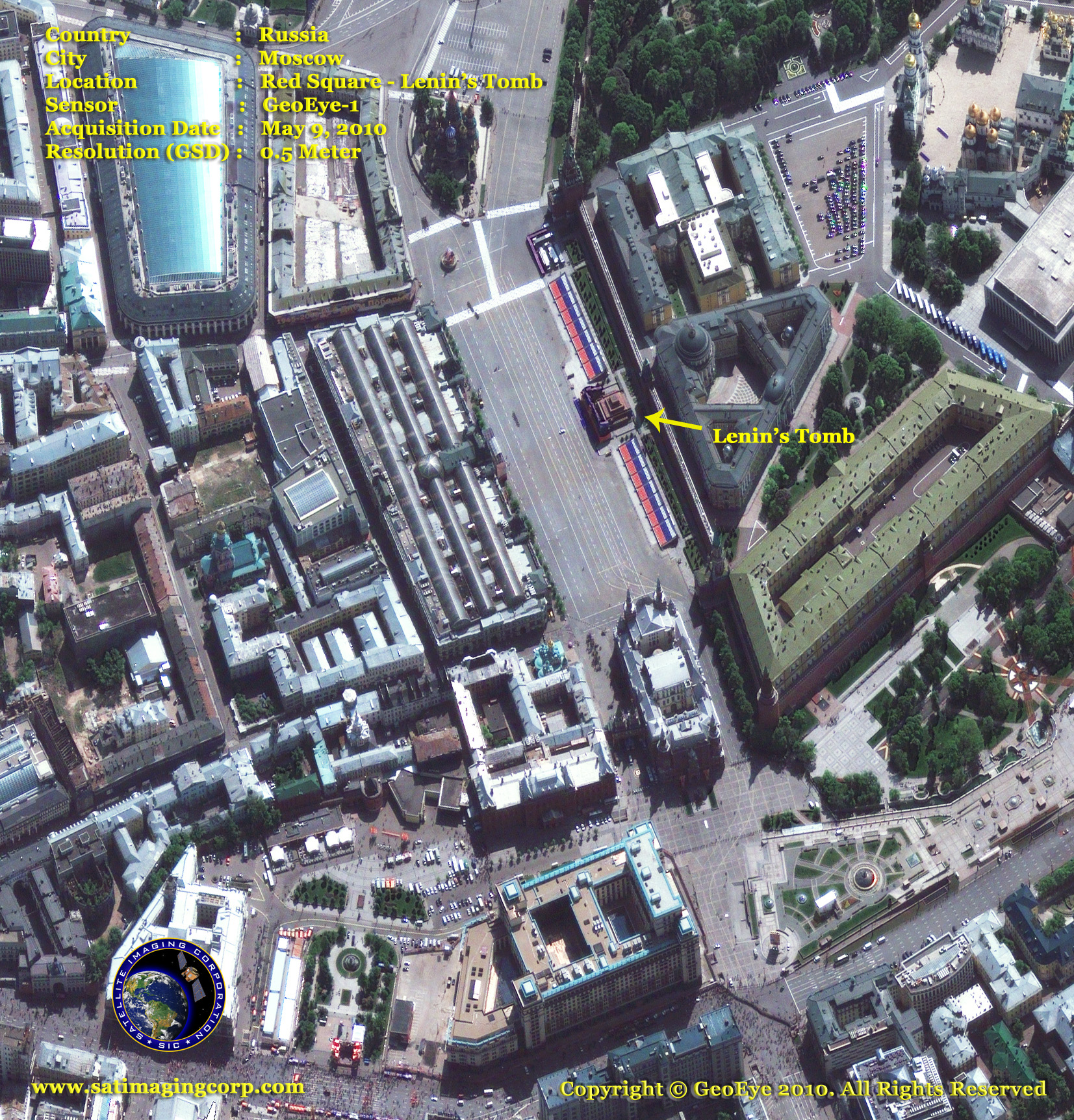
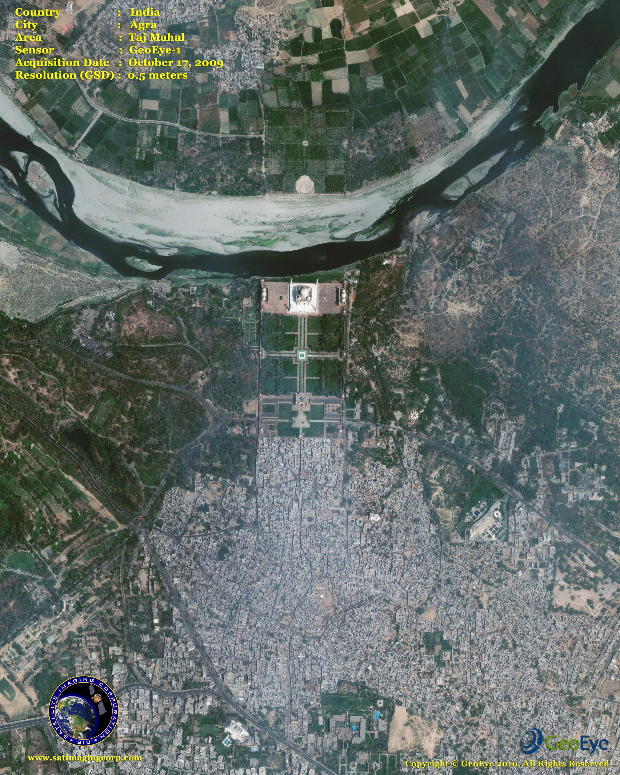
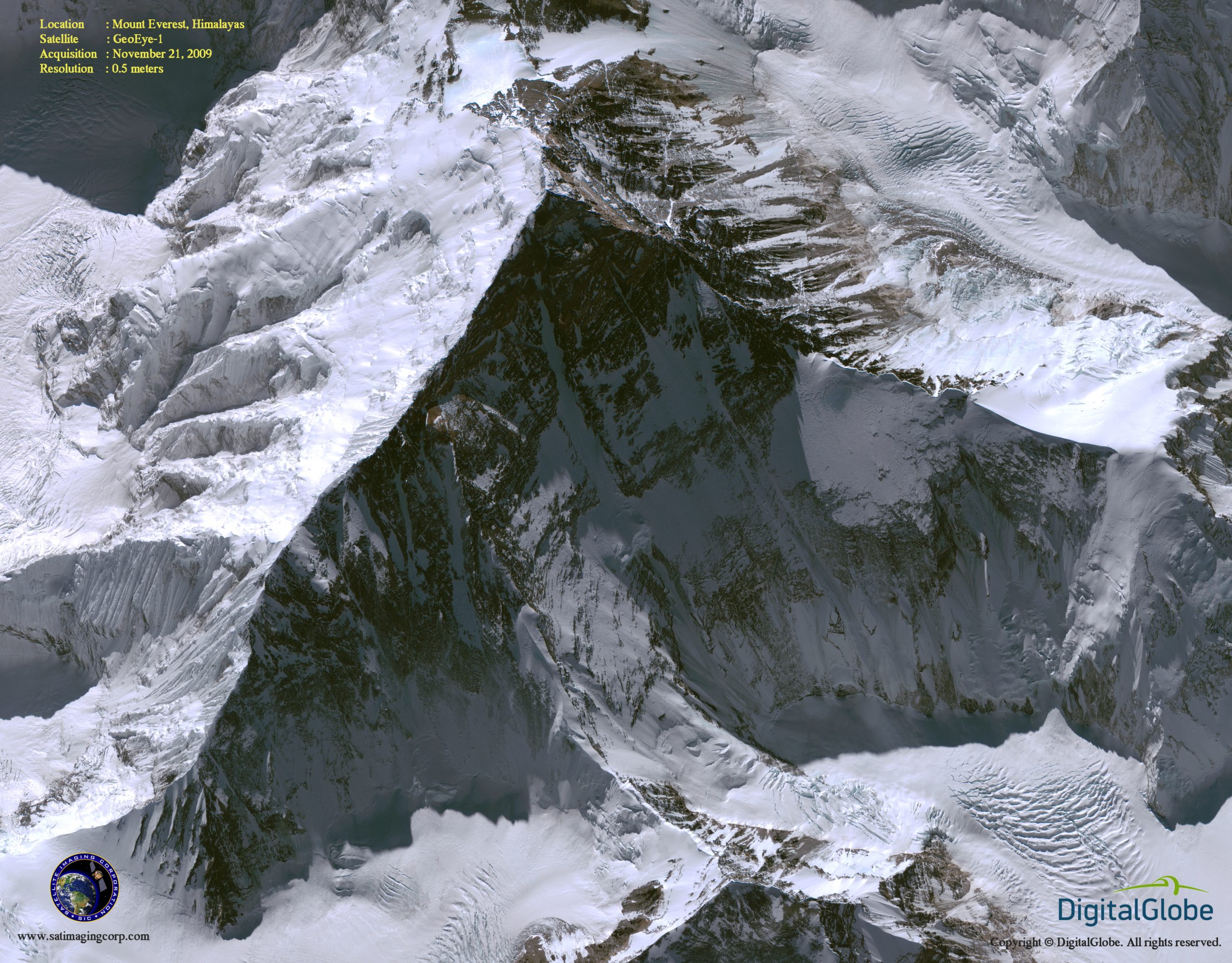
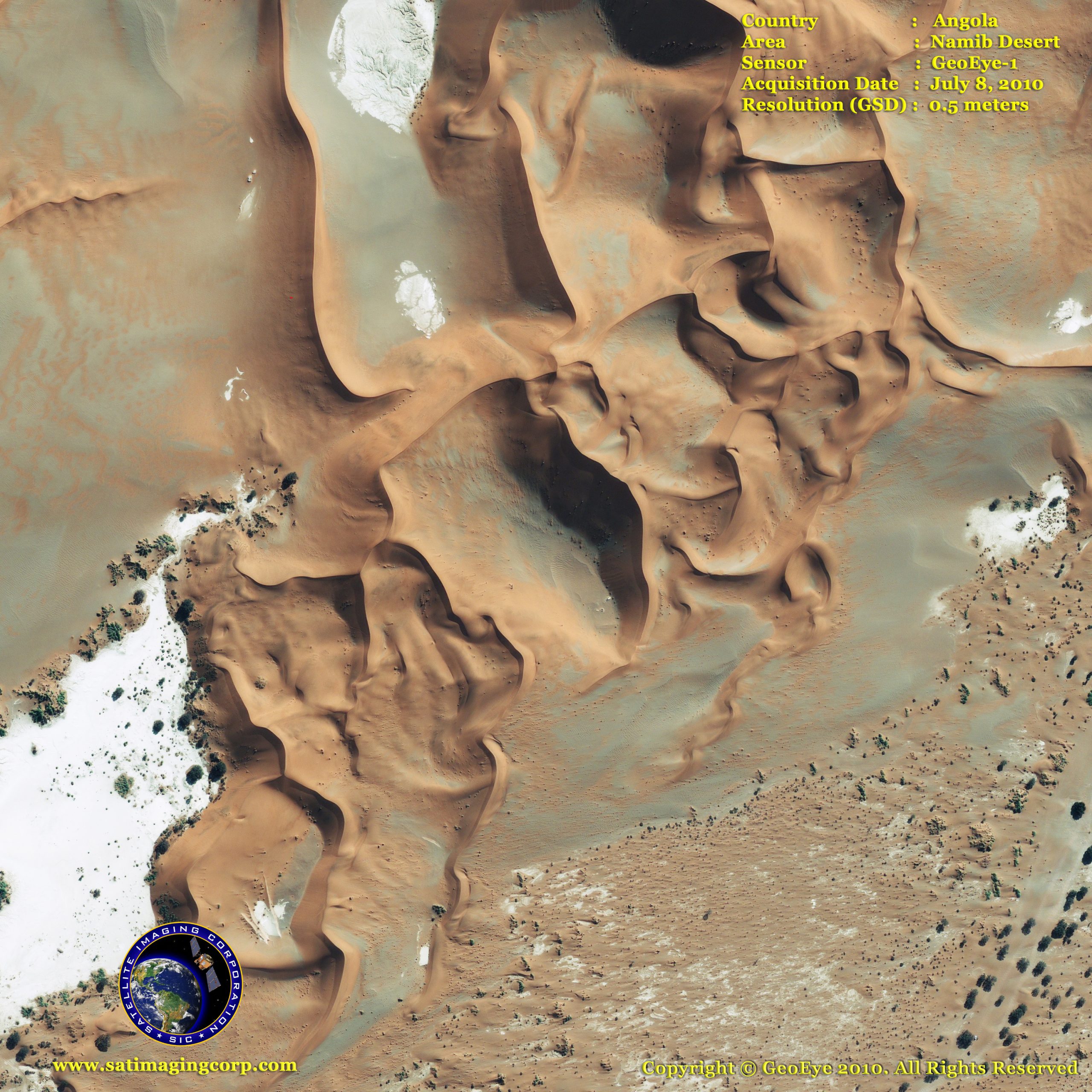
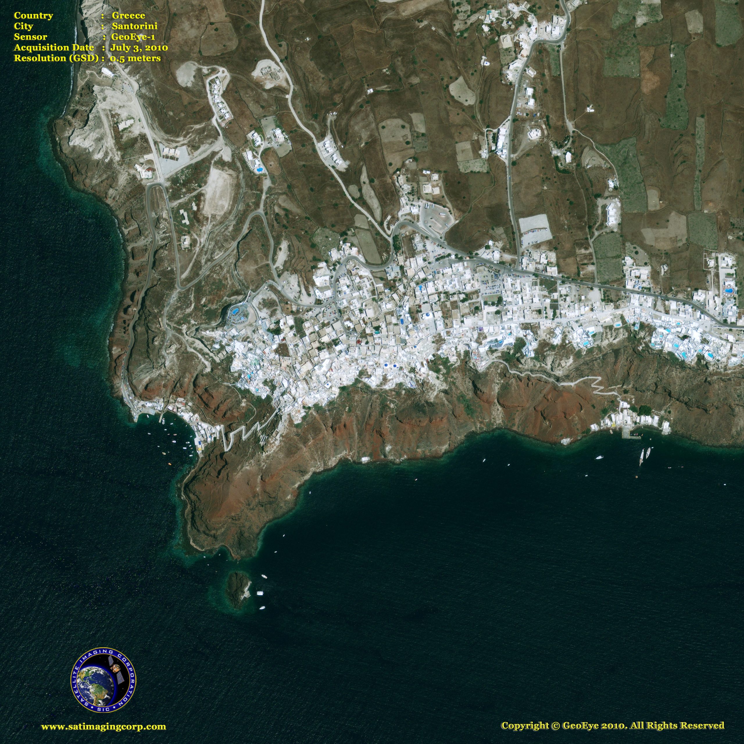
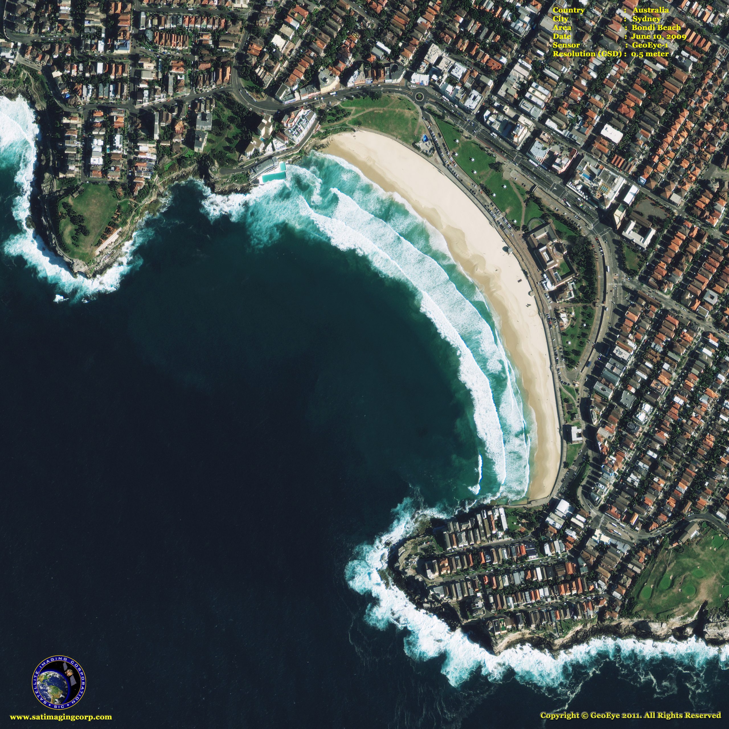
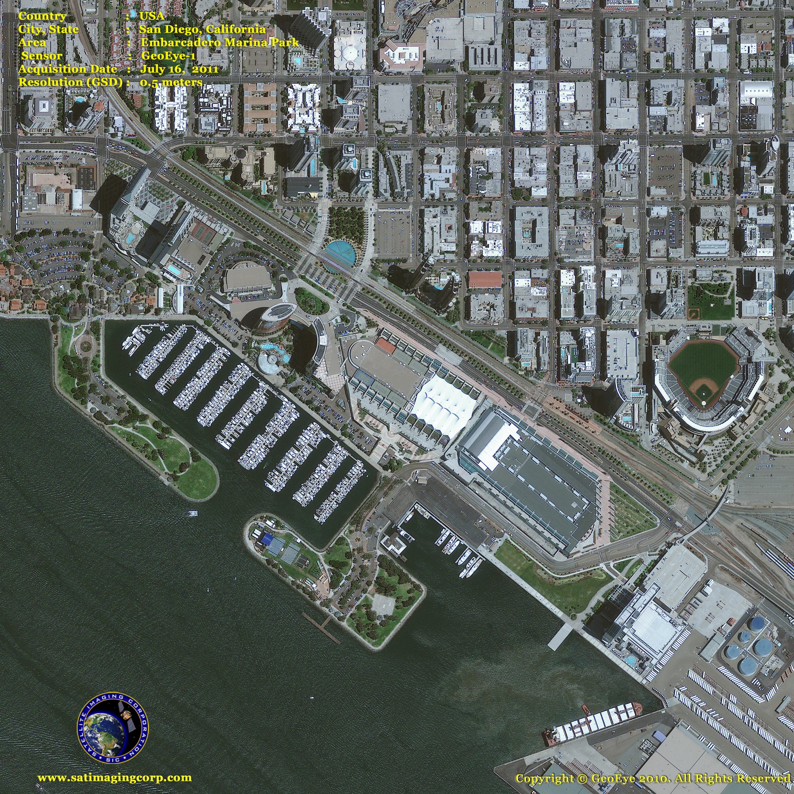
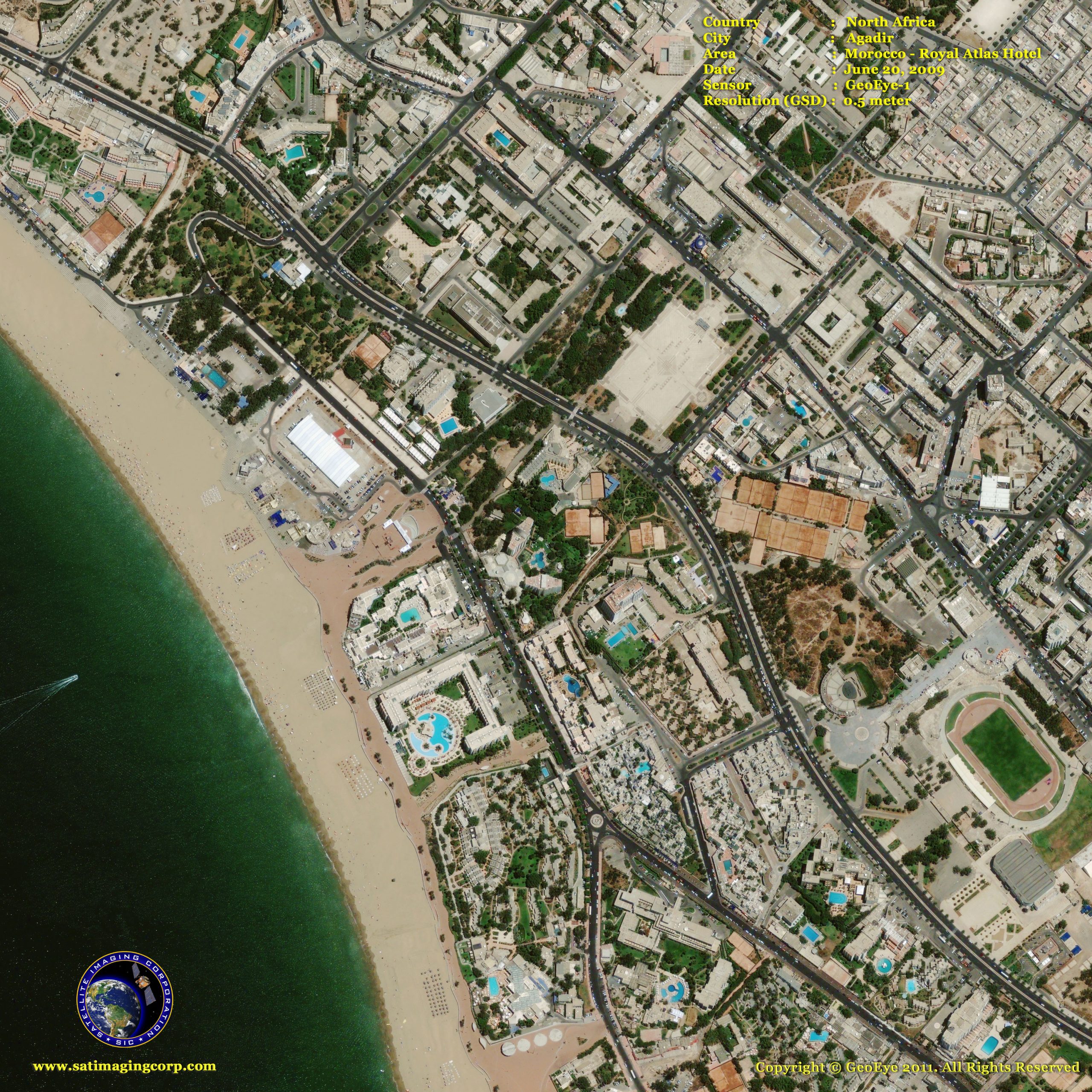
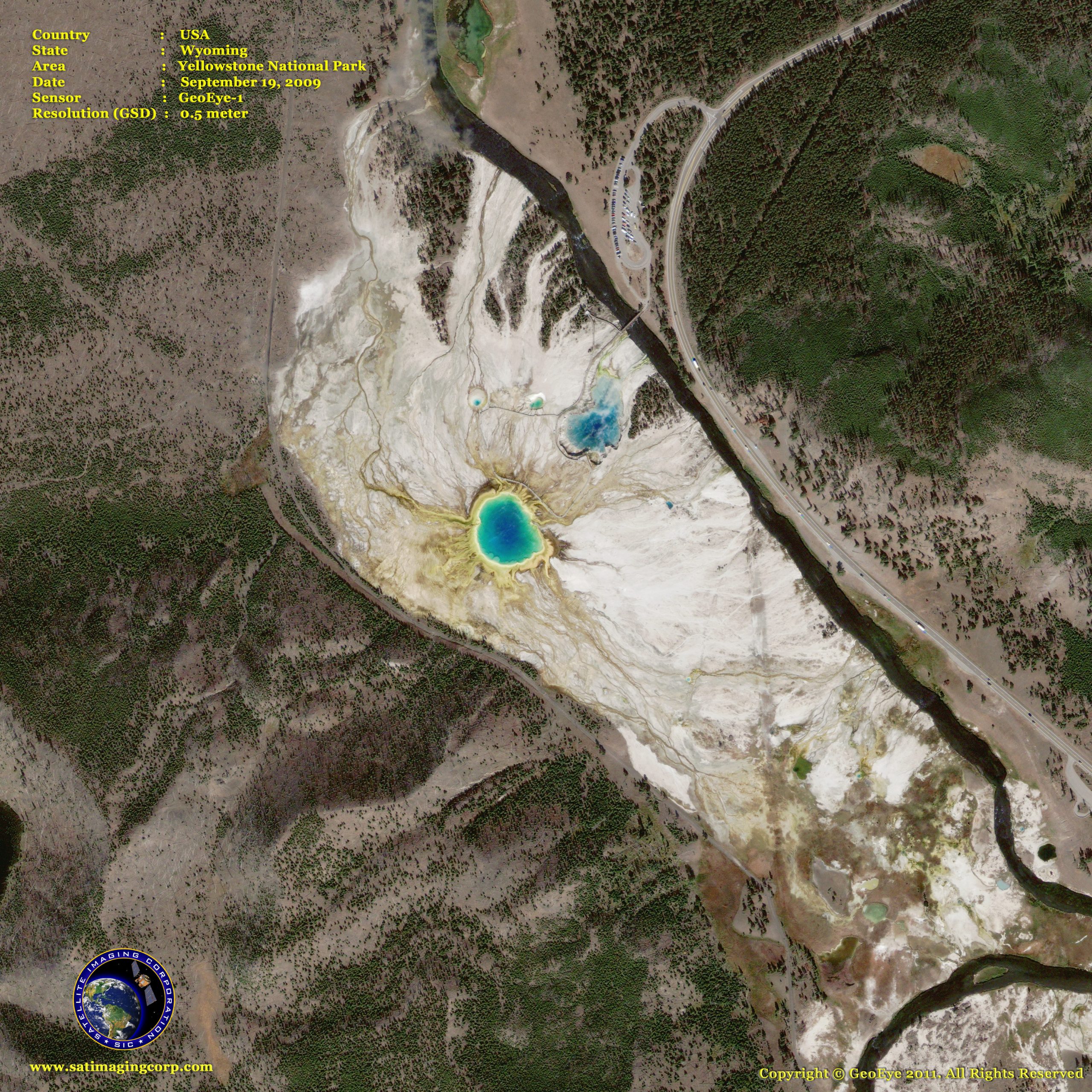
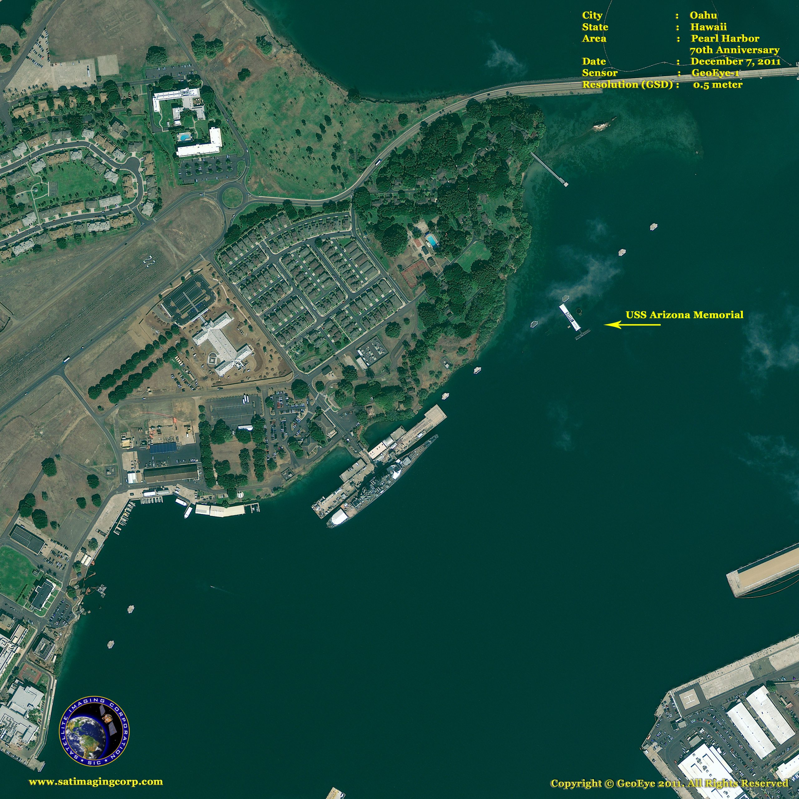
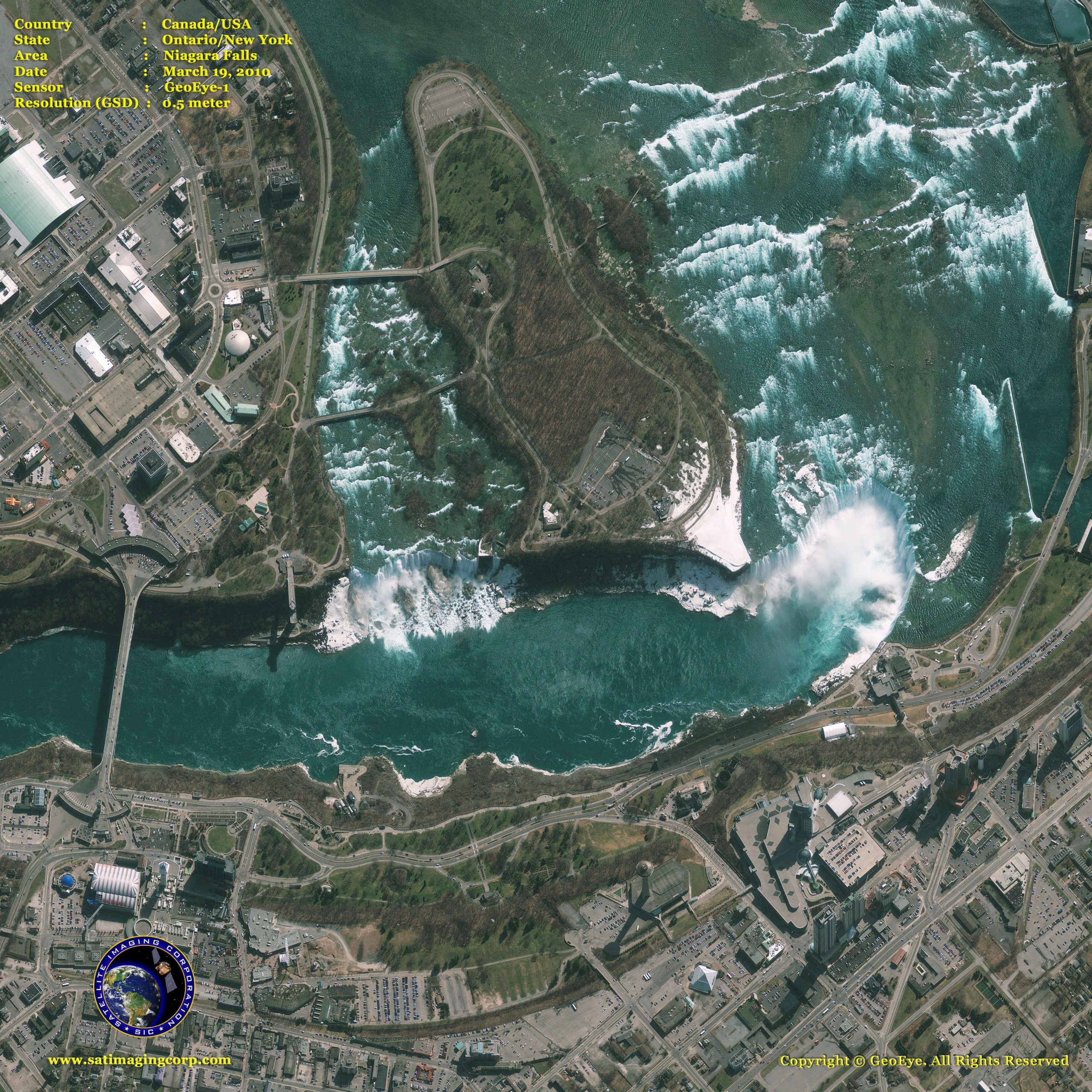
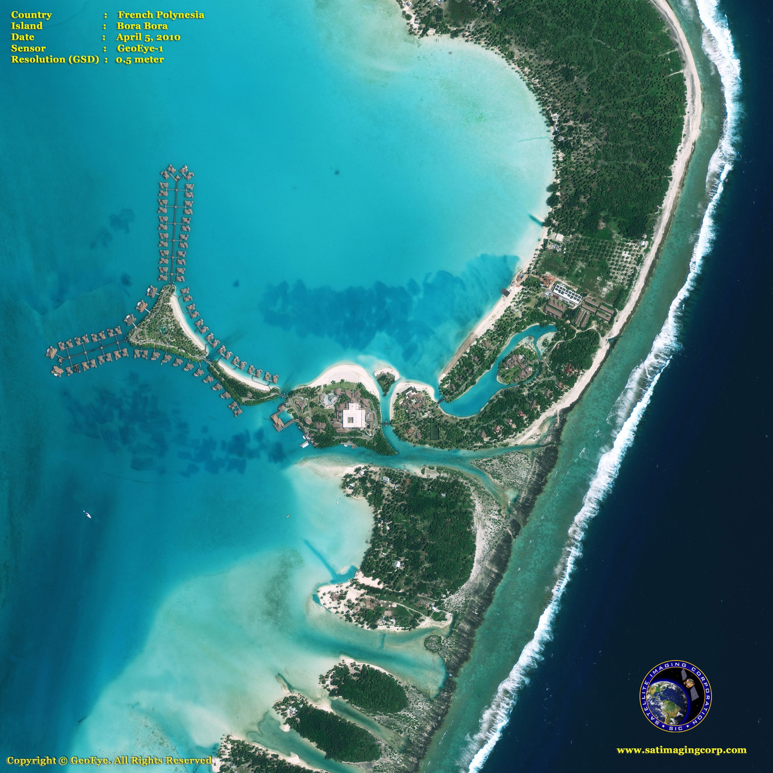
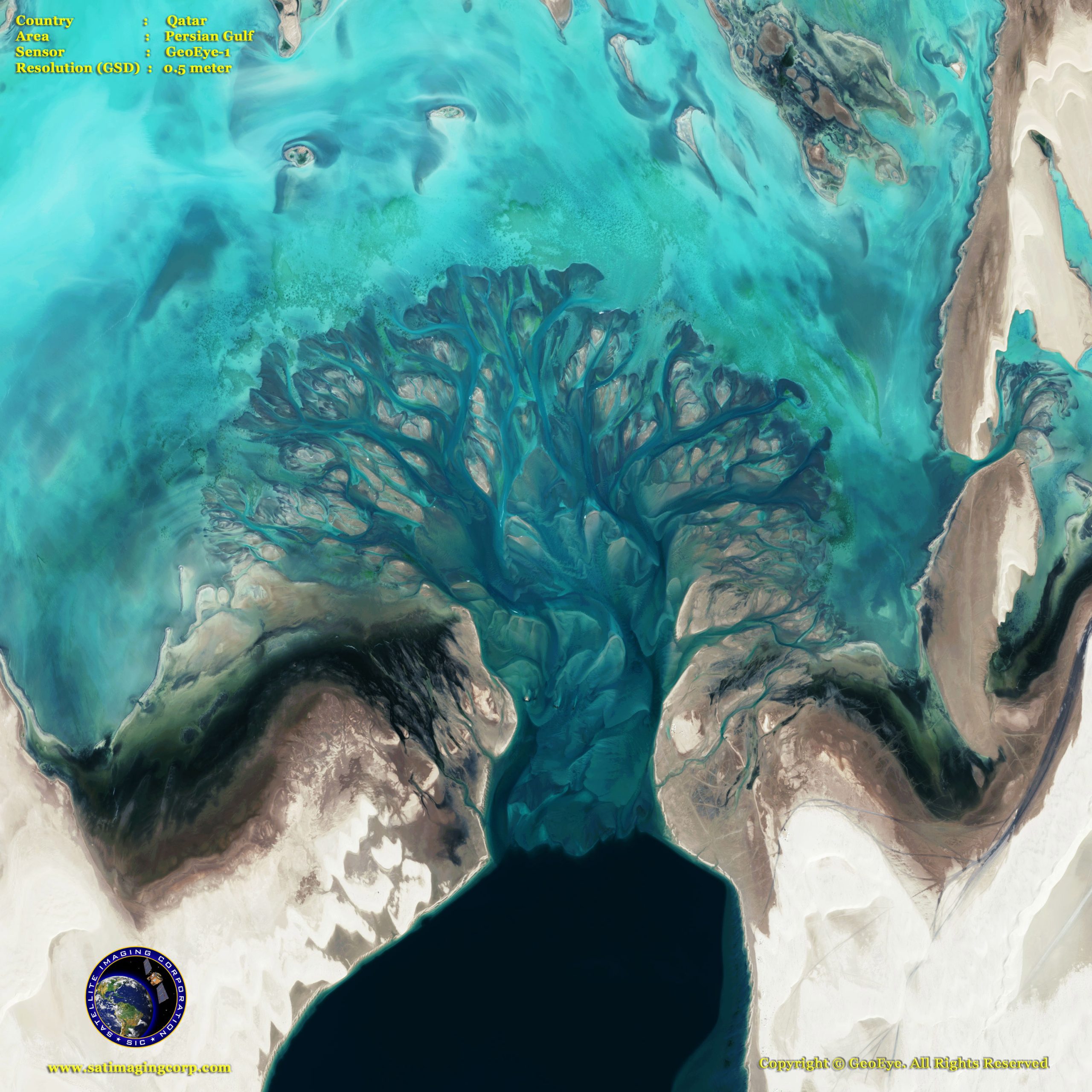
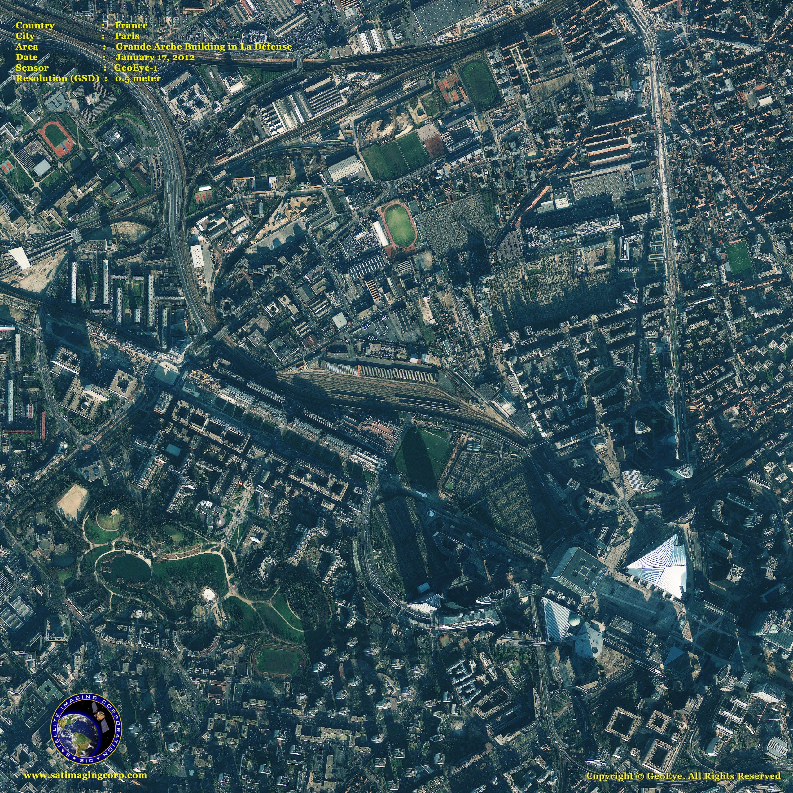
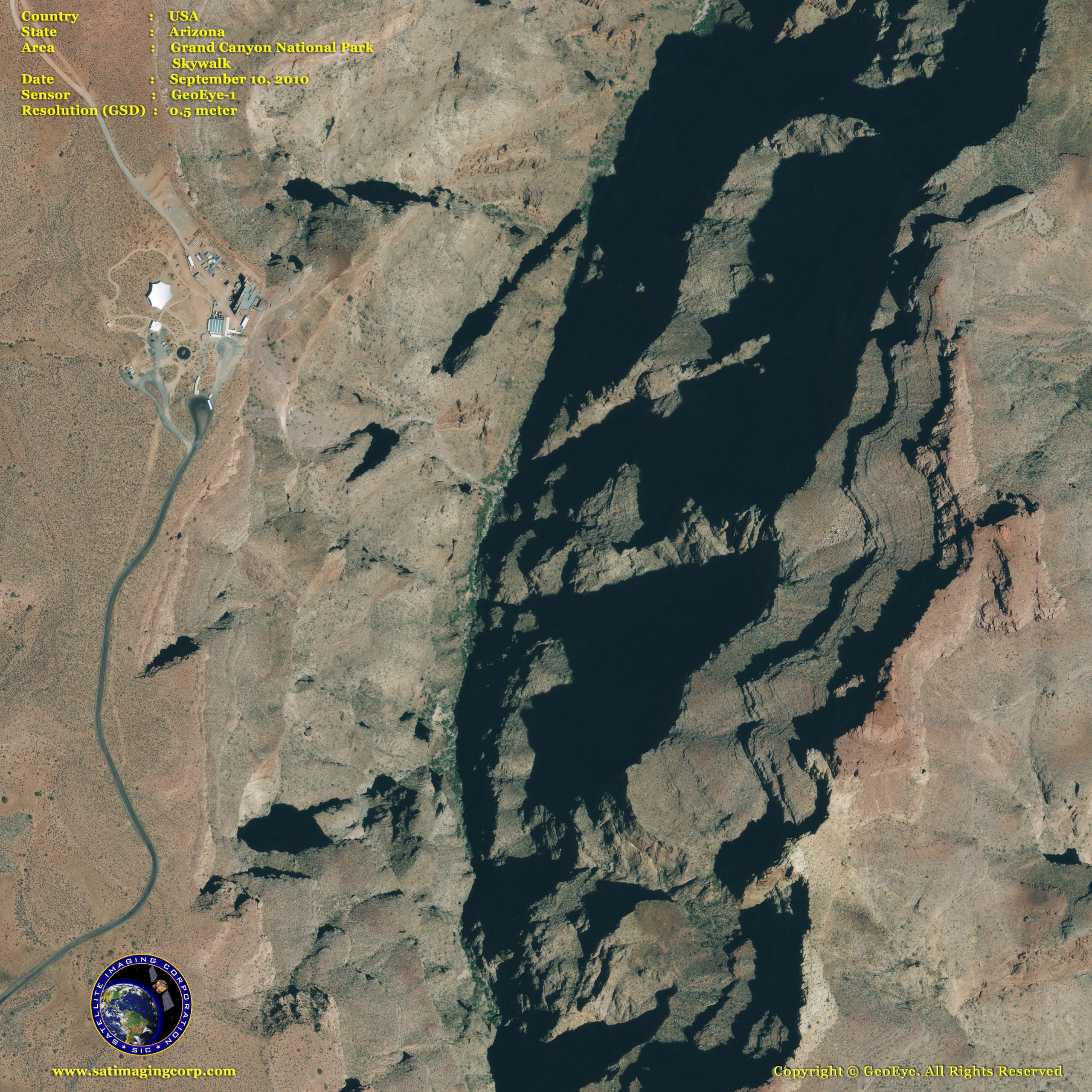
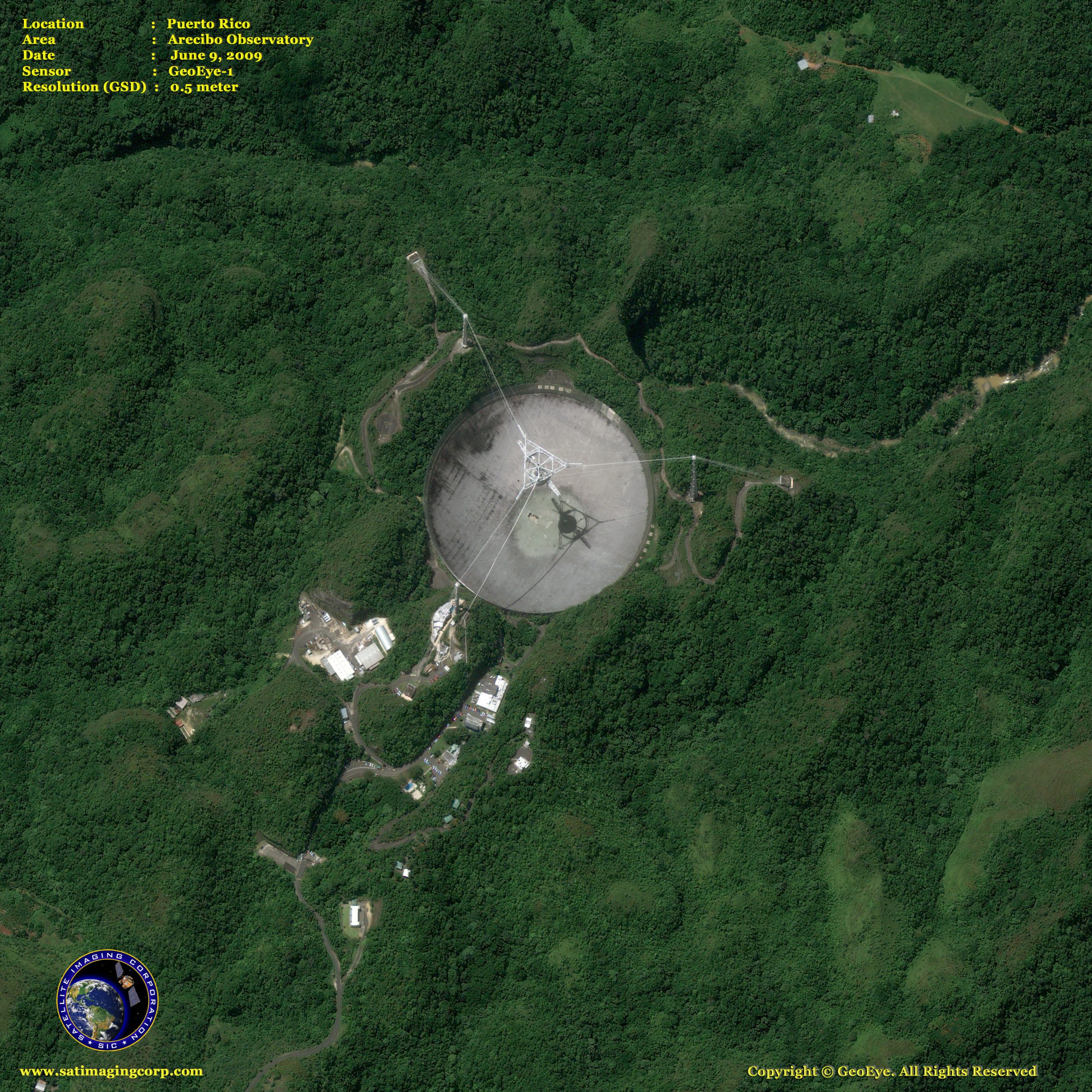
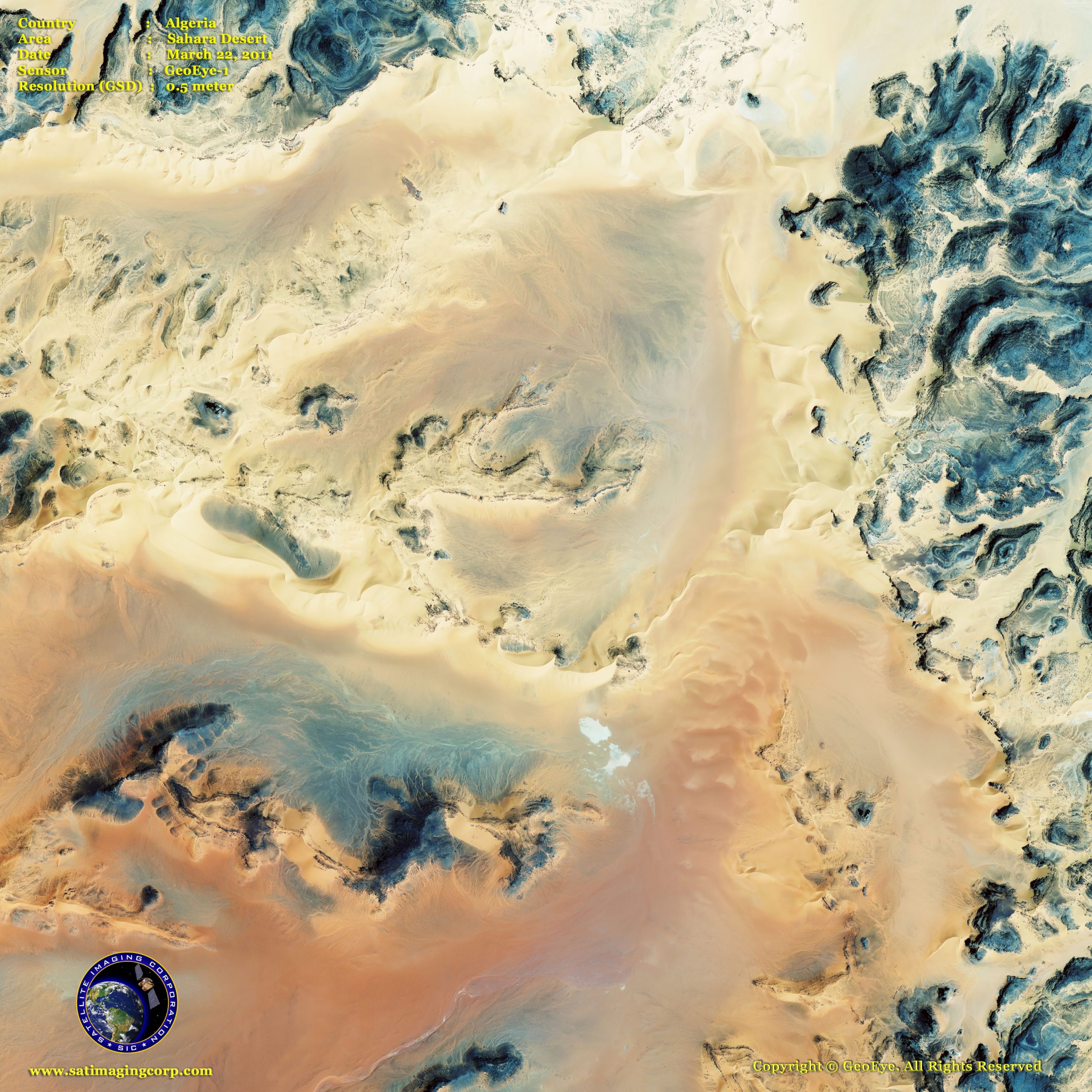
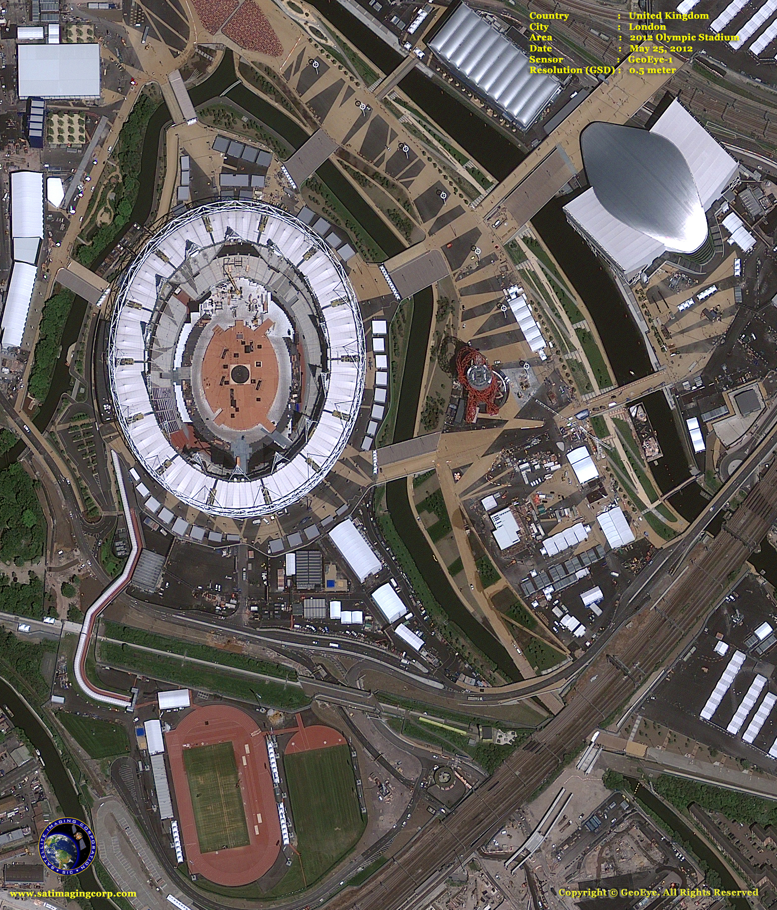
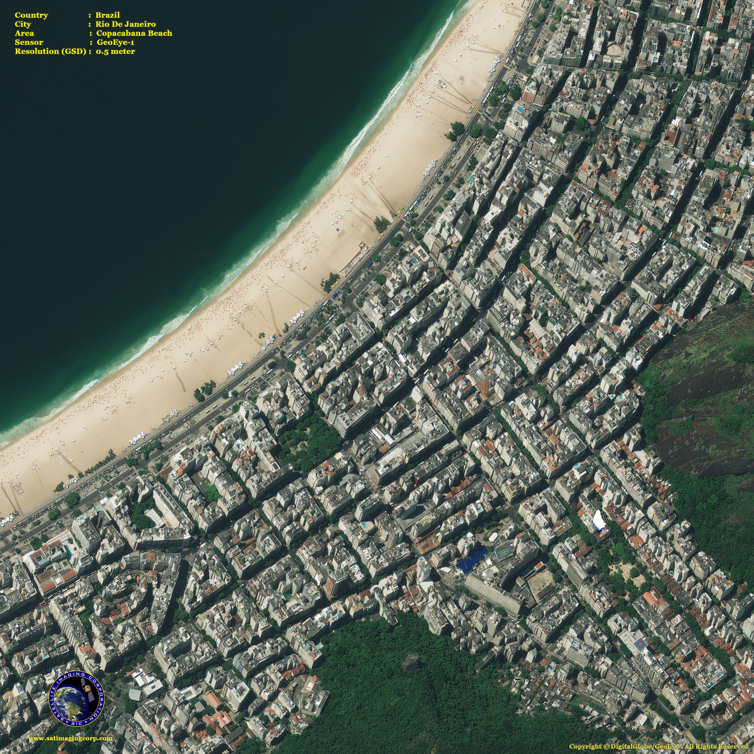
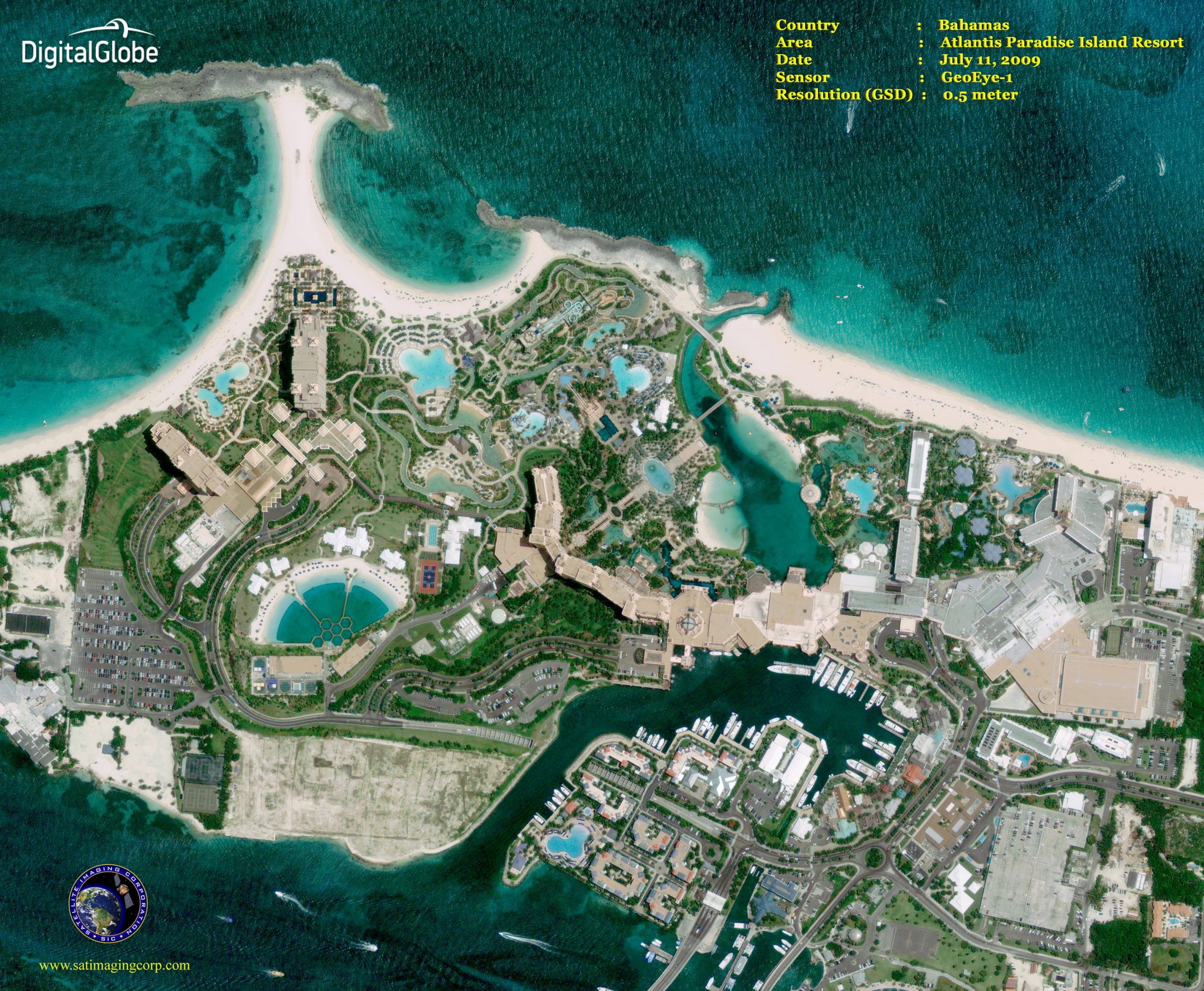
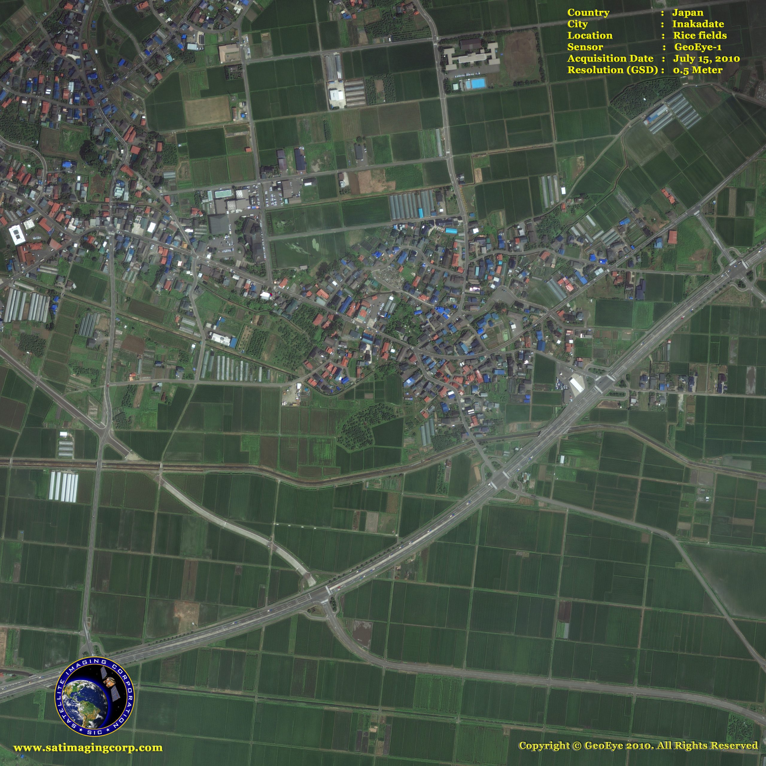
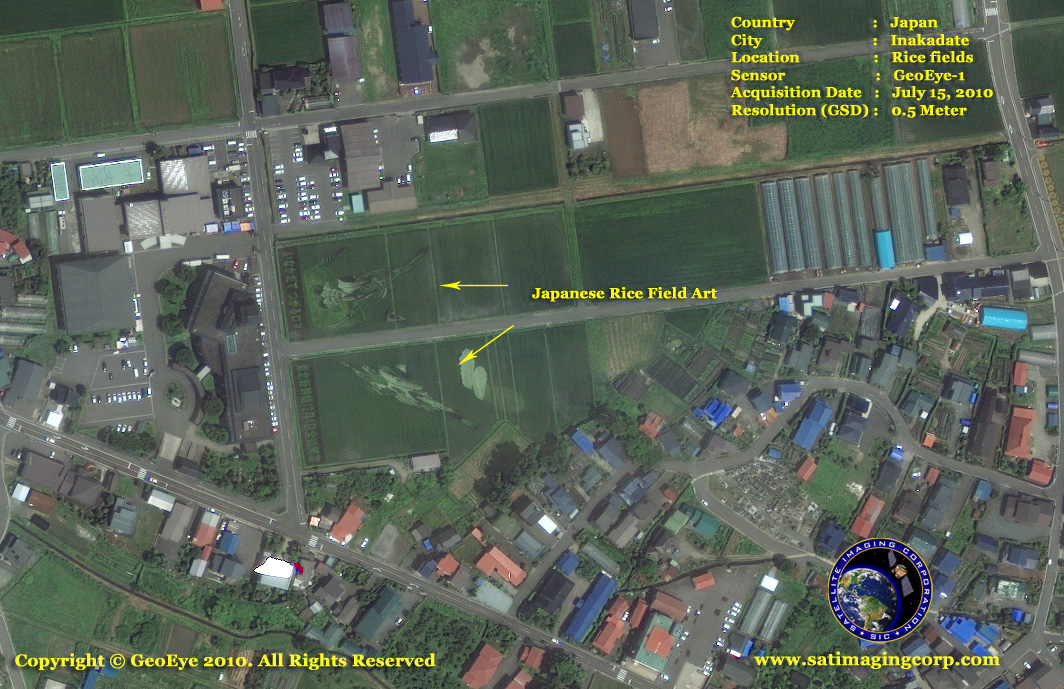
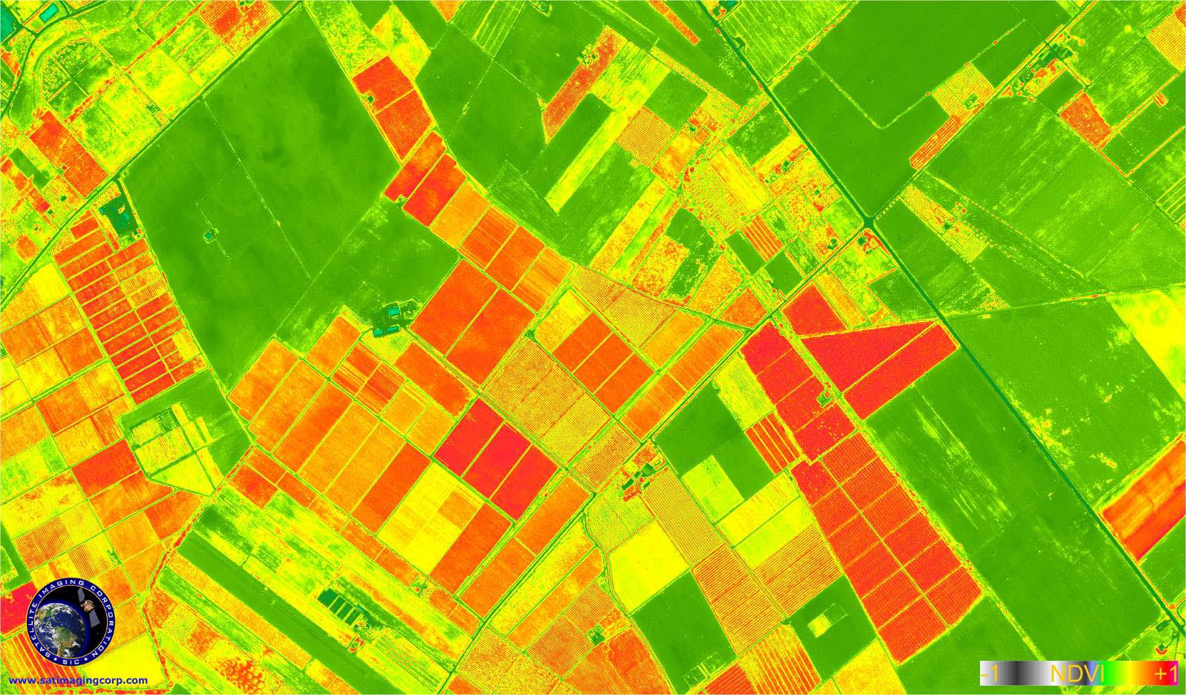
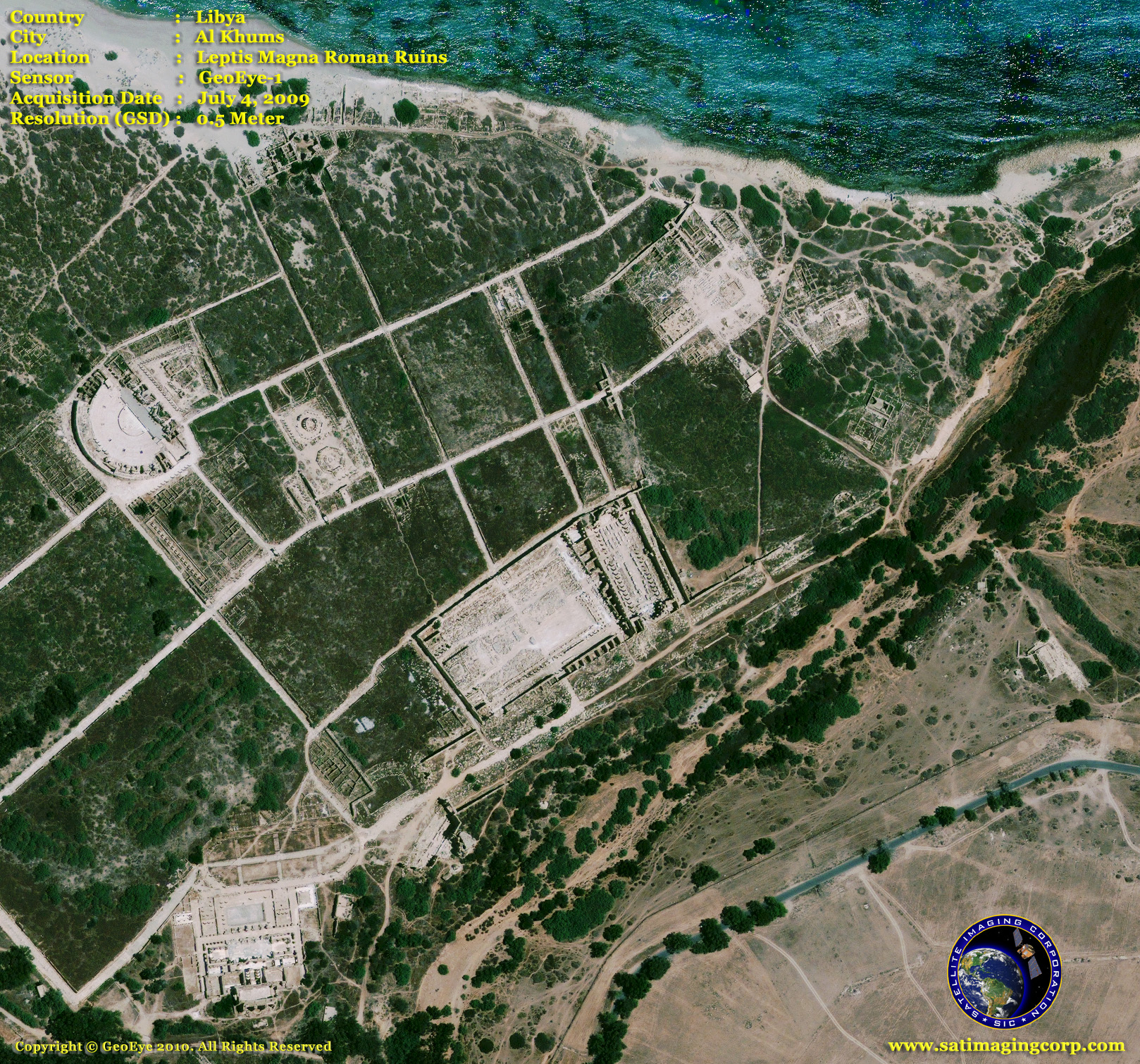
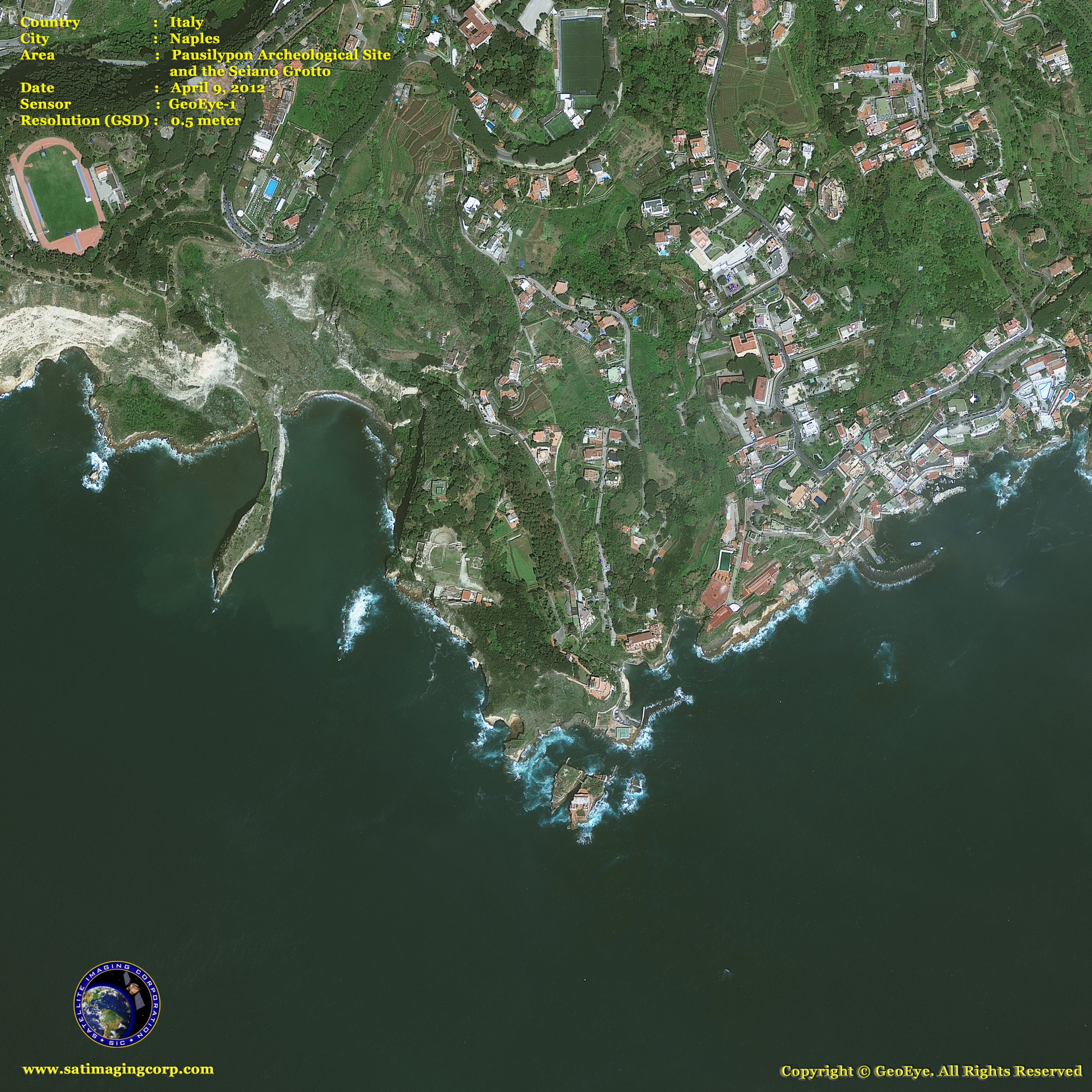
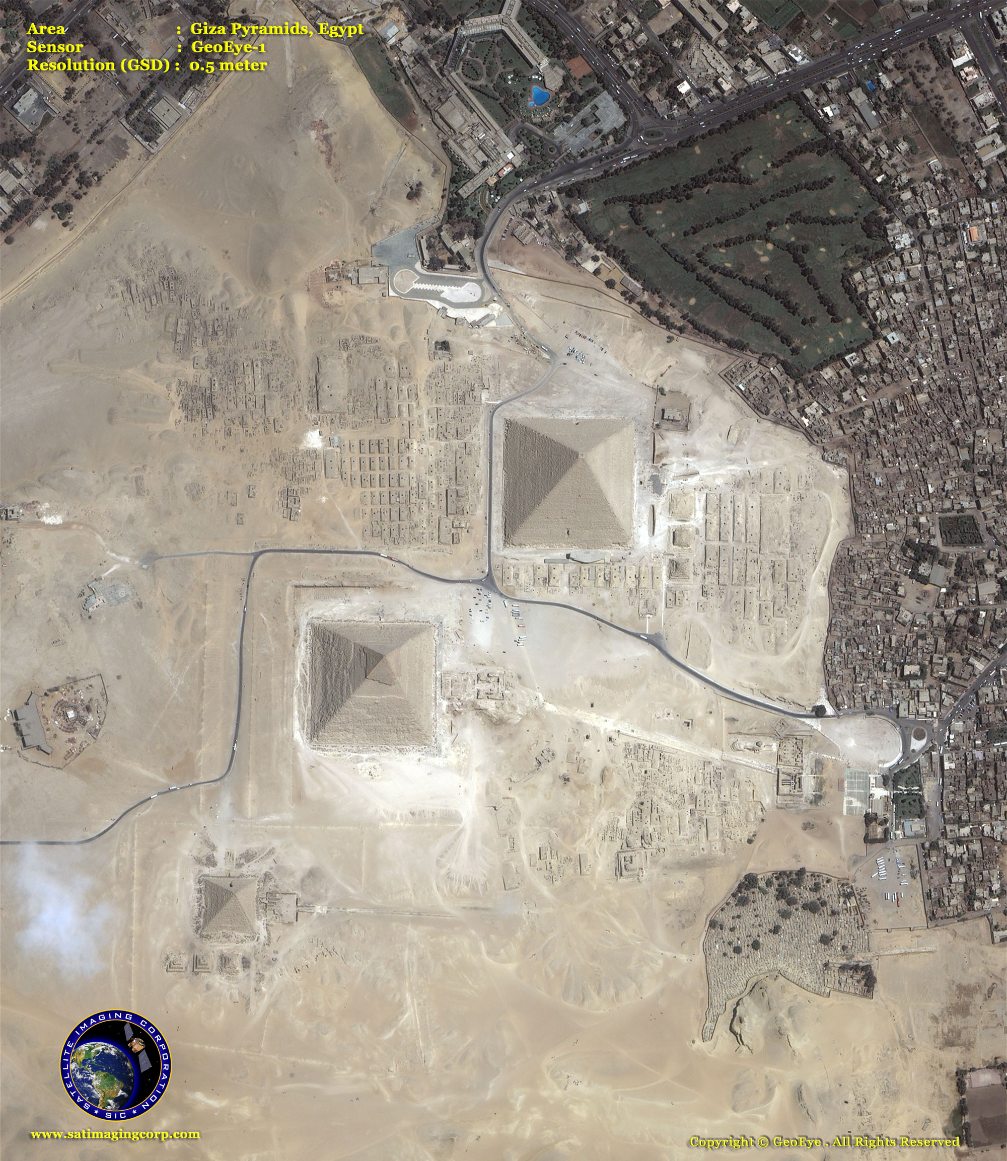
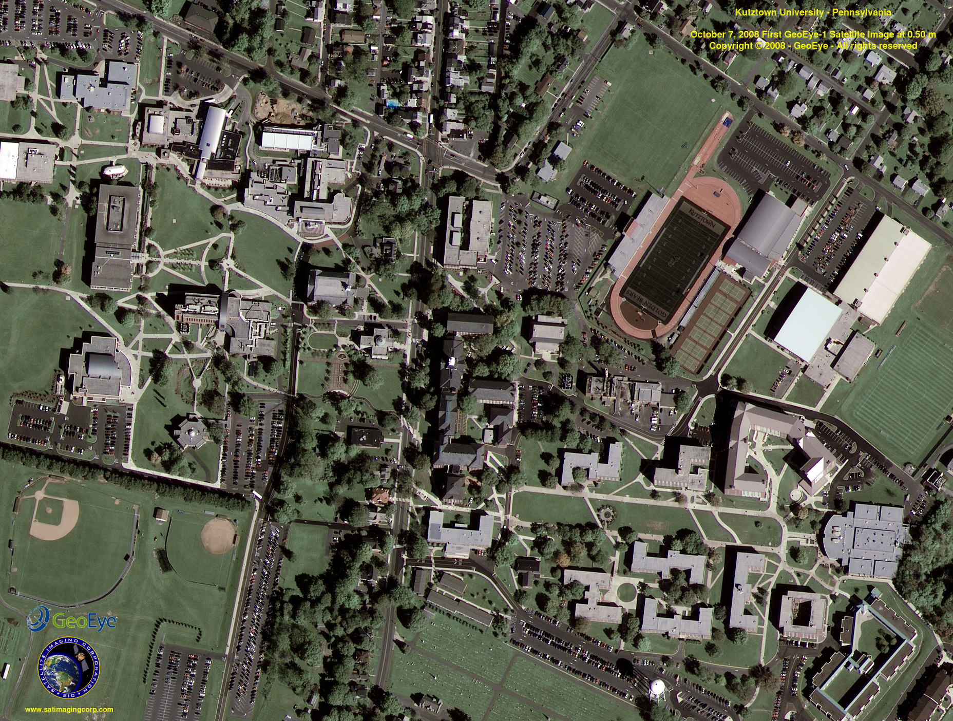
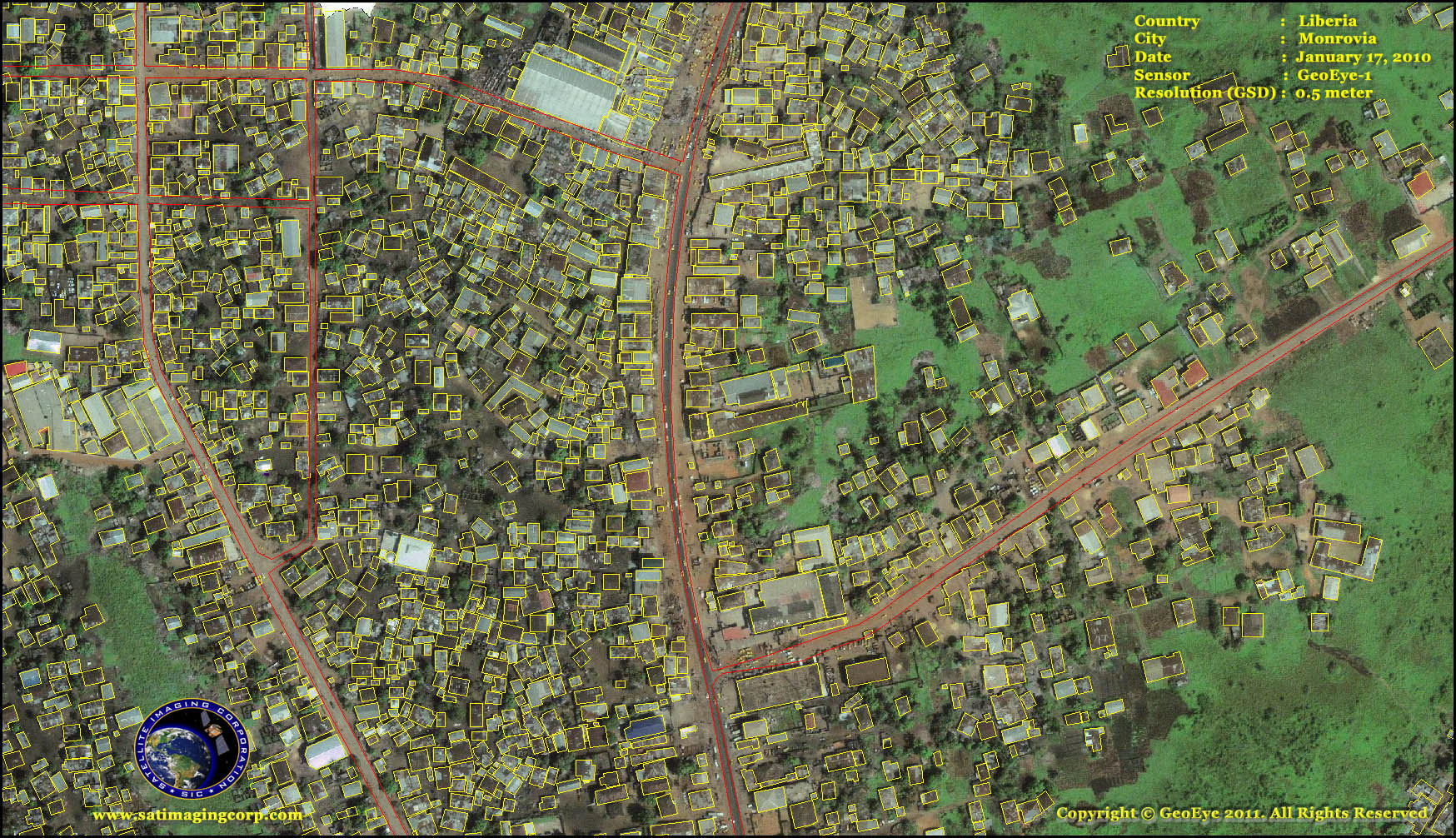
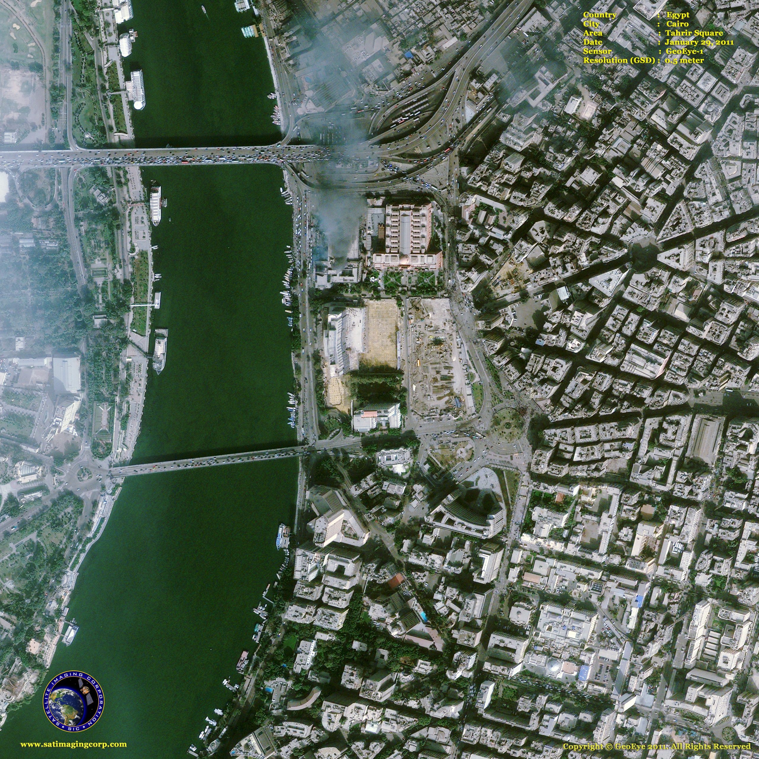
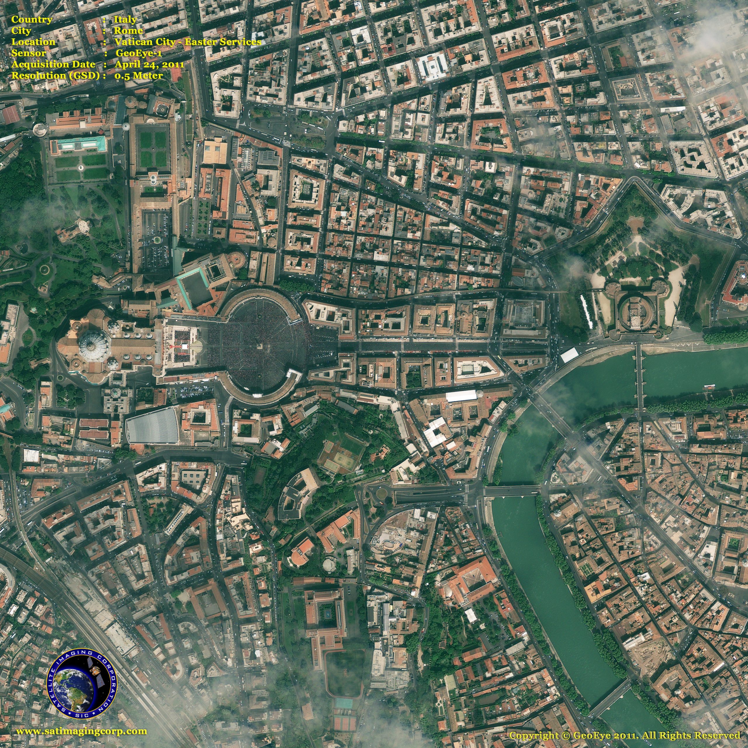
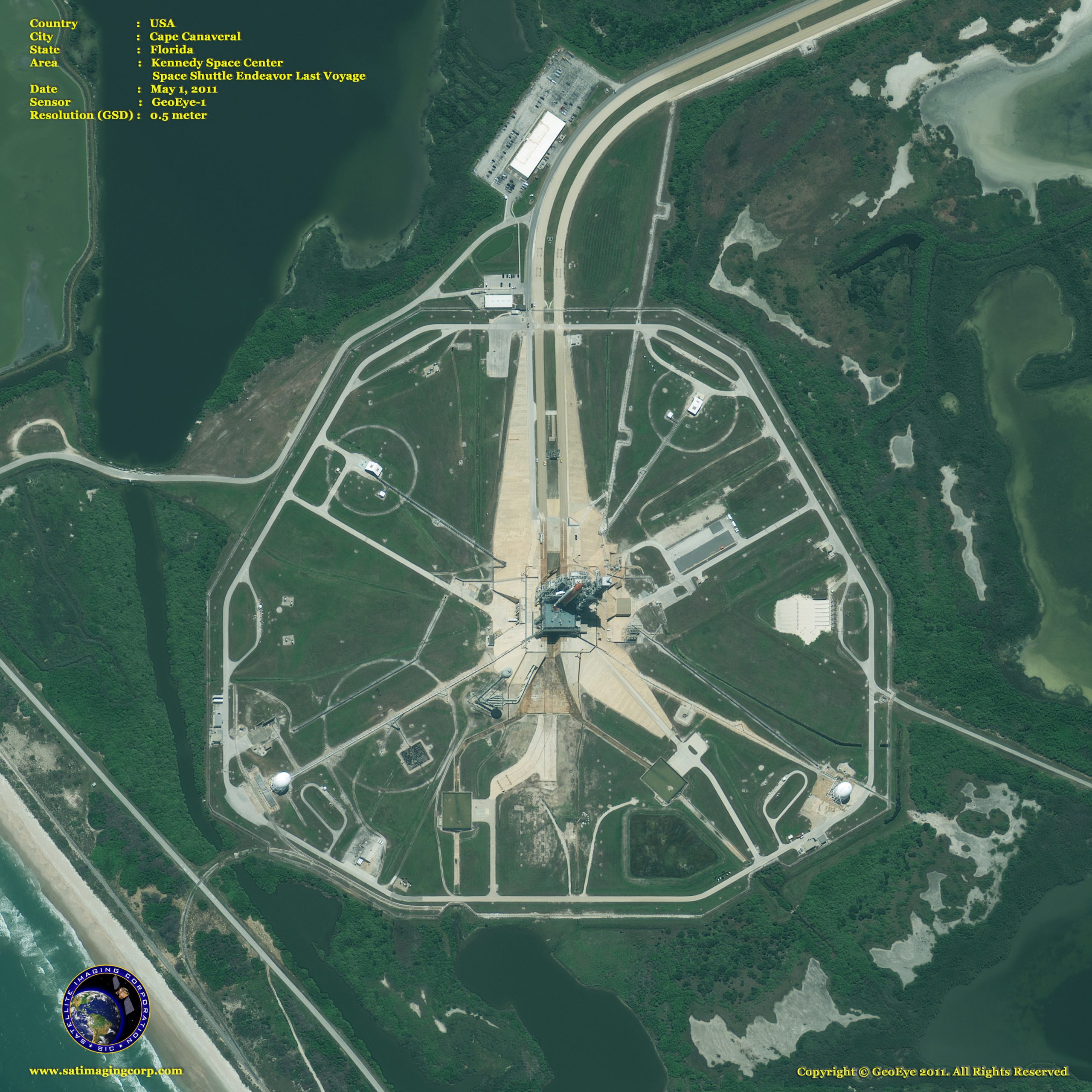
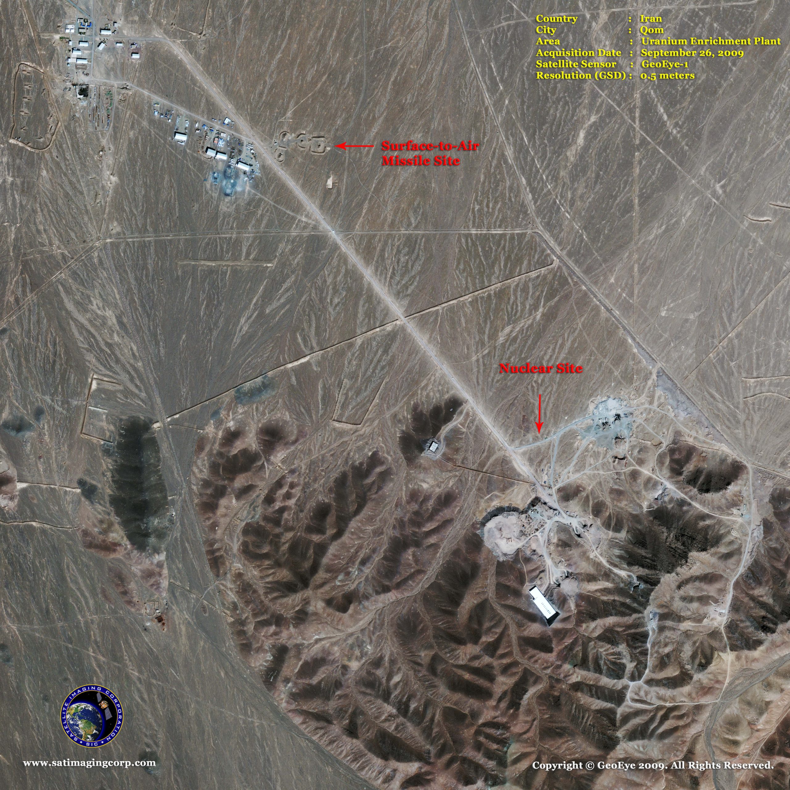
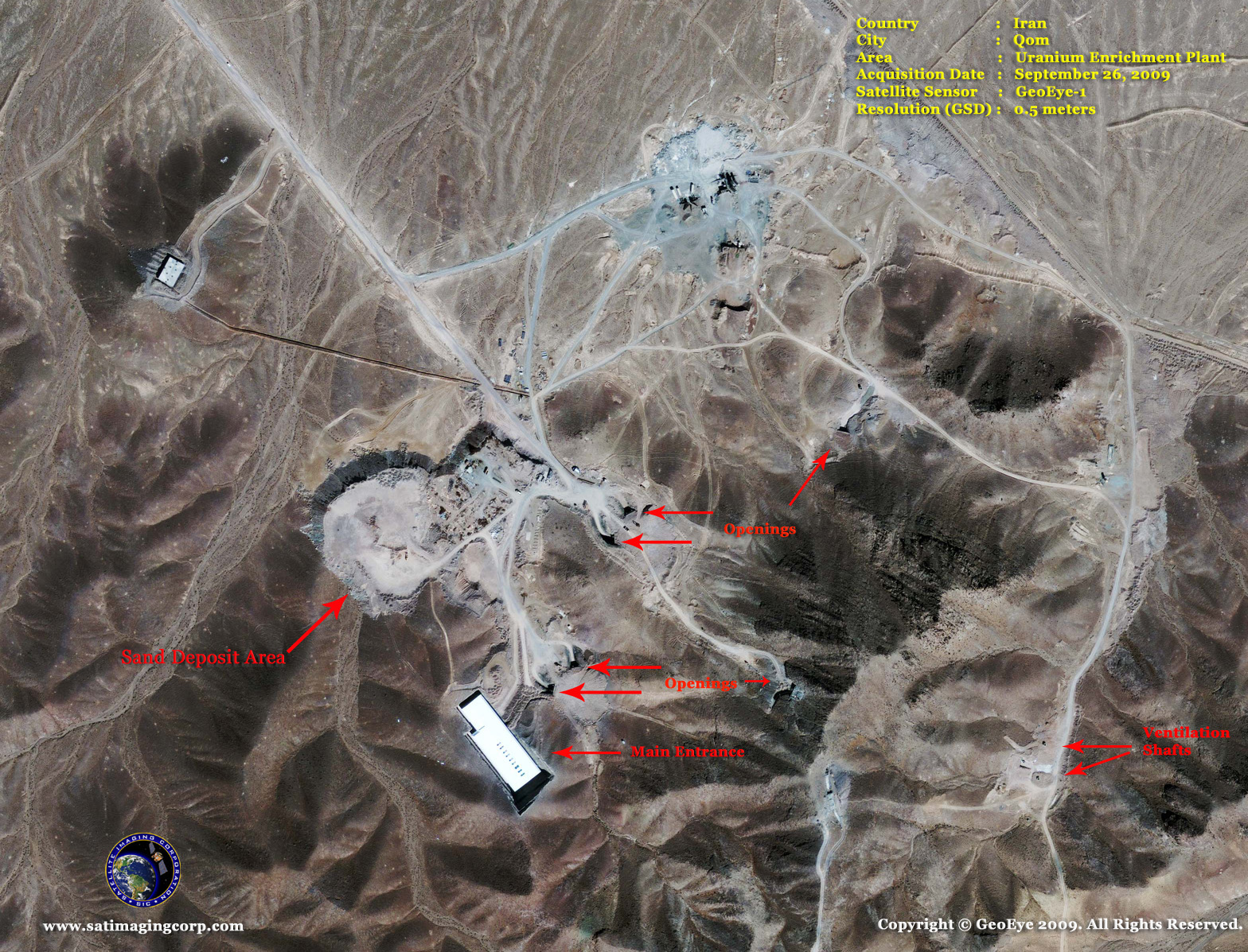
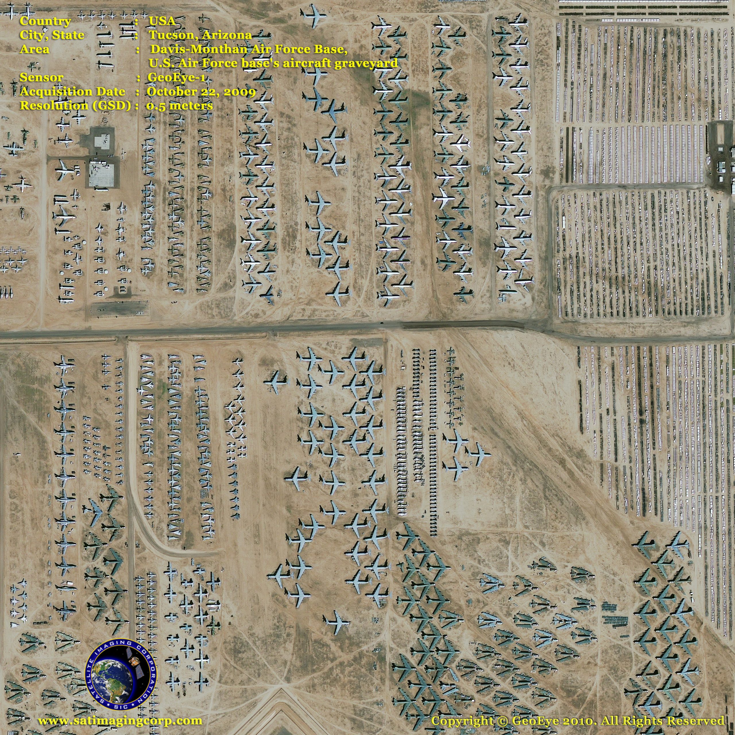
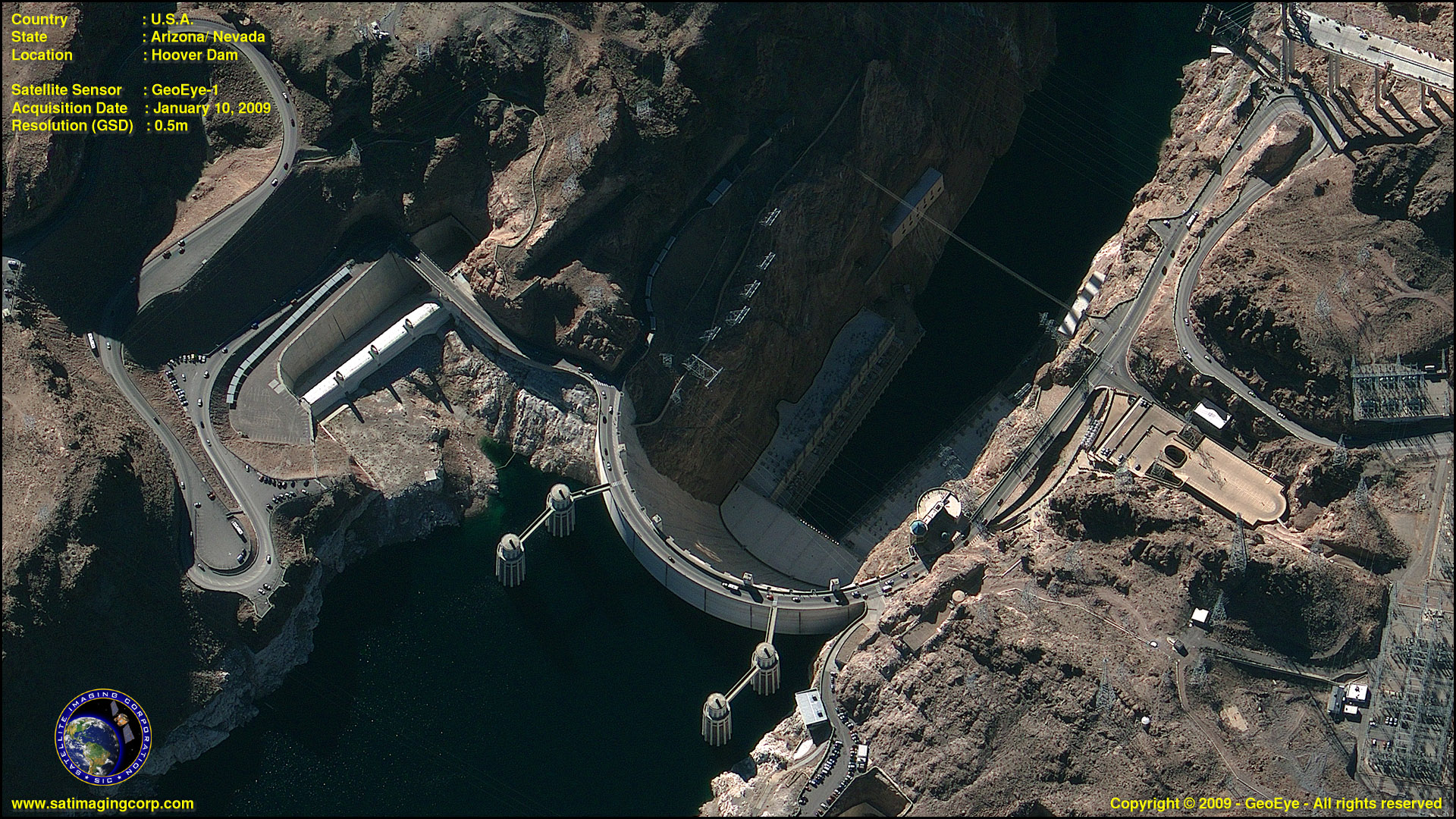
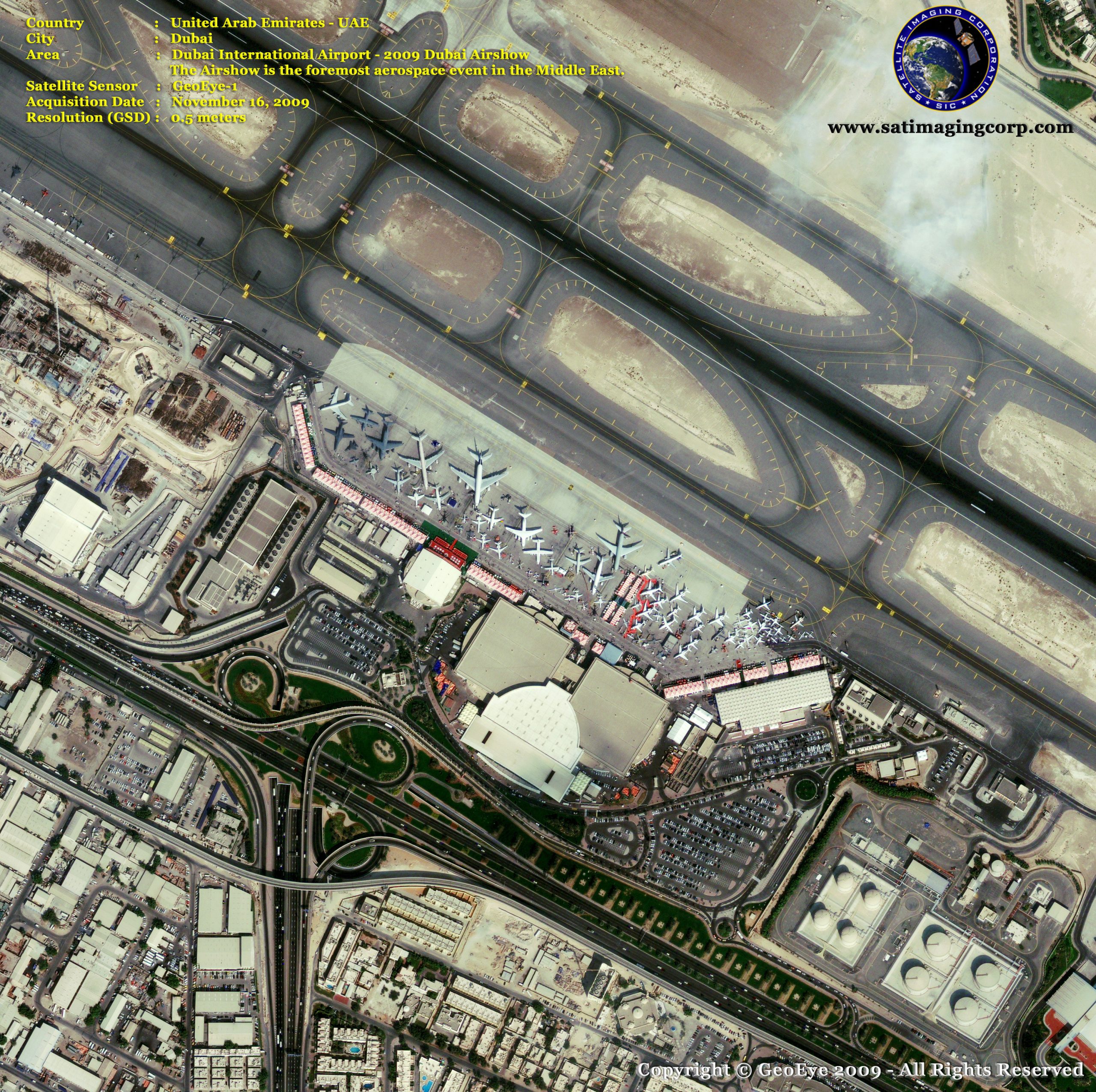
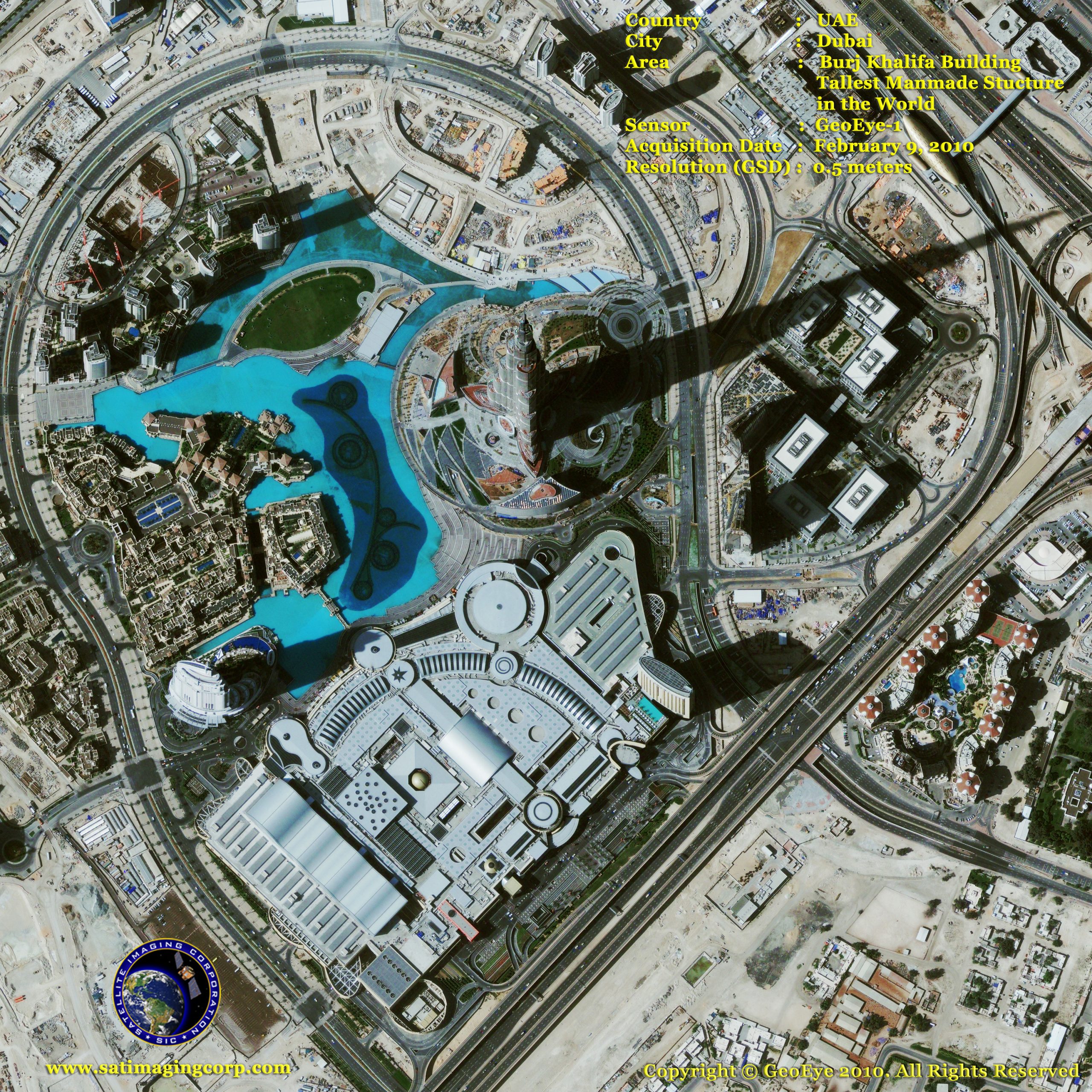
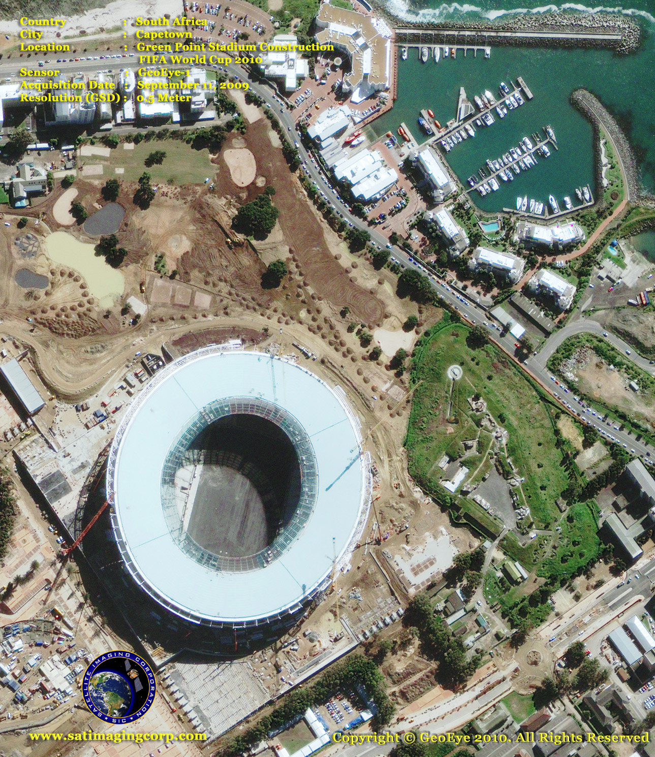
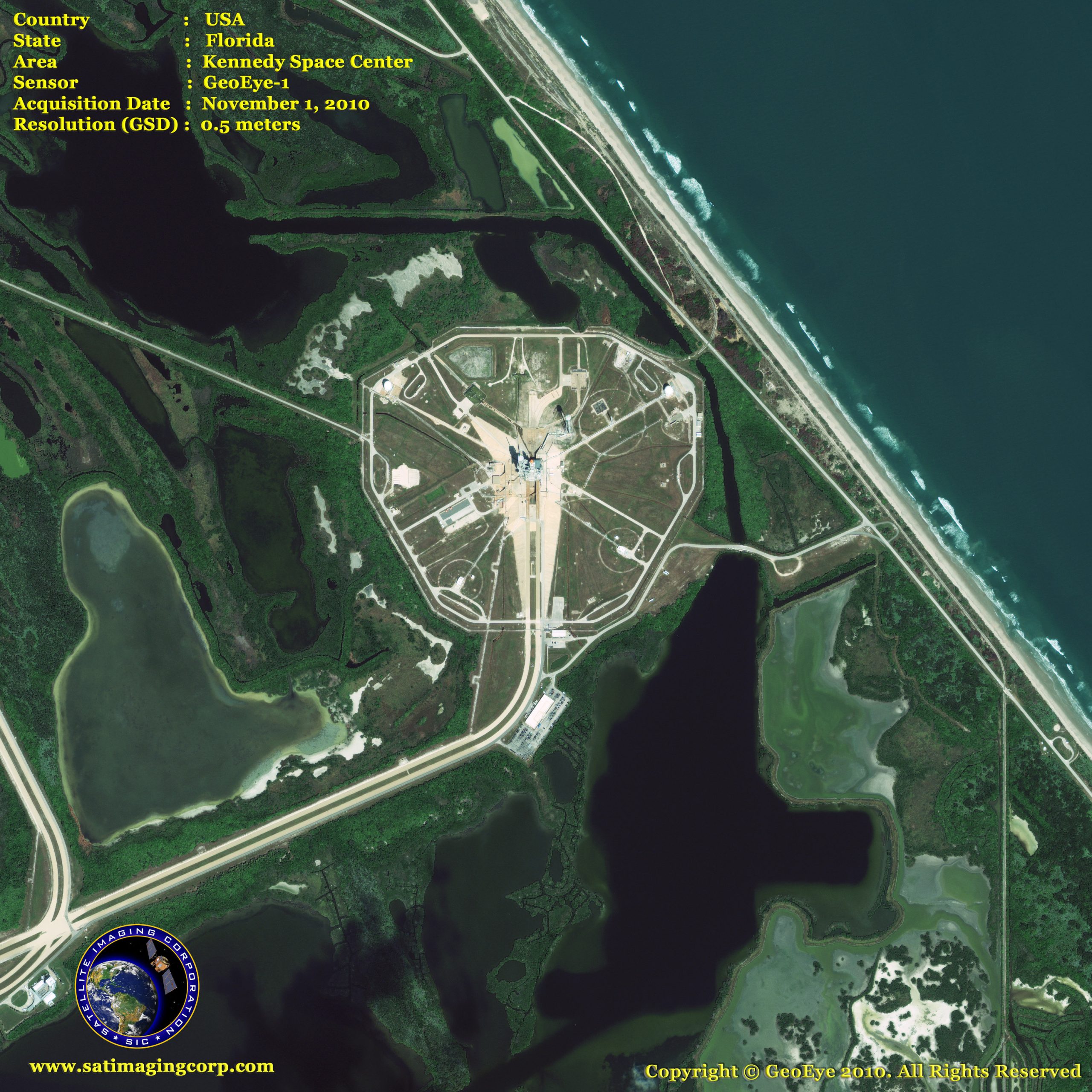
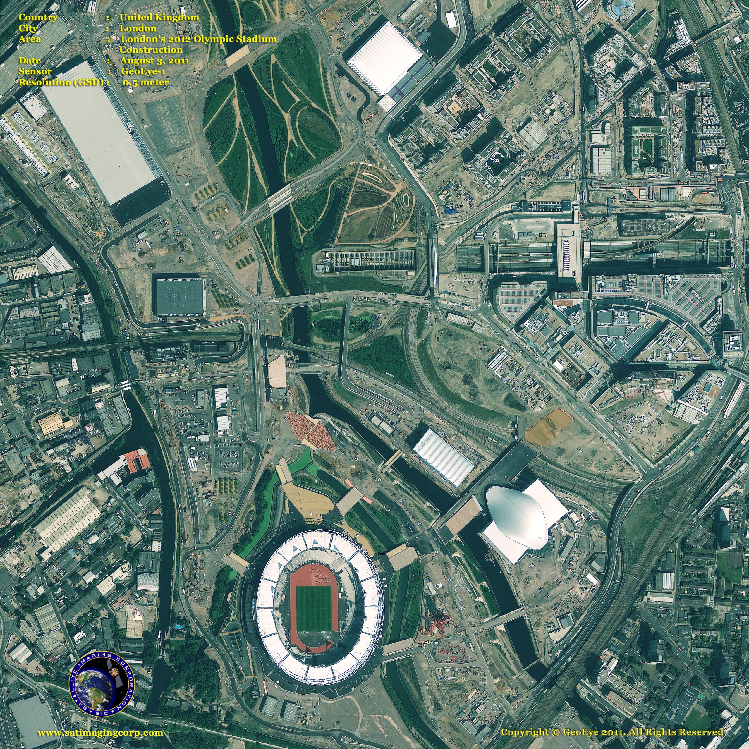
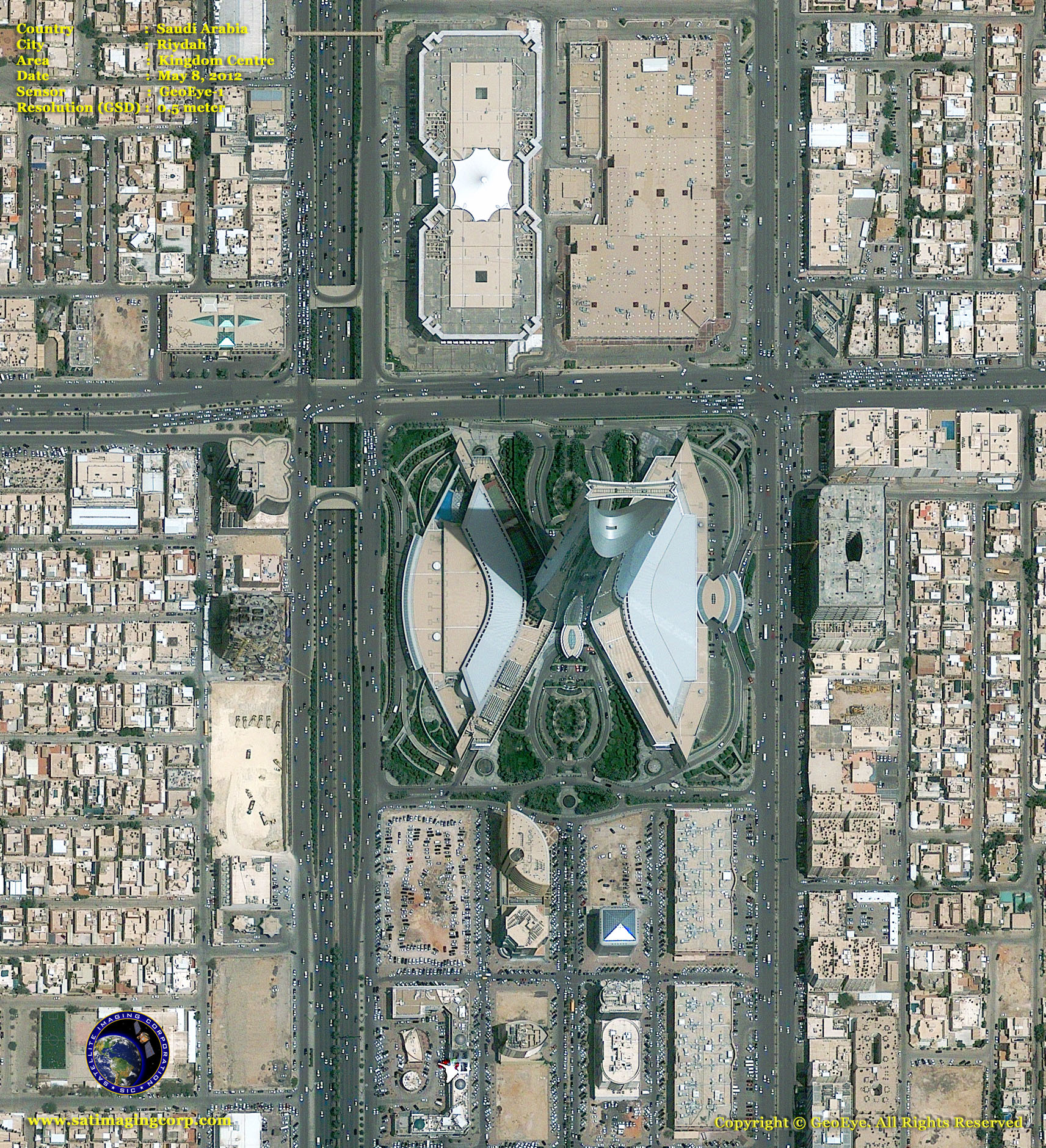
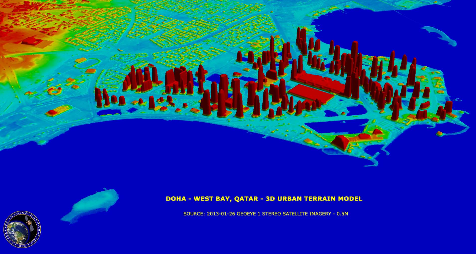
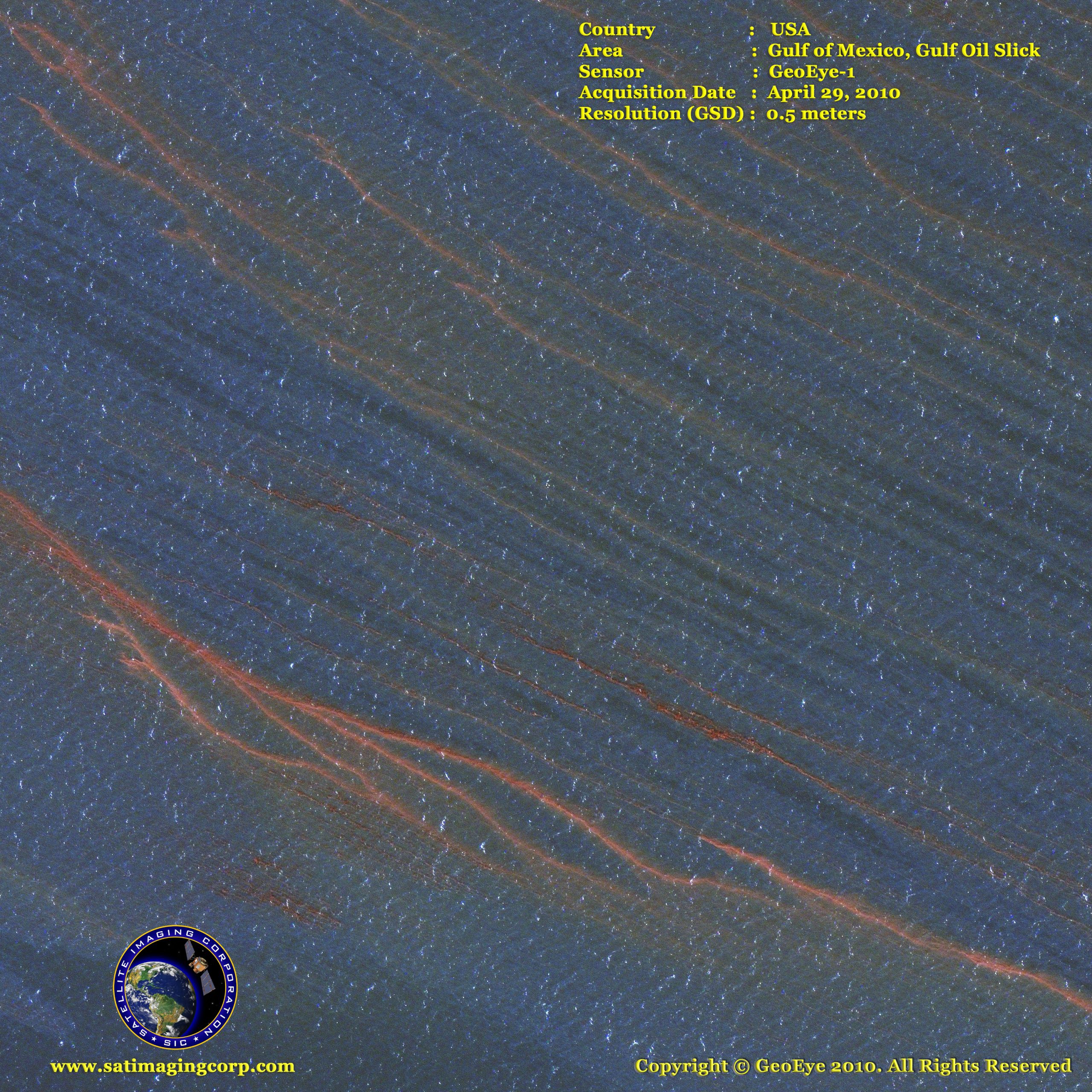
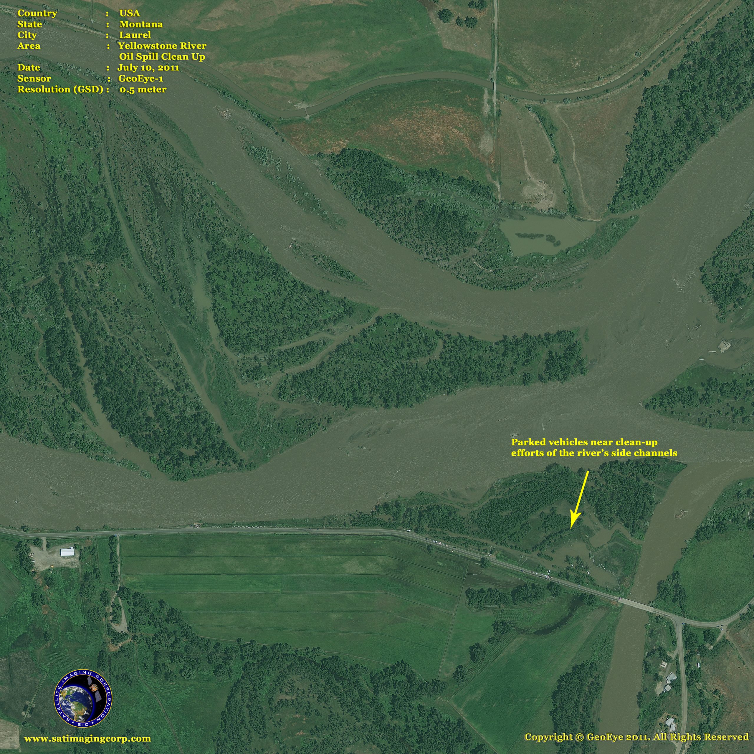
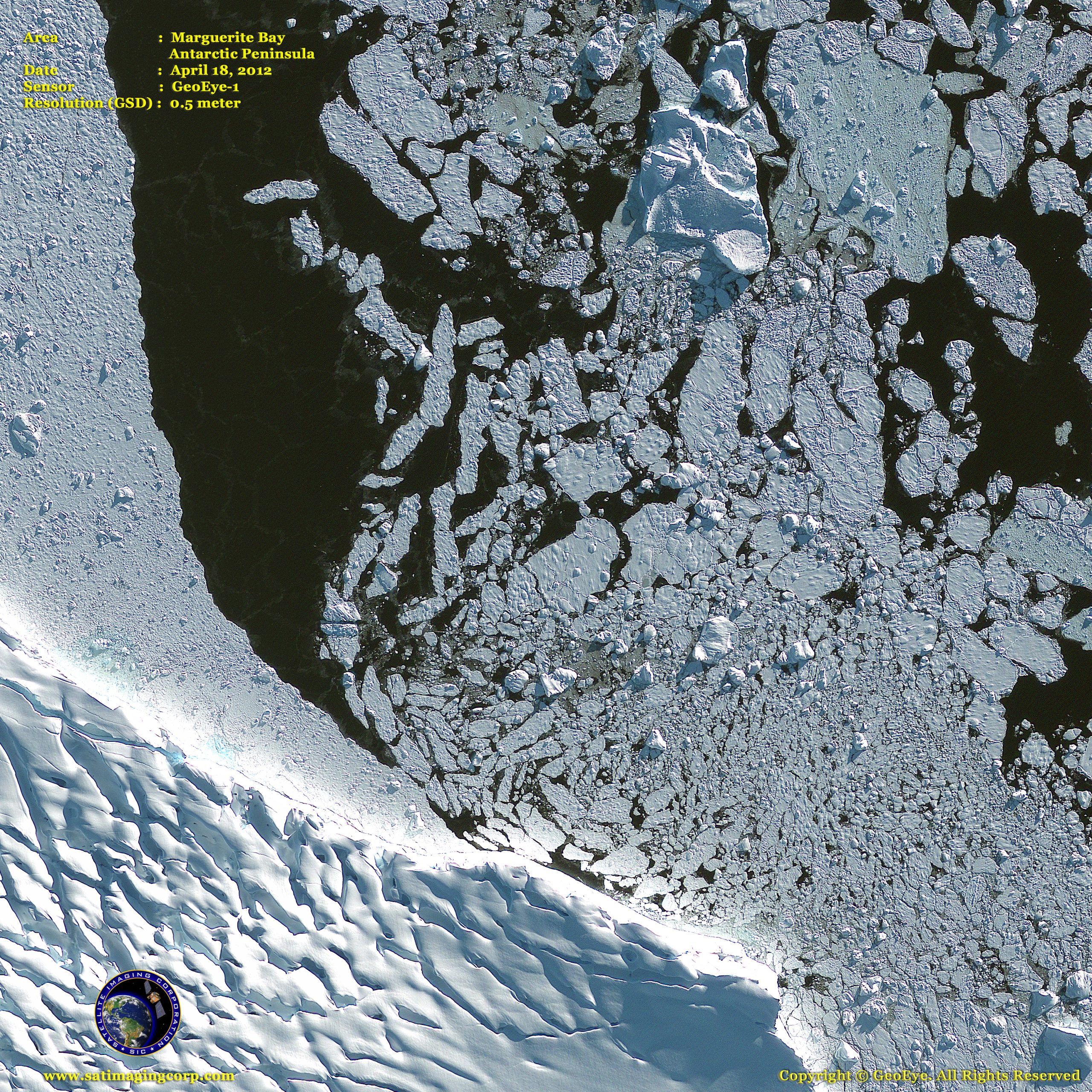
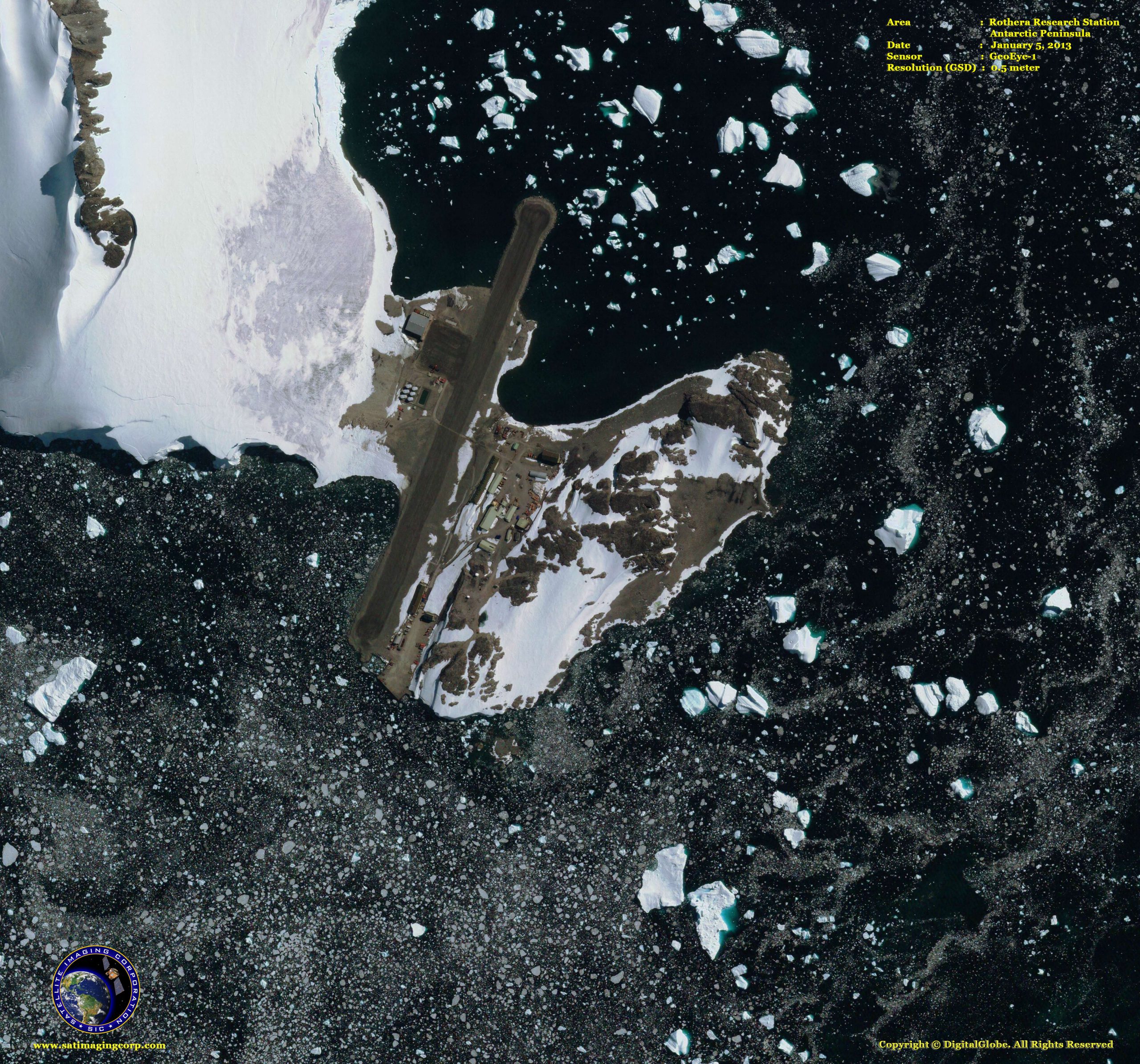
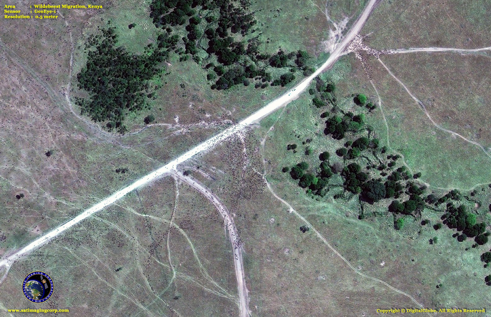
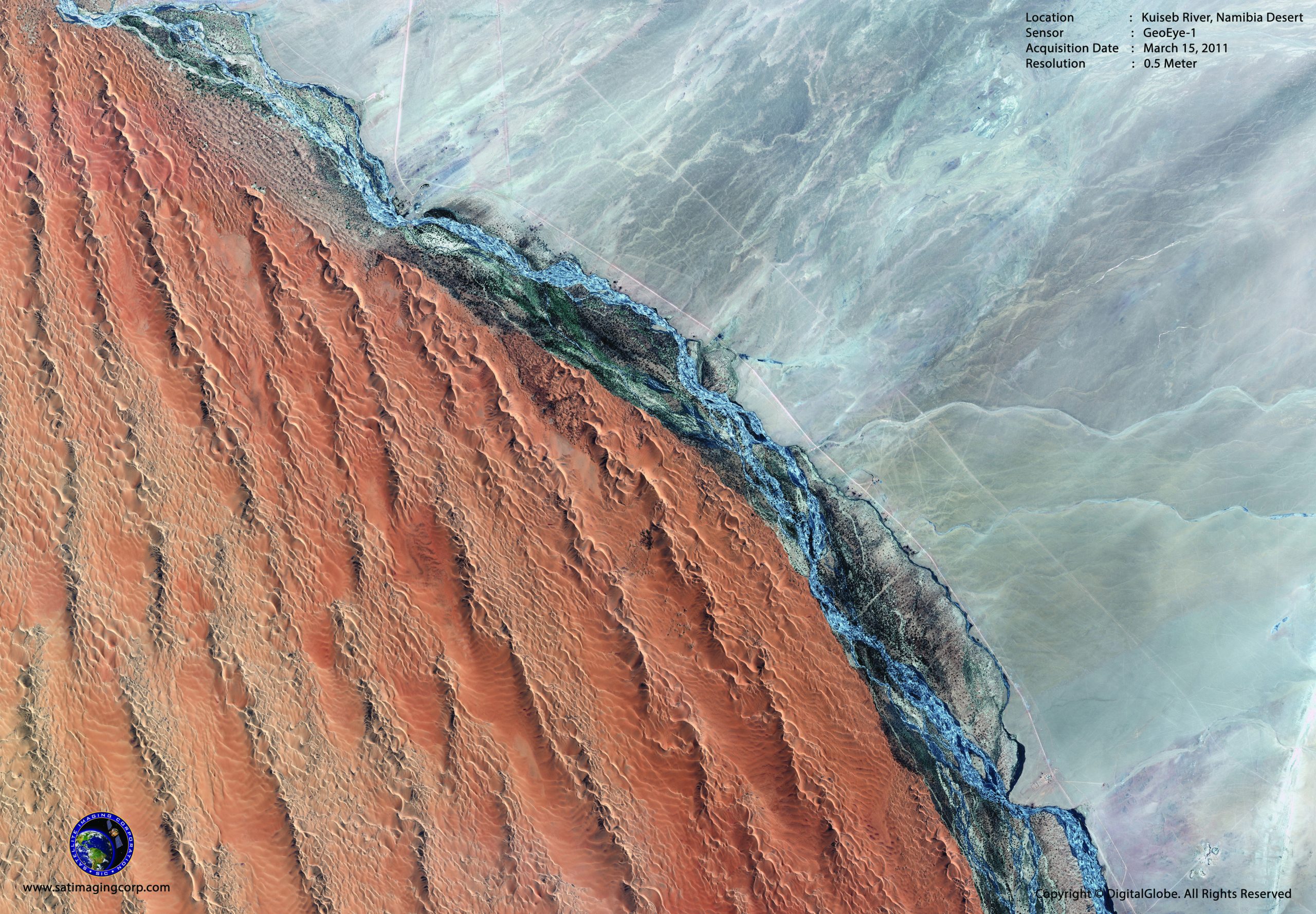
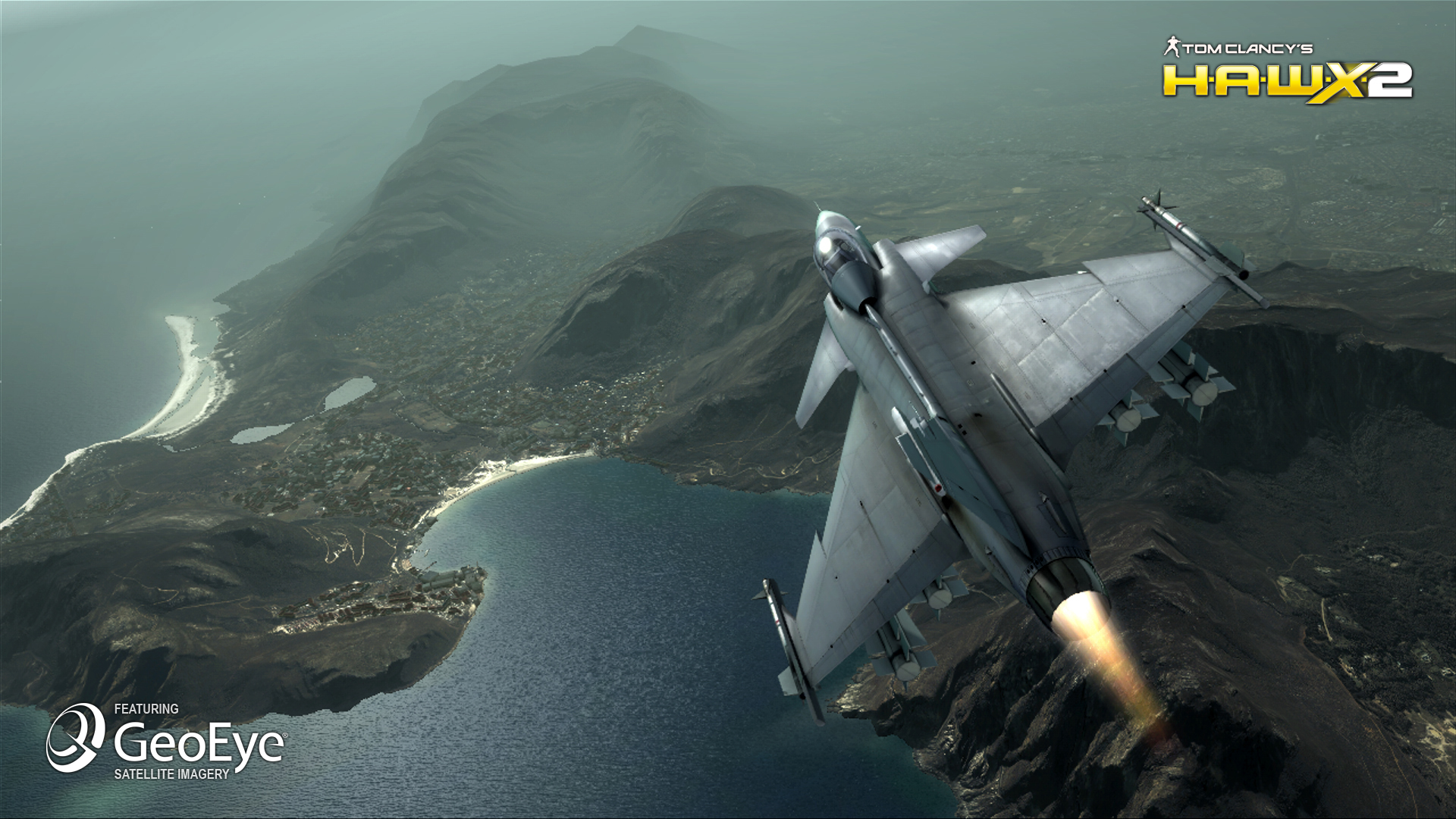
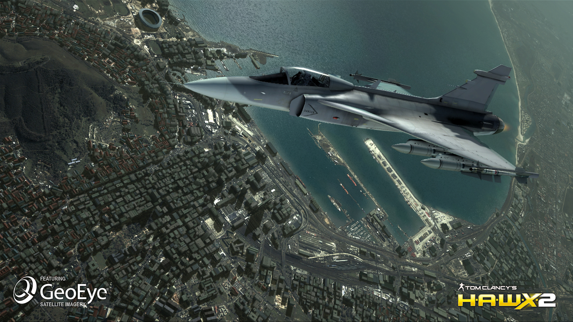
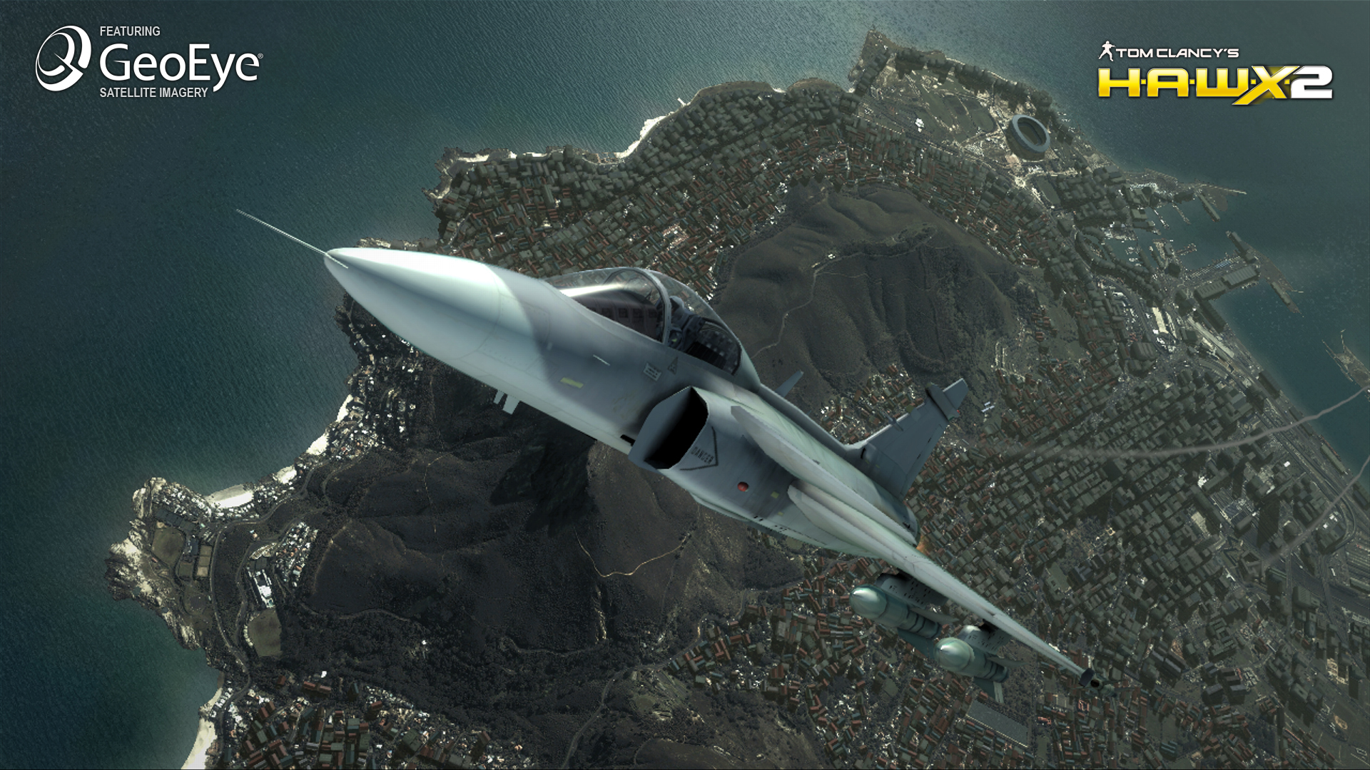
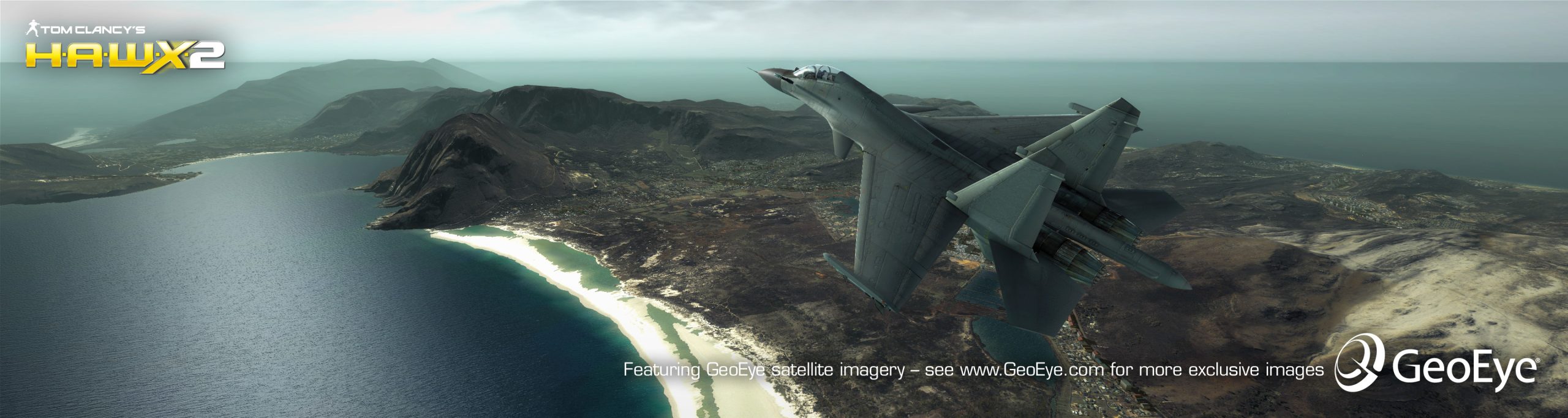
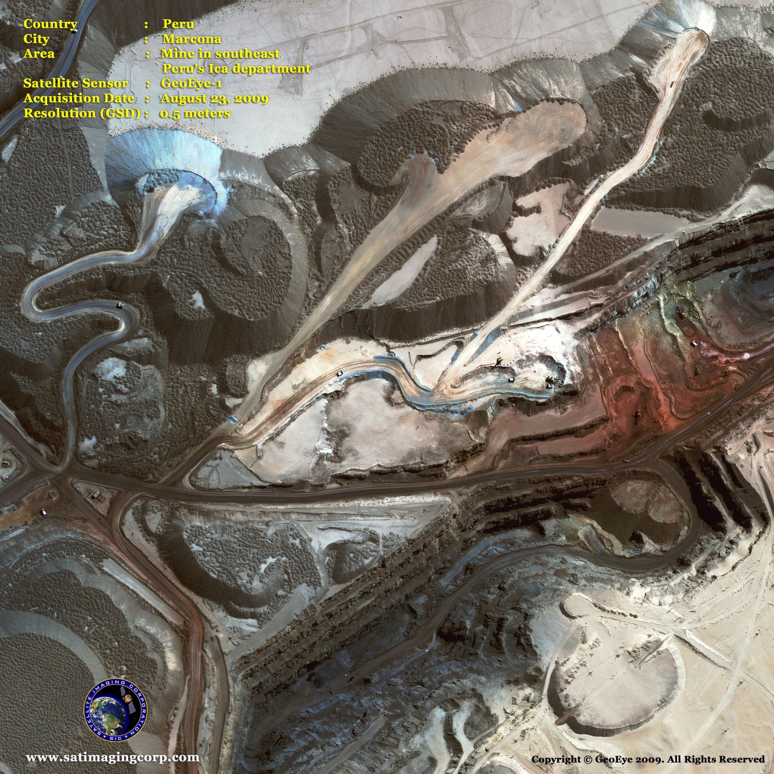
Sample Images
GeoEye-1 Satellite Image Gallery
* Click on thumbnail to view in full resolution.
Learn more about our products and satellite imaging services with a complimentary consultation. Contact us today.
GeoEye-1 Satellite Sensor Specifications
Launch date
September 6, 2008
Camera Modes
Simultaneous panchromatic and multispectral (pan-sharpened)
Panchromatic only
Multispectral only
Resolution
0.50 m / 1.51 ft* panchromatic (nominal at Nadir)
1.84 m / 6.04 ft* multispectral (nominal at Nadir)
Spectral Range
Panchromatic: 450 – 800 nm
Blue: 450 – 510 nm
Green: 510 – 580 nm
Red: 655 – 690 nm
Near Infra Red: 780 – 920 nm
Metric Accuracy / Geolocation
5 m CE90, 3 m CE90 (measured)
Swath Widths & Representative Area Sizes
Nominal swath width – 15.2 km / 9.44 mi at Nadir
Single-point scene – 225 sq km (15×15 km)
Contiguous large area – 15,000 sq km (300×50 km)
Contiguous 1° cell size areas – 10,000 sq km
(100×100 km)
Contiguous stereo area – 6,270 sq km (224×28 km)
(Area assumes pan mode at highest line rate)
Imaging Angle
Capable of imaging in any direction
Revisit Frequency at 770 km Altitude (40° Latitude Target)
Max Pan GSD (m)
0.42
0.50
0.59
Off Nadir Look Angle (deg)
10
28
35
Average Revisit (days)
8.3
2.8
2.1
Daily Monoscopic Area Collection Capacity
Up to 700,000 sq km/day (270,271 sq mi/day) of pan area (about the size of Texas). Up to 350,000 sq km/day (135,135 sq mi/day)of pan-sharpened multispectral area (about the size of New Mexico)
Technical Information
Launch Vehicle
Delta II
Launch Vehicle Manufacturer
Boeing Corporation
Launch Location
Vandenberg Air Force Base, California
Satellite Weight
1955 kg / 4310 lbs
Satellite Storage and Downlink
1 Terabit recorder; X-band downlink (at 740 mb/sec or 150 mb/sec)
Operational Life
Fully redundant 7+ year design life; fuel for 15 years
Satellite Modes of Operation
Store and forward
Real-time image and downlink
Direct uplink with real-time downlink
Orbital Altitude
770 km / 478 miles
Orbital Velocity
About 7.5 km/sec or 17,000 mi/hr
Inclination / Equator Crossing Time
98 degrees / 10:30am
Orbit type / period
Sun-synchronous / 98 minutes


