Beijing-3 Satellite Constellation (BJ3A and BJ3N)
(30cm)
Beijing-3 is a constellation of two optical Earth observation satellites owned and operated by Twenty First Century Aerospace Technology Co., Ltd (21AT). The BJ3A, with a spatial resolution of 50cm, was launched on June 11, 2021. 21AT launched the 30cm BJ3N satellite on August 24, 2022. The BJ3N satellite sensor is the first AI (Artificial Intelligence) earth-observation-operated satellite to maintain stability in orbit and to facilitate on-board analytical processing and delivery.
BJ3N Satellite (30cm)

Copyright © Twenty First Century Aerospace Technology Co., Ltd (21AT)
The BJ3A satellite collects mono, stereo, and Tri-Stereo satellite image data at 50cm. In contrast, the BJ3N 30cm panchromatic spatial resolution and 4-band (RGBN) multispectral image data. It uses AI (Artificial Intelligence) onboard the spacecraft to plan in-orbit image processing, using AI/ML algorithms and download analytical data. The Beijing-3B satellite provides 2D and 3D geospatial data for various applications in environmental monitoring, urban planning, oil & gas, agriculture, land resource management sectors, and digital twin transfers.
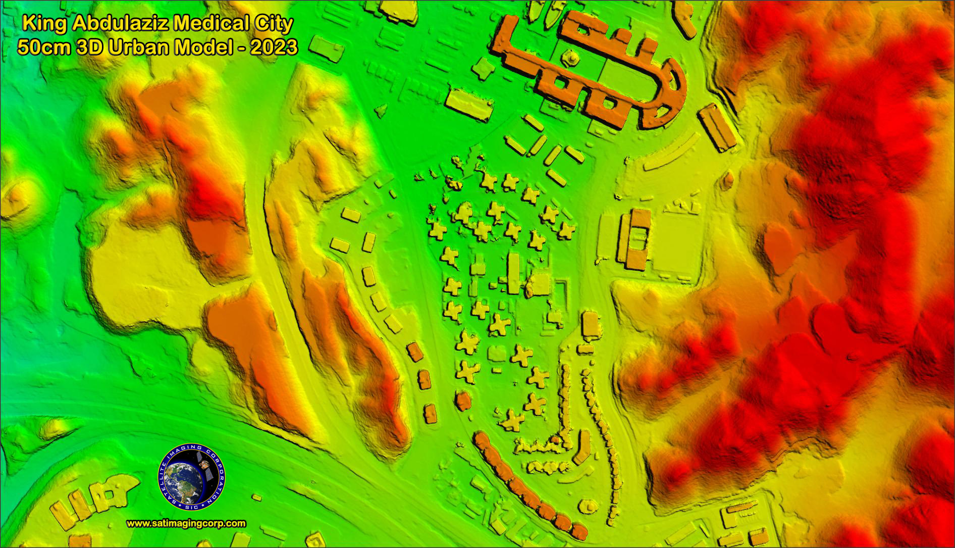
BJ3N stereo and Tri-Stereo satellite imaging capabilities offer high accuracy and detailed Digital Terrain Models (DTM) and produce bare earth elevation models, with and without breaklines, for hydrological research and studies. Some key features are automatic mass point generation, 3D break lines, hydro-enforcement, water bodies flattening, high resolution- fidelity DSM, smooth building and ground surface, and high-volume scalability using a GRID processing computer.
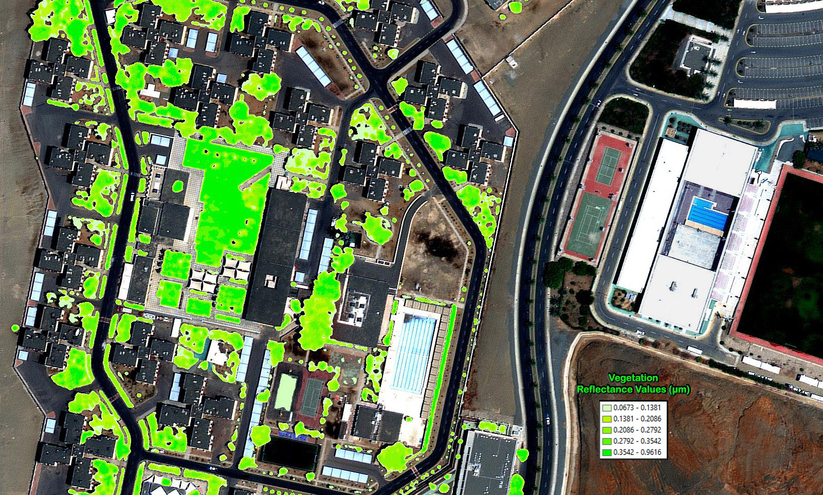
*King Abdulaziz Medical City – Saudi Green Initiative – 2023
* Click on the image for a larger scene
Sample Images
Beijing-3 (BJ3A and BJ3N) Satellite Images
* Click on thumbnail to view in full resolution.
Beijing-3 Satellite Constellation Specifications
Orbit
SSO (Sun-synchronous orbit) Altitude 610 km LTAN 11:00 local time
Spectrum bands
Panchromatic – 450 to 900 nm
Blue – 450 to 520 nm
Green – 520 to 590 nm
Red – 630 to 690 nm
NIR – 770 to 890 nm
Resolution
0.3m panchromatic
1.2m multispectral
Precision
Better than 1:10000 map
Dynamic range
11 bits
Swadth width
11.5 km
Revisit
5 days


