Satellite Images for Oil and Gas Production
“Acquire satellite images from the most remote areas and track progress with the most advanced techniques.“
Once underway, accurate tracking of your oil and gas project is imperative to its success. Accountability to upper levels of management, as well as to environmental parties, requires that you have a clear picture of your project’s growth and its impact the surrounding area over time. Satellite Imaging Corporation is experienced in providing highly detailed and accurate satellite imagery and aerial photography optimized for the oil and gas industry.
Middle East Map of Rumalia, Iraq Oil Facility - 2003
IKONOS (0.81m) Satellite Image
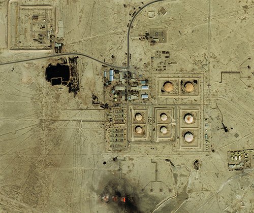
Copyright © MAXAR. All rights reserved.
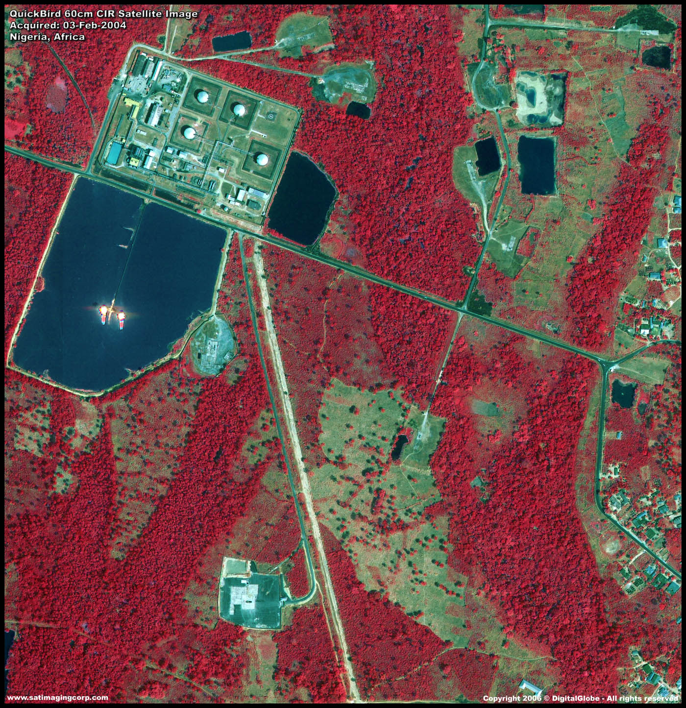
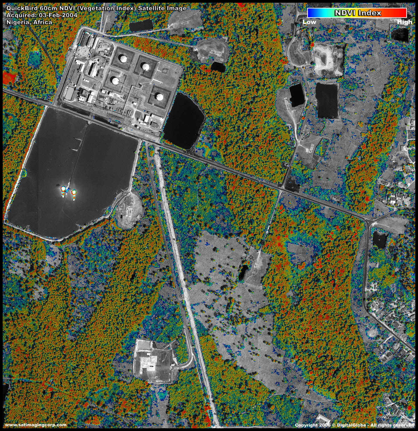
QuickBird Satellite Image Data at 0.61m, acquired over Oil Production facility in Nigeria on 02/03/2004
Left to right: Natural Color, Near Infrared (NIR), Vegetation Index Image (NDVI).
Image processing services provided include Spectral Analysis to support environmental monitoring.
Left to right: Vegetation Landcover Index, Soil Zone Index, Vegetation Hue Colorized.
Copyright © MAXAR/processed by Satellite Imaging Corporation. All rights reserved.
Satellite images are invaluable for the detection of leakage, that regular control systems may not be able to detect. Satellite Imaging Corporation acquires high-resolution satellite imagery from 30-centimeters to 1.5-meter resolution. that can detect a spill early, saving time and money on clean-up procedures.
Satellite maps for oil and gas production supports monitoring:
- Project development
- Leakage
- Environmental impact
- Deforestation
- Selection of oil and gas well placement
- Facility growth


