Precision Agriculture Mapping
Geographic Information Systems (GIS), GPS (Global Positioning System) and satellite imaging technology can greatly support farmers and growers in gathering crucial information to monitor and manage crops, yields, soil, and vegetation. GIS and satellite imaging technology collect data to support precision agricultural mapping for farmers and growers to support crop production and to manage potential threats to their fields.
WorldView-2 Satellite Image (0.5m) Crop Field South Africa
Copyright © MAXAR. All rights reserved.
Precision Agriculture Mapping
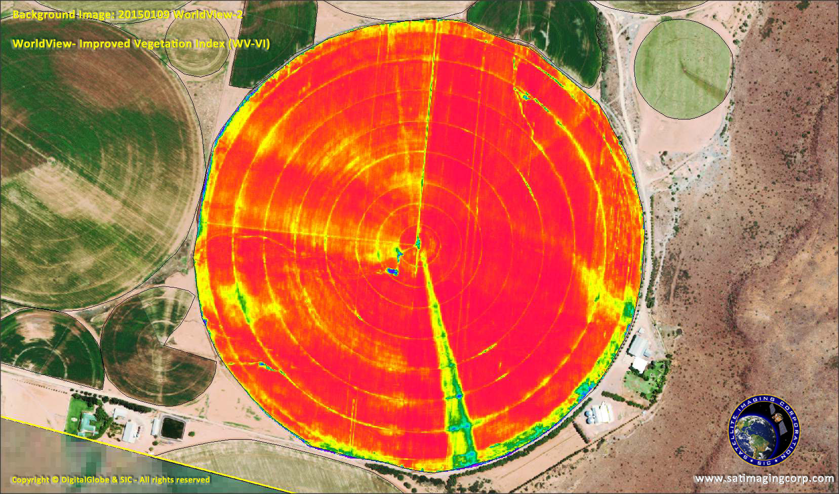
Medium and high-resolution satellite sensors can collect data to analyze crops and soil using green vegetation indices maps such as Normalized Difference Vegetation Index (NDVI) to produce yield and soil index maps. This data can help farmers and growers monitor and manage their fields for successful crop production. Satellite imagery and GIS data can help farmers and growers to better understand what is happening on the ground in real-time to help analyze soil health, climate change, disease, pest management, and provides knowledge for improved farming, crop protection, and getting the job done faster.
Farmers and growers require information on their fields and soil analysis is critical in order to keep their farms flourishing to increase their return on investment.
Soil Zone Maps
With a soil zone map, you can clearly see landscape variations, lighter colors indicate dry, salty, or coarsely textured soils, while darker colors indicate wet or organic soils. Often, variations in color indicate topographic variations across fields, which can greatly impact your crop management strategies and zone map creation for precision agriculture management applications.
Soil Testing and Analysis
Copyright © DigitalGlobe. All rights reserved.
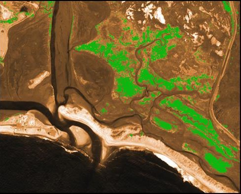
Crop Yield
With satellite imagery and GIS data, you can routinely and quantitatively assess vegetation, crop yields, status, and variation across your land, from bare soil to a dense canopy, to better manage your crops throughout the season and to work backward in time to identify yield-limiting factors.
Crop Yields & TreeGrading
Copyright © DigitalGlobe. All rights reserved.
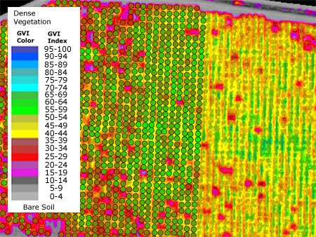
Green Vegetation Indices (NDVI Maps)
Green vegetation index maps provide farmers an absolute measure of the amount of green vegetation presently in their fields and determine the health of the soil and moisture measurement. These maps show the integrated result of inputs and environmental, physical, and cultural factors affecting their crops.
Green vegetation maps are a significant revenue-enhancing tool that shows you were to scout and sample, the extent and severity of problem areas protect their crops, and to take action to resolve any potential problems including droughts and flooding.
Sentinel-2A 10M Satellite Image of NDVI Map – Kuwait
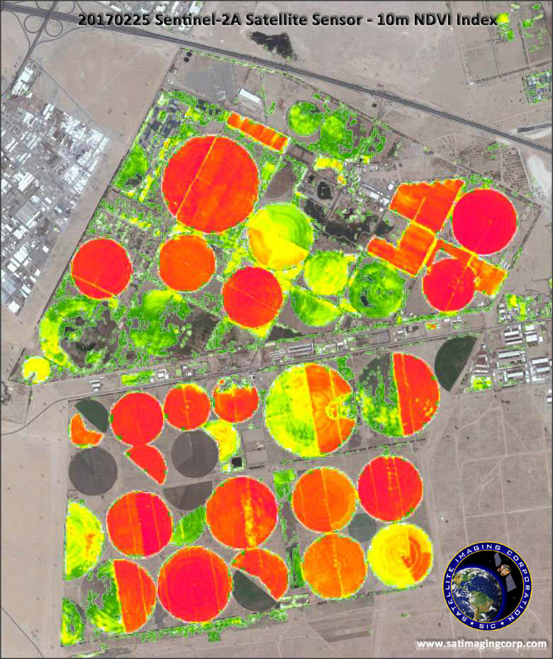
Copyright © ESA. All rights reserved.
Consultancy
Ongoing Satellite remote sensing and GIS consultancy services are provided to our clients, including the set-up of reliable source coordinate databases in support of computerized mapping, exploration, and development of projects around the world and to clients implementing AI, CV, or GIS management systems, utilizing a variety of source data. For more information or for a consultation, please contact us.