Airport Mapping
Satellite Imaging Corporation (SIC) provides 3D airport mapping using high-resolution stereo satellite imagery to support airport pre-planning and design, airport layout plans (ALPs), navigational mapping, airport security, and aviation safety operations, utilizing Artificial Intelligence (AI), Machine Learning (ML), and Computer Vision (CV) algorithms and management systems.
3D Digital Surface Models (DSMs) and Digital Terrain Models (DTMs) can be created to support airport and aviation operations to provide details and data for the construction of airport runways, airport terminals, airport layout design, airspace analysis, obstruction surveys, facility mapping, taxiways, aprons or parking areas, 3D flight simulation for pilot training, aircraft operations, and GIS database maintenance.
Remote sensing satellite image data and Geographic Information Systems (GIS) can give airport planners and developers information needed to support and improve transportation planning within the airport infrastructure with a cost effective solution. Some of the key issues that need to be better understood is the development of the infrastructure and flight operations including the development of roads, zoning, and air space. Remote sensing satellite image data can also aid in the ability for identifying environmental changes, urban development near the airport, as well as land use changes and behaviors of vegetation.
WorldVIew-3 (40cm) Satellite Image Airport Mapping - Madrid Spain
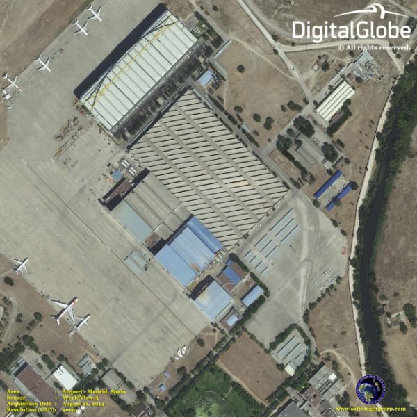
Image Copyright © MAXAR. All rights reserved.
High-resolution multispectral satellite image data and LiDAR have palyed a big role in retrieving data that is crucial to airport operations. LiDAR can produce precise and accurate elevation data to create 3D maps of airport infrastructure. Multispectral satellite image data can detect land and environmental changes to the vegetation around the airport. For example, LiDAR and multispectral data on vegetation such as trees, can obstruct certain air space or visibility that can cause a castrophe in airport operations.
Ongoing remote sensing, geodetic, and GIS mapping consultancy services are provided to our clients, including the set-up of reliable source coordinate databases in support of computerized mapping, exploration, and development of projects around the world and to clients, implementing AI management systems, utilizing a variety of source data, referenced to various survey datums and mapping projections. For more information or for a consultation, please contact us.
Pleiades-1 TriStereo Satellite Imagery - 3D Urban Terrain Model Map of Dubai, U.A.E.
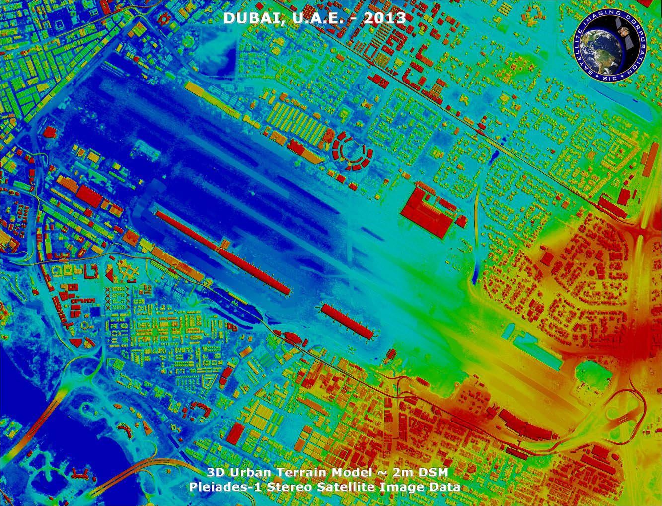
Copyright © AIRBUS Defence & Space. Processed by Satellite Imaging Corporation. All rights reserved


