Improve Safety and Security for Pipeline and Transmission Surveys
Satellite imagery and GIS map data have significant potential to reduce the number of safety and security issues for pipeline corridor planning as well as supply managers with solutions through the spatial representation of data for land, lease management, exploration, production, transmissions, environmental, financial, and facilities management. This information is required to make decisions that will significantly impact the operator’s ability to provide the services demanded by their customers.
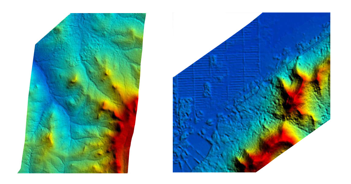
Digital Surface Model (DSM) Pipeline Construction
Copyright © Satellite Imaging Corporation. All rights reserved.
Satellite images can aid engineers and operators in:
- Monitoring electric and gas transmission corridors and rights-of-way
- Accurate and economical corridor analysis for power and gas pipelines
- Monitoring vegetation intrusion on transmission and distribution lines
- Mapping for cable placement
- Determine if the situation calls for a notice, alert, or alarm category of response
- Traditional safety, hazards, and disaster issues facing pipeline and infrastructure
- Deliberate acts of aggression
- Location of leakage
- HCA Spill Modeling
Satellite Imaging Corporation has an unmatched commitment to quality control. We provide continuing geodesy, mapping, coordinate transformation, ArcView GIS, and ArcGIS 3D Analyst consultancy services to our clients for their project needs. We ensure that the 2D and 3D satellite map data sets provided to our clients are utilized in only the most effective manner. On every GIS map project, whether it is large or small, we implement ongoing data quality control to ensure that coordinate databases, foreign source data such as geological and topographic maps, satellite imagery, GIS data attributes, and layers to create a truly seamless GIS mapping environment.


