Renewable Energy
High-resolution satellite images of 30cm or less can monitor land and infrastructure changes over time to manage what is happening on the ground. Using Artificial Intelligence (AI), Machine Learning (ML), and satellite imagery can detect and capture deforestation, agriculture, climate change, land use, conservation, and environmental impact assessment for many industries working in the renewable energy fields of solar power, wind power, and hydro power.
Artificial Intelligence, Machine Learning, and high-resolution satellite images can monitor and detect energy assets for consumption and production during the day and nighttime. These technologies will support critical environmental decision-making around the world and can track solar and wind at a large scale. Many organizations are partnering toensure that we reach a goal for having access to renewable energies for everyone.
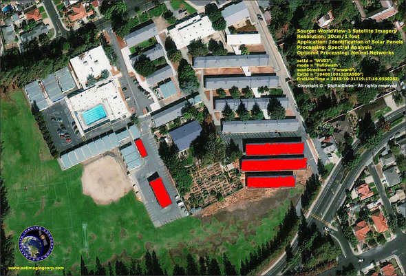
WorldView-3 (30cm) Satellite Image – Spectral Analysis of Solar Panels San Jose, CA
Copyright © MAXAR Technologies. All rights reserved.


