Satellite Images for Oil and Gas Development
On-the-ground fieldwork in hostile terrain can be expensive, time-consuming, and could have Health Safety Environmental (HSE) implications. With accurate satellite map data, seismic planning in high dunes, mountainous, or tropical areas can be mapped out before your crew ever reaches the proposed development area, saving thousands or millions of dollars in development and exploration costs.
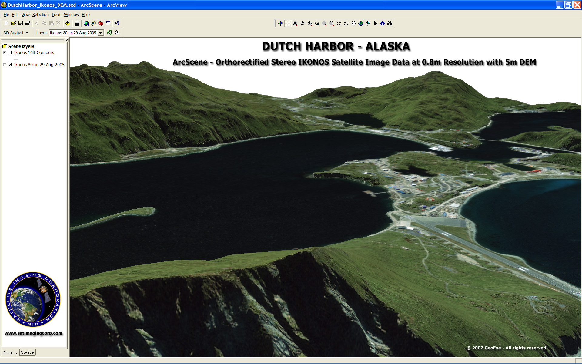
ArcScene 3D Digital Terrain Model - Dutch Harbor, Alaska
IKONOS (0.8m) Satellite Image and 5m DEM
After retrieval of the satellite imagery for the proposed drill site, geological and seismic interpreted information is supplemented with the extraction of vector data, such as current proposed well positions, field data, geochemical data, elevation data, and environmental habitats by creating a complete picture of the potential work-site.
Our products can be used to:
- Identify access roads
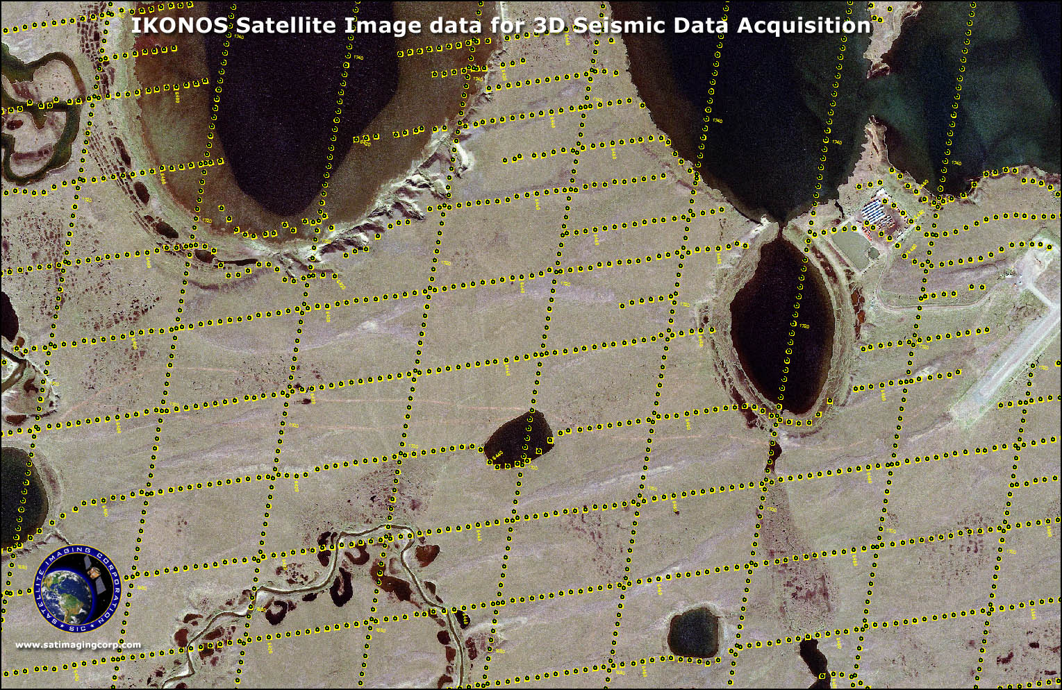
- Plot new and identify old seismic surveys and well locations
- Select proposed new well locations
- Determine private property lines
- Calculate pump size and stations based on terrain elevations
- Map pipeline routes in hostile or heavily developed terrain
- Avoid conflicts with underground utilities
3D Seismic Data Acquisition - North Slope Alaska